
Topo France V3
This TOPO contains a great deal of map information - a lot of it is hidden , ie invisible.
Much of what is written here can be applied to other TOPOs.
To change any colour, size etc of all the mapping elements you need to work on its TYP file.
So, to work on a TOPO, look for a filename ending .typ
Finding the TYP file
Good news:
It is pretty straight forward to edit a TYP file - we are using TYPWiz7.
Bad news:
If the TYP file is not found on your PC then you can extract it from a large file using various tools
like gmaptools or gmap2typ but you can not easily replace it, ie put it back again.
We are using Basecamp so we can quickly see the effect of changing the TYP file.
Our typ file is located in the
’c:\programdata\garmin\maps\topofrance v3Pro’
folder
How to load your TYP file
We assume that you have some knowledge of
how to obtain the necessary TYP file for this
topo .
1) In TYPwiz 7 & 4 go Tools --> TYP files
from Bascecamp/Mapsource.
2) Click on TOPO France v3 and click ’Open TYP’
Note : When saving, both TYPWiz 7 & 4 make a copy of any topo files before it saves your
changes.

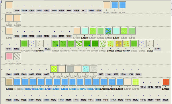
What can we change?
•
Make Street Names Visible
•
Change size of Font & colour of Font
•
Change size and colour of Names of towns,cities etc
•
Change the colours & width of highways / lines
•
Change the bitmap of lines
•
Change the colour ,size and bitmap of POIs
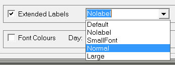
Making Street Names Visible.
For reasons unknown many rivers & streams and many highways in the TYP file have had their
fontstyles set to NoLabel.
This renders them invisible. So the solution is
simple: Edit their FontStyles and change them
to , say ’Normal’,
Garmin does not support numerical fontsizes:
You are lumbered with small, normal or large!
TYPWiz 7 clearly shows any element with fontstyle set
to NoLabel by greying out the label.
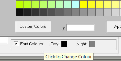
Changing Colour
If you wish you can set the colour of
highways,polygons and pois.
Tick Font Colours and double click on
Day
Change size and colour of Names of towns,cities etc
This topo uses types 400 - 1F00 at a low- medium zoom level .
Higher numbers are used when you zoom in.
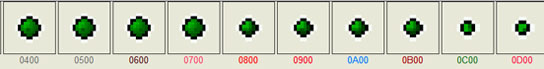
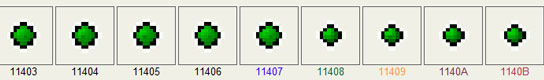
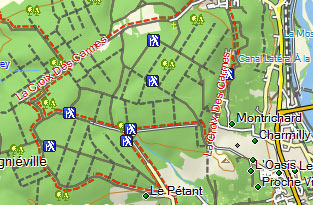
Changing POIs
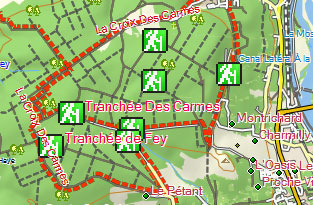
We have changed the ’walking’ poi as it is rather small.
Some pois, used by the TOPO , cannot be changed as they are ’built’ into the firmware.
If a poi appears in a TOPO , then it can be changed ; if it doesn’t and yet it appears on the map we
need to conjecture its type number.
POI before
POI After: edited with labels showing

What you can do
You can change all pois, their colour,sizes, fontsize & fontcolor
You can add transparency if need be
What you mustn’t do
Do not change type number: if you do, some POIs won’t show, or appear in a default style’
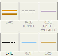
Changing Highways
There are several unusual entries in this TYP file which are easily missed
waterfalls,bulkheads,retaining walls & slopes
Slopes Before
Slopes After
What you can do
You can change all lines, their colour,thickness, fontsize & fontcolor
You can change from lines with bmp to lines without bmp or vice versa
What you mustn’t do
Do not change type number: if you do, some lines won’t show, or appear in a default style’
Changing polygons
A lot of care has gone into merging various colours in this TOPO
What you can do
You can change all polygons, their colour, fontsize, fontcolor,
You can change from bmp to non bmp or vice versa
What you mustn’t do
You must not change draworder - if you do, some polygons won’t show.
Many new TOPOs do not use draworder .
Do not change type number
Editing ’extra draworders’
The typ file shows many ’stand alone’ draworders , ie these are not linked to any polygons found in
the typ file. Latest TYPWiz 7 shows them quite clearly.
What you can do
They could provide a draworder to a default polygon. Removing them does not seem to make a
difference, but this needs experimenting.
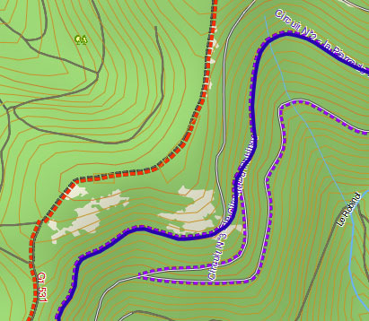
Active Routing
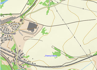
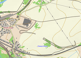
This TOPO has ’so called’ active
routing - so called, as highways with
active routing are not given a special
status in the TYP file.
It is also unusual in that there are only 2
activities reserved for this purpose,
hiking and cycling .
In fact, these lines are used as layers and
do not like other TOPOs with active
routing replacing highways.
Picture shows Routes having been
enlarged.
Red : hiking
Purple: cycling
Blue : current trail
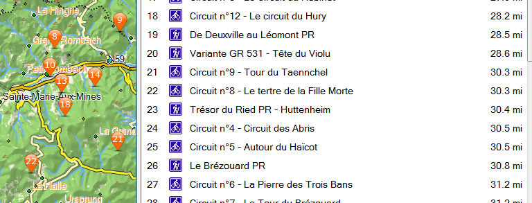
In Basecamp or Oregons etc, an extra option appears in the Search options , ie ’Named Trails’
When you select this, basecamp & your device lists trails contained in the .db file nearest to your
current position. (If your topo does not contain a .db file then just adding the required .db file in the
SQL folder will not trigger off the new option!)
You cannot change these icons, as they do not appear in the TYP file.

Finally, save your TYP file
1 ) Just enter CTRL S (save) : DO NOT save AS
If Basecamp or Mapsource are currently open, they will have to be closed first.
TYPwiz will do this for you.
2) Load Basecamp
3) Press CTRL G 2x to clear cache
4) If you cannot see the changes then
check the filename ; this must be the same as found in the list showing all topo typs - see page 3
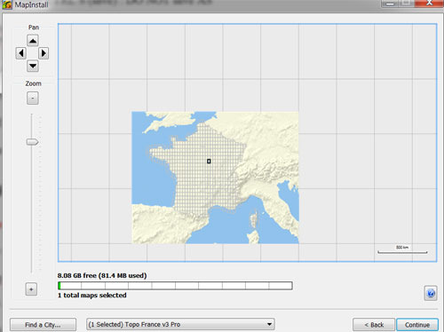
How do I upload this file to my GPS
Warning, always make a backup of your TOPO file first
Use Garmin’s MapInstall - its free and effective . Make sure you have the latest version.
Mapinstall will replace the original TYP file with the one you have edited TYP
TIP -
1) Use the partial install option - this means you can test your TYP file on one a small tile.
2) Select your area
Right click to deselect
Left click to select.