
Problems with TYP files
1) Some of my polygons are not rendered:
- This could be because the offending polygons need to be set at at higher level. Increase your draworder.
- As far as possible try and match your type numbers to those used by Garmin - ie Garmin uses 0x0d for reservation , so use 0x0d for nature-reserve
- Check the type numbers in the cgpsmapper manual.
- Check if the types in your polygon style file match those in the TYP file; you may have declared say a farmyard as 0x28 in your styles but 0x2B in your TYP file.
- TYPWiz can check for such discrepancies.
| 2) Some of my highways or POIs are not rendered: |
- It could be that 0x -- declarations in both the typ and lines or points file do not correspond - when defining hedges you may have used,say, 0x28 in the typ file but 0x something else in the lines file.
- As before, find the nearest Garmin type match for your 'highway'
- If you're not using mkgmap.jar then change the typ number to those reserved for cities, ie 0 x d00
|
|
You can check whether your img file contains your unrendered highway or POI by downloading img2typ.
download img2typ
Simply load your IMG file into img2typ and check if your highway or POI is listed.
|
If it appears in the IMG but not in the TYP then check your TYP file. If it doesn't get listed in the IMG then check your styles lines or points files.
Mapsource is not as forgiving as your Garmin and does not show certain types - ie if disused railways do not appear in Mapsource , despite your style settings, give them a number type reserved for paths. Some Garmin TOPO maps use the same trick.
Remember, if you change your style you need to recompile your osm file. |
|
| |
|
For more information
read more
Advanced Style Tricks
1) Show addresses, steep hills, hiking routes on your map -
see
style tricks
2) How to add an
address search
to your maps
3) Give polygons an outline as with OpenCycleMap
4) Much more |
|
|
More Help with Styles
For style examples
Read more
OS50 Type
- This popular TYP file is an attempt to give maps the OS 50,000 look.
- New version includes address numbers
- Names of Cities,Towns Villages in different colours and fontsizes
- Bridges & one way systems in urban
areas are shown as well.
- Style files are included for those using LATEST 2014 mkgmap
- Style enables address searches
- Tested for errors with mapuploader 6
Download
os50 Style & TYP
os50.TYP
Pleae Note:
OS50.TYP includes Garmin's extra polygons which only TYPWiz can read.
The TYP file works for all Garmin maps and mkgmap.
Download
os50 UTF8 txt >
created in TYPWiz 6
|
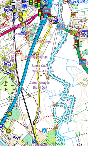 |
White background
Notice, white , NOT yellow, background. For
those interested , polygon 0x4b has been set to level1 with colour = &FFFFFF
; all other polygons are set to a higher level.
White background on Oregons
Use the Setup --> Map --> Advanced Map Set up . Set Shaded Relief as :
Do Not Show.
class="h3">Mapnik Style & Type
With this excellent type you can have a Mapnik look on your Garmin and
Mapsource! The style does not enable routing but this can be remedied using
Route Editor,
download
here
Download the Mapnik Style from
here