Tavistock Walks | exploring a peaceful & historic landscape |
| Walk 1 (1.4 miles) | Walk 2 (2.9 miles) | Walk 3 (3.6 miles) |
| Viaduct & Town | Tavistock Canal, Viaduct &Town | Whitchurch & Plaster Down |
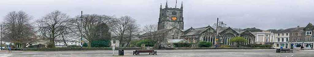
Tavistock - farm on the river Tavy - is a town known for its Pannier Market and individual shops and cafes .
Sir Francis Drake was born in Crowndale Farm near Tavistock - today it's left in ruins.
The viaduct was part of the Plymouth to Tavistock link opened in 1859.
| Drake, Pannier Market, Goose Fair, Viaduct | |
| The Tavistock Inn the Cornish Arms The Market Inn | |
| spectacular views of Tavistock | |
| Bedford SawmillCar Park Pay & Display | |
| SATNAV Postcode:PL19 8JE |
Walk 1 Viaduct & Town (1.4 miles)
![]() Difficulty:
Difficulty:![]()
| Best Devon Town Trails |
An easy town walk around Tavistock following lanes and public foot paths.
The Walk
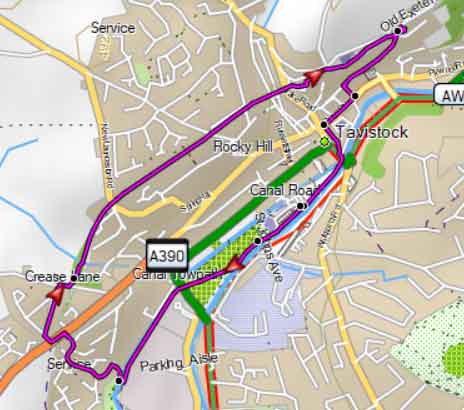
A Begin your route in Bedford Car Park, heading toward the furthest left corner in the direction of the town centre.
Turn left onto a path, cross over a stream, and then turn left again onto Plymouth Road.
Cross Plymouth Road and continue into Russell Street.
Follow Russell Street and turn left when you reach West Street. Continue along West Street for approximately 119 metres.
Cross to the other side of West Street and take the steps to the right of Rocky Hill.
BClimb the steps and follow the path leading to Glanville Road.
Turn right onto Glanville Road and continue uphill until you reach the Viaduct, ignoring Madge Lane on your right.
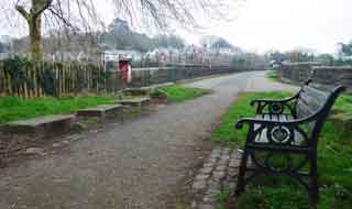
cTake a right onto the public footpath across the viaduct and enjoy the scenic views.
DOnce off the viaduct, where the road sharply bends to the right, look for an almost hidden footpath on your left. This path skirts the old railway station.
Follow the footpath/cycle path until it loops back onto itself and joins a residential road.
Turn left and continue downhill for approximately 1 mile.
E Discover Paddons Row
Look for steep steps on your left and descend into Paddons Row.
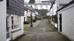
Follow Paddons Row, which leads to the main shopping area.
Cross diagonally left into Market Street and continue along the river until you find an opening on your right leading into Pannier Market.
Explore Pannier Market and return the way you entered. Then, turn right and follow the river.
At the end of the river path, cross over and turn onto a riverside path. Follow this path back to the car park.
Please note, Panier market can not be accessed during Bank Holidays or Sundays.
Download Route
| Download GPX | Mobile or GPS | |
| Download FIT | Watches | |
| Google Earth | ||

Map of Viaduct Walk
| Walks near Tavistock | |
| Tamar Trails | |
 | Enjoy two of the best newly created family trails through woodland and an old mining landscape with spectacular views of the Tamar Valley near Tavistock. |
| Shaugh Prior | |
 | Explore a magical river valley, open moorland and the mysterious Dewerstone Rock. |
| Princetown | |
 | Princetown offers the walker spectacular views of Dartmoor's almost volcanic landscapes. Relive a railway journey through quarries. |
| Mary Tavey | |
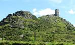 | A delightful walk to Brent Tor, with its church on top of a hill. |
| Postbridge | |
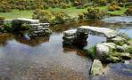 | A popular and varied forest walk with lots to see:bronze age stone & hut circles, a clapper bridge & Bellever Tor. |
Walk 2 Tavistock Canal & Viaduct (1.4 miles)
Difficulty:![]()
The route starts at Bedford Car Park.
Head towards the river (there are two openings from the car park) and turn right following a path a long the river Tavy.
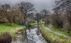
In the park take right-diagonal path which continues under the main road and then along the Tavistock Canal ; this canal linked Tavistock to the English Channel.
Take tow-path along canal - cross canal over footbridge and follow cycle route to the top and the viaduct.
Follow instructions for walk 1 from D.
Download Route
| Download GPX | Mobile or GPS | |
| Download FIT | Watches | |
| Google Earth | ||
Map of Tavistock Canal Walk
Walk 3 Whitchurch & Plaster Down (3.6 miles)
Difficulty:![]()
| Limited spaces on Church Hill near Whitchurch church |
A pleasant & peaceful field walk South of Tavistock following public footpaths and quiet lanes.
Wellies are recommended after heavy rain.
Download Route
| Download GPX | Mobile or GPS | |
| Download FIT | Watches | |
| Google Earth | ||
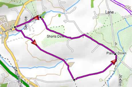
Map of Walk 3
Walk 4 Tamar Trails (4.8 miles)
Difficulty:![]()
The Tamar Trails (SW of Tavistock) are in the heart of the Tamar Valley .
This walk great forest walk from the Tamar Trails Centre is ideal for a family day out.
| Tamar Trail Centre, off A390 | |
| what3words ///positions.snow.unites | |
| SATNAV Postcode:PL19 8JE |
For more details and downloads of routes:
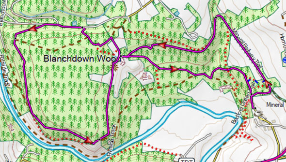
Map of Tamar Trails