Postbridge Walks | clapper bridges & stones circles |
| Select Your Walk | Walk 1 (4.1 miles) | Walk 2 (8.5 miles) | Walk 3 (4.9 miles) |
| Postbridge to Bellever Tor & Clapper Bridge | Postbridge & Cator Common | East Dart River |
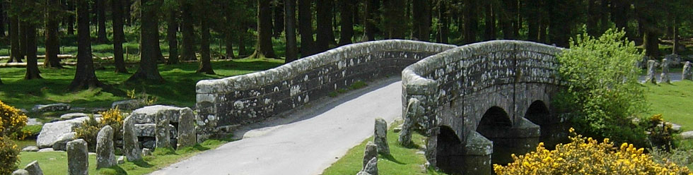
Throughout the ages a narrow bridge made of granite slabs across the East Dart caused many a bottleneck!
It was on the main road almost half way between Tavistock and Moretonhampstead and lead to the emergence of a hamlet named after the bridge - no , not Slabbridge (locals referred to slabs as posts).
- The earliest Victorian maps show a 'temperance' hotel for teetotalers, various bronze age stone & hut circles and several footpaths
- Today's forest seems to have been planted much later
| What to explore? |
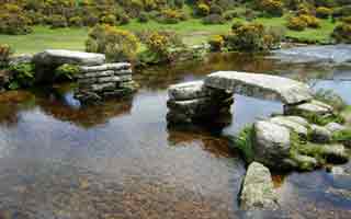
- Clapper Bridges
- Stone and Cairn circles
- Bellever Tor
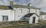
| East Dart Hotel | |
| Best Woodland Walks in Devon | |
| Car Park Postbridge | |
| what3words ///plotter.cheese.surnames | |
| SATNAV Postcode:PL20 6TH |
Walk 1 Postbridge to Bellever Tor & Clapper Bridge (4.1 miles)
![]() Difficulty:
Difficulty:![]()
An easy and popular walk to Bellever Clapper Bridge.
The Walk
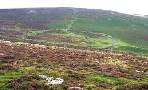
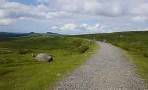
A From the Car Park enter Bellever forest.
It is difficult to imagine that , a century ago , this forest did not exist.
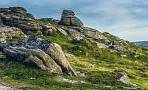
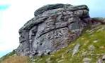
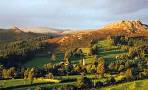
B Continue along the path to Bellever Tor, an area full of prehistoric interest. Unfortunately, during the Victorian times, it became a haven for 'souvenir hunters'.
You can skip the climb and follow a path to the left of the Tor.
There are several opportunities to explore prehistoric cairn and stone circles.
CAfter re-entering the forest you reach the hamlet of Bellever , beyond which is another clapper bridge well worth seeing.
D The walk joins part of the long distance Lych Way, an old route used for religious purposes linking Bellever to Lydford - click here to download Lych Way.
Download Route
| Download GPX | Mobile or GPS | |
| Download FIT | Watches | |
| Google Earth | ||

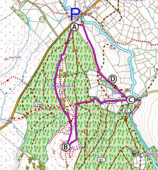
Map of Walk 1
| Walks near Postbridge | |
| Warren House Inn | |
 | Explore Dartmoor's old tin workings & the ruins of medieval village |
| Dartmeet | |
 | A popular tourist attraction in the heart of Dartmoor |
| Grimspound | |
 | During the bronze age Grimspound , made of granite blocks , enclosed 24 hut circles, suggesting a milder climate and an abundance of trees. Two popular walks. |
| Fernworthy | |
 | Enjoy a peaceful forest walk around a trout filled reservoir & explore a prehistoric landscape of mysterious stone circles and rows. |
| Princetown | |
 | Princetown offers the walker spectacular views of Dartmoor's almost volcanic landscapes. Relive a railway journey through quarries. |
| Meavy | |
 | A great pub walk to Meavy and Burrator Reservoir with spectacular views of a dramatic landscape featured in the film 'War Horse' . |
Walk 2 Postbridge & Cator Common (8.5 miles)
Difficulty:![]()
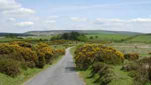
A delightful walk past Postbridge's clapper bridge following mainly public foot/bridle paths to Cator Common and returning via Sherwell and Laugher Hold house.
From the car park walk along the main road & across the bridge to a foot path on your right.
Caution: this walk crosses a river using stepping stones
Alternative Walk (5.1 miles)
Difficulty:![]()
To avoid the stepping stones you could follow the blue route along a country lane - see map.
Download Route
| Download GPX | Mobile or GPS | |
| Download FIT | Watches | |
| Google Earth | ||
| Car Park Postbridge |
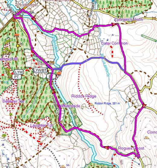
Map of Walk 2
Walk 3 Postbridge & East Dart River (4.9 miles)
Difficulty:![]()
An ideal 5 mile moorland hike for a sunny day through the East Dart River Valley - there is no cover against rain.
Firm footwear is essential.
The following directions are minimal - we advise you download the route below.
The Walk
A With back to Car Park turn left and walk towards the famous Clapper Bridge. Once over the bridge turn left through a small gate onto a Public Bridleway.
B At the T junction with another Bridleway turn left and continue with the river on your left.
C Where the river bends to left leave bridle path and take path following river on your left.
Continue uphill then descend towards the river where you will join another path.
D Cross river - some nice views in this spot - and turn left with river on your right. The path now leaves the river and after a while descendsto a gate.
E At Gate continue and head in a south westerly direction.
F After 0.7 of a mile rejoin the river and continue back to the Car Park.
Download Route
| Download GPX | Mobile or GPS | |
| Download FIT | Watches | |
| Google Earth | ||
| Car Park Postbridge |
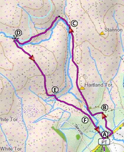
Map of Walk 3