Best Warren House Inn Walks |
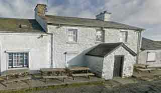
Warren House Inn was built in 1845 opposite a house, now destroyed , which quenched the thirst of many a tin miner.
Two favourite walks starting near this pub which has to rely on its own electricity.
| Best Dartmoor Walks |
| What to explore? | |
|
| Small Car Park off B3212 , 150m NE of the pub The pub lies 2 miles North East of Postbridge on the B3212 | |
| what3words ////morphing.wiped.slightly | |
| SATNAV Postcode:PL20 6TA |
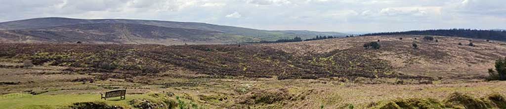
Walk 1 Medieval Village (5.1 miles)
Difficulty:![]()
Enjoy a scenic 5-mile hike through Dartmoor’s stunning landscapes and uncover the fascinating history of its ancient tin mines.
Walks start near the Warren House Inn, which looks quite weatherworn from the outside but promises a warm welcome inside.
We recommend you download the route below as the following instructions are a brief description of the walk.
The Walk
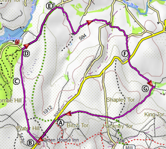
A From the Car Park follow a bridle path which takes you down to Birch Tor.
B Cross the bridge then follow a bridle path heading South to a gate then continue past Golden Dagger Mine.
C After 105 m turn right and take a bridle path to the forest.
D After a mile through the forest the track makes a sharp turn heading east.
Continue along this track past Boussons Farm keeping the hill (Challacombe Down) on your left.
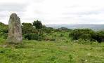
E After the medieval village ignore a drive on right but continue North not crossing the small river Some stretches of the route are not clear.
F At a fingerpost signed Warren House Inn turn left.
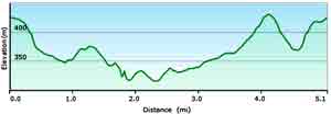
length: | 5.1 miles |
terrain: | tracks bridle/ footpaths |
| country lanes | |
main roads | 0 % |
yes | |
altitude range | 72 - 173 m |
Download Route
| Download GPX | Mobile or GPS | |
| Download FIT | Watches | |
| Google Earth | ||

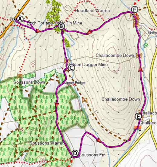
Warren House Inn Walk 1
| Walks near Warren House Inn | |
| Grimspound | |
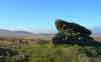
 | During the bronze age Grimspound , made of granite blocks , enclosed 24 hut circles, suggesting a milder climate and an abundance of trees. Two popular walks. |
| Postbridge | |
 | A popular and varied forest walk with lots to see:bronze age stone & hut circles, a clapper bridge & Bellever Tor. |
| Moretonhampstead | |
 | Moretonhampstead , gateway to Dartmoor, is an ideal town for walkers to explore the lush edge of the moor. |
Walk 2 Chagford Common (8.8 miles)
Difficulty:![]()
An invigorating 9 mile hike following long stretches of the Two Moors Way with lots to see including a stone row & hut circles.
Choose a fine day as there is little shelter throughout the walk.
The Walk
A With back to car part turn left and continue on the verge of the main road to the pub.
B Just before the pub turn right and head up roughly 90 degrees to the main road - the path is barely visible.
At top of hill head towards the right edge of Fernworthy Forest - the path is not clear but eventually takes you to a lane leading to Fernworthy Reservoir.
C Stone Row and hut circles.
D After a mile take footpath signed with a 2 Moors Way symbol on right.
This meanders via Lower Shapely, Hurston, Lettaford.
E Take care crossing the B3212 and continue following the 2 Moors Way.
F At Westcoombe, where you join a lane , take path on right - do not cross stream.
Continue following the 2 Moors Way back to the car park.
Download Route
| Download GPX | Mobile or GPS | |
| Download FIT | Watches |
Warren House Inn Walk 2