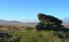
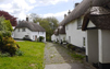
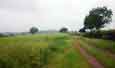
All walks come with free downloadable gpx files, no membership required!
Walks Near YouContact us | ||||
If you have any comments. suggestions or requests: please feel free to contact us | ||||
Why GPS? Which Sat Nav?More and more walkers are using gps handhelds now that prices have dropped and maps are more detailed.Garmin are the leaders and ,importantly, can display free maps created by thousands of volunteers . For useful advice click here. |
Free GPX downloadAll our walks can be downloaded for free in gpx format. The files you download need to be unzipped first.Our gpx files contain Routes, not Tracks and are saved as Direct Routes.
|
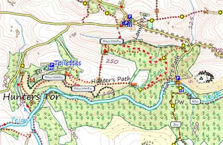
Free Walker's Map of Devon |
Print out up to date maps & walks |
Install free 3D maps on your Garmin GPS |
Click here for FREE 2017 Walkers Map of DEVON & CORNWALL |
![]() |
Right: Area near Castle Drogo and Fingle Bridge showing ALL existing tracks,paths, footpaths & bridle paths AND long distance routes | ![]() |
Non-Muddy Walks |
There is nothing worse than suddenly being faced with a water logged track or field. Our walks give an indication of the possibility of a muddy stretch,particularly after heavy rain. Look out for the 'welly sign' . Our Coastal , Dartmoor & Town walks generally follow well drained footpaths or tracks. |
Defra Non Permissive paths | ||
Defra makes available a list of permissive walks which you can download as a pdf. It has been our experience that many are suddenly withdrawn by the owner of the estate. Regrettably, we do not recommend Defra walks ! |
||
Free Devon Hiking Routes |
||
Why not have a go and download a gpx track of most of the main walking/hiking routes in Devon,including South West Coast Path All routes are compiled by osm volunteers - some routes are not complete. Click here for more information. |
||
Interactive map of Devon | ||
Check out this excellent site . | ||
Reporting Hazards | ||
You can report broken stiles,hazardous bridges etc using an easy to complete form : Report hereto Devon County Council. |
![]() |
![]() |
OpenStreetMap |
New additions to our collection of walks feature routes using data from OpenStreetMap. These maps are generally far more up to date as they take into account any recent changes to paths and tracks. We will also endeavour to display stiles and gates.
|
For more information see OpenStreetMap and Beginners Guide . |
Why not start a new free hobby and map your local area? All you need is a handheld GPS device, create a free account with Openstreetmap and plot your data. You may like to involve the whole family! |
Tarka Line Walks |
The Tarka Line runs between Barnstaple and Exeter and a colourful 52-page booklet ,containing 22 walks, gives you the opportunity to hop on the train and explore Devon at your own leisure. You can obtain your free copy of this most impressive booklet from Tarka Line Walks! |