|  |  |  |  |
Fernworthy Walks | exploring a prehistoric landscape |

| Select Your Walk | Walk 1 (3.6 miles) | Walk 2 (6.1 miles) | Walk 3 (7.4 miles) | |
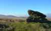
| Reservoir,Circle & Stone Row | Grey Wethers | Kestor Rock |
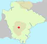
Fernworthy is a popular place for walkers enjoying quiet woodland walks, the views of the reservoir or its many archaeological sites.
Fernworthy Forest was planted in the 1920's.
The reservoir was finished in 1929.and has been stocked with brown trout
If you are just interested in a walk around the reservoir, the route following paths measures 2.7 miles, so allow 60 -90 minutes.
 | Start :Fernworthy Car Park. |
FAQs
How difficult are the walks?
Walk 1 is relatively easy
Walks 2 & 3 require some climbing .
Where can I park to start a walk in Fernworthy?
Pay & Display Fernworthy Car Park
Are there any pubs nearby or en route?
No. Nearest pub is Warren House Inn on the B3212
Is the walk suitable for wet weather?
Walks 1 & 2 offer woodland protection against rain.
Half of Walk 3 is exposed to the elements and is best enjoyed on a fine day.
Can I download the Fernworthy walking routes To my GPS?
Yes. The routes have downloadable GPX files for compatible GPS devices And mobile navigation applications, as well as FIT files for compatible sports watches.
Where can I find out more about GSX or FIT files?
Check out this link.
 | Fernworthy Circle Fernworthy Stone Row Reservoir |
 | Pay & Display Fernworthy Car Park |
 | Car Park |
 | what3words ///retail.wiped.afflicted |
 | TQ13 8EA |
Walk 1 Reservoir and ancient circle (3.6 miles)

 Difficulty:

A popular and easy walk to a historic site.
From the Car Park take footpath towards reservoir, keeping it on your left.
At the wall of the dam descend into a wooded area then up again and continue keeping reservoir on your left.
Download the gpx file below onto your mobile and follow the route.

Download Route
| Download GPX | Mobile or GPS | |
| Download FIT | Watches | |
| Google Earth | ||


| Walks near Fernworthy | |
| Warren House Inn | |
 | Explore Dartmoor's old tin workings & the ruins of medieval village |
| Postbridge | |
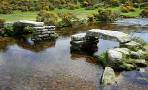 | A popular and varied forest walk with lots to see: bronze age stone & hut circles, a clapper bridge & Bellever Tor. |
| Grimspound | |
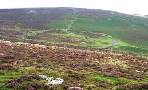 | During the bronze age Grimspound , made of granite blocks , enclosed 24 hut circles, suggesting a milder climate and an abundance of trees. Two popular walks. |
Walk 2 Grey Wethers Stone Circles (6.1 miles)
Difficulty:
A great woodland walk to the Grey Wethers Stone Circles ;it includes a visit to Fernworthy Circle and Stone Row
Wethers is an old English word meaning 'sheep'.
Unusually, there are two stone circles near each other.
It is said that a farmer ,drinking cider at the Warren House Inn, had been old that a magnificent flock of sheep was for sale grazing on the moor.
After a few pints of cider he decided to check them out. When in the distance through the mist he could see what he thought were the sheep , he returned to the pub and agreed to buy them.

Download Route
| Download GPX | Mobile or GPS | |
| Download FIT | Watches | |
| Google Earth | ||

Walk 3 Fernworthy & Kestor Rock (7.4 miles)

Difficulty:
A popular walk to Kestor Rock part of which follows the famous Ten Tor Challenge route.
We recommend a rain free day before you embark on this walk.
Paths are generally well defined.
Download Route
| Download GPX | Mobile or GPS | |
| Download FIT | Watches | |
| Google Earth | ||