Otterton Walks | must do walks near the Jurassic Coast |
| Walk 1 (5.4 miles) | Walk 2 (1.3 miles) | Walk 3 (3.8 miles) | Walk 4 (6.5 miles) |
| Jurassic Coast | Otter Weir | Along the Otter | Mutters Moor |
Tucked behind the Jurassic coast and on the river Otter, Otterton has become a favourite centre for walkers and hikers.
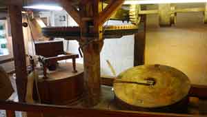
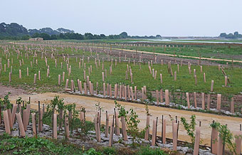
Otterton Mill , dating back to the middle ages, with its restaurant and gift shops is well worth a visit.
Milling Dates 2026
Milling times are 11am–12.30pm & 2pm–3pm
| Jan 25th | |
| Feb 15rth & 29th | |
| April 12th & 26th |
|
| Extensive views | |
| Residential in Otterton. There is no official Car Park | |
 | Otterton Mill Tearoom |
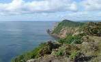
Walk 1 Jurassic Coast, Ladram Bay (5.4 miles)
Difficulty:![]()
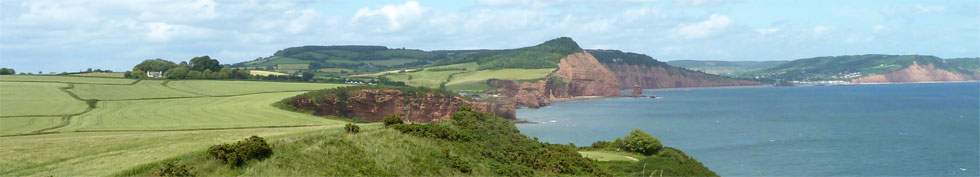
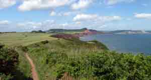
This is a well known and must-do 5 mile hike with spectacular views of the coast line stretching out to Dorset and beyond.
The Walk
A You can observe the wildlife on the Otter Estuary from a bird watching hut at the top of the pine clad cliffs.
Parking is residential and limited.
B Monks from Otterton priory used to extract salt from the brine near the mouth of the Otter; the area became known as Salterton , later Budleigh-Salterton.
C Near the top of the cliff , known as Otterton Point, the site a fairly high status roman villa was discovered in 1988 - no mosaics were found.
The walk passes a WW2 look-out post and leaves the South west coastal path near Ladram bay , below.
main roads | 0 % |
2% | |
altitude range | 1 - 52 m |
quality of track | **** |
stiles | some |
| Residential, Otterton This can also be done from carpark for walk 3. |
Download Route
| Download GPX | Mobile or GPS | |
| Download FIT | Watches | |
| Google Earth | ||

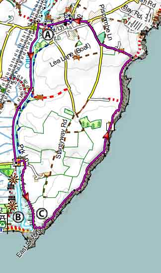
Map of Walk 1
| Walks near Otterton | |
| Budleigh Salterton | |
 | ThIs easy walk takes you along the pebbled sea-front, the famous 'Raleigh Wall', the Otter Estuary Nature reserve with its teeming wild life. |
| East Budleigh | |
 | Mentioned in the Doomesday Book this picturesque village with a car park is and a famous pub is ideal for exploring the delightful Raleigh country. |
| Colaton Raleigh | |
 | This walk follows quiet lanes, old tracks and public footpaths to explore the beautiful rolling hills and moorland near Colaton. |
| Sidmouth | |
 | Great walks combining forests, moorland and sea with breathtaking views of the Jurassic coast. |
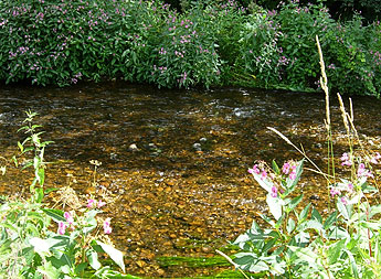
Walk 2 Walk to the Otter Weir (1.3 miles)
Difficulty:![]()
This pleasant and short walk takes you across a footbridge to the recently restored Otter Weir where salmon have be seen leaping up stream.

|
Walk 3 Along the Otter to White Bridge (3.8 miles)
Difficulty![]()
A delightful and easy walk along the Otter into Otterton avoiding parking problems.
| Small Free Car park, South Farm Rd, near Budleigh Salterton | |
| what3words///secret.major.catapult | |
| SATNAV Postcode: EX9 7AZ |
Download Route
| Download GPX | Mobile or GPS | |
| Download FIT | Watches |
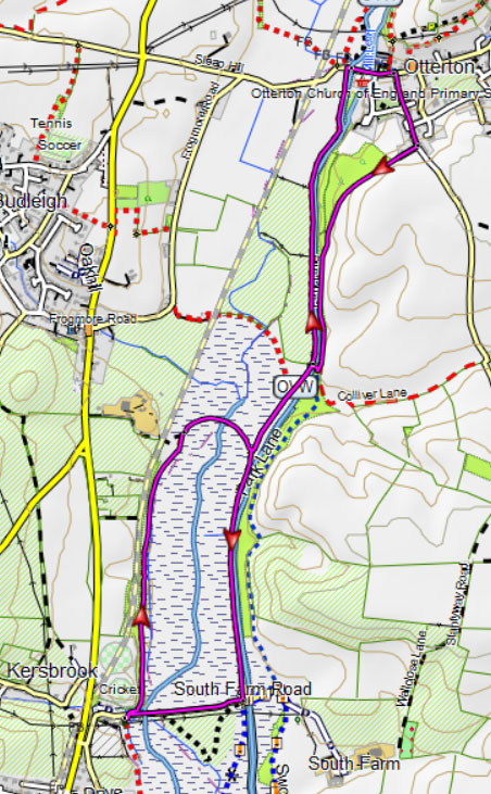
Walk 3
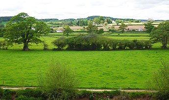
Walk 4 Mutlers Moor (6.5 miles)
Difficulty:![]()
A longer but equally rewarding walk to Mutler's Moor near Sidmouth, then returning along the river Otter, north of Otterton.
The walk follows lanes & public foot paths and includes a steep descent - see map.
Download Route
| Download GPX | Mobile or GPS | |
| Download FIT | Watches | |
| Google Earth | ||
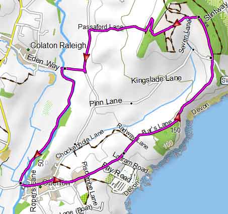
Walk 4