Best Budleigh Salterton Walks |
| Walk 1 (1.6 m) | Walk 2 (3.2 m) | Walk 3 (5.9 m) | Walk 4 (2.1 m) | Walk 5 (4.4 m) | Walk 6 (8.2 m) |
| Town Trail | Otter Estuary | Littleham | Woods & Moorland | Coastline | East Budleigh |
Budleigh Salterton owes its name to salt pans made by monks from Otterton Priory (located on the grounds of Otterton church).
The name means A place where salt is made or sold.
| What to explore? |
- Otter Estuary
- Raleigh Wall
- Pebble Beach
- Museum
| Mouth of Otter, coast line | |
| See below | |
| Several in town |
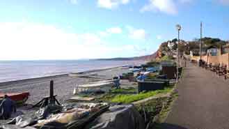
Walk 1 Town Trail (1.6 miles)
Difficulty:![]()
| This is one of our 'Thirty Minute Walks' |
A must do walk with several beach cafes if all the other walks are too long!
| Where to Eat? | |
| Longboat Cafe, Fifty Degrees North | |
Walk 1
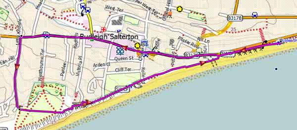
Walk 2 Otter Estuary (3.2 miles)
Difficulty:![]()
This is an easy and very popular walk.
| Lime Kiln Long Stay off Salting Hill |
The Route includes:
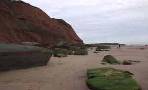
- the pebbled beach home to a variety of marine life - crabs, fish, and seabirds.
- Popular cafes along the sea front.
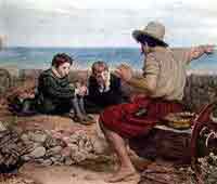
- the famous 'Raleigh Wall', where John Millais painted 'The Boyhood of Raleigh".
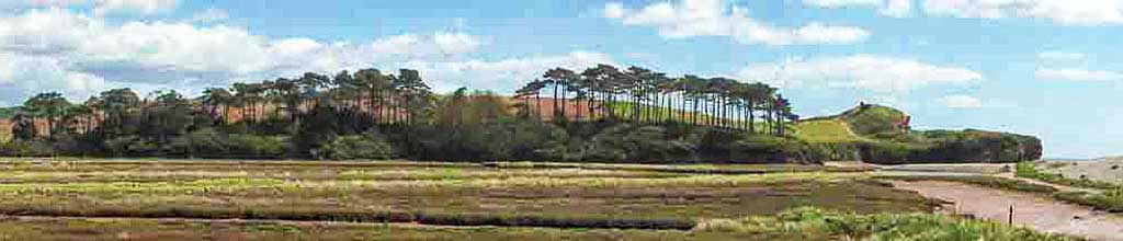
- the Otter Estuary Nature reserve with its teeming wild life. The estuary is currently under development but you can still access the paths with a new bridge for pedestrians open 2024.
- Queen Elizabeth Bridge
- the disused railway line to Otterton.
| Where to Eat? | |
| Longboat Cafe, Fifty Degrees North | |
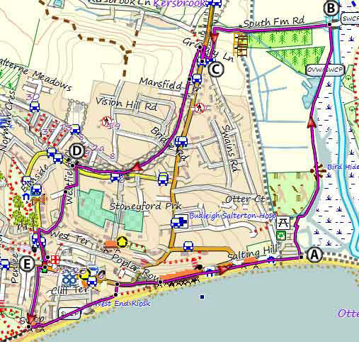
The Walk
AWith back to entrance into Lime Kiln Long Stay Car Park, head towards far end of car park parallel to seafront.
At edge of car park, turn Left onto public footpath, crossing the Queen Elizabeth Bridge completed in November 2023 as part of the Lower Otter Restoration Project.
Continue following foot path, passing several bird hides.
BWhen reaching bridge across the river Otter, turn Left onto a recently resurfaced road.
Continue along this road until it joins the B3178 to Budleigh passing a small car park on left.
CAt T junction, cross over and turn left then soon right onto a path heading to a bridge.
Just before bridge, turn Right and follow path to top of bridge.
Continue along this track which used to be part of the railway line between Exmouth and Otterton.
DAt the end of the track, cross residential Road and turn Left along pavement.
Soon, turn Right into Westfield Close.
Turn Right onto a Public Footpath.
Continue all the way – the path ends between some houses.
When joining Station Road, cross over and walk across grass border onto a paved foot/cycle path and turn Left.
Follow path al the way to High Street (the main shopping street).
At T junction, turn Right.
E Turn Left into Victoria Place ( a small lane).
Follow to the end when it joins a footpath.
Continue along this path.
When joining the SW Coastal path, turn Left.
Continue following the coastline back to the car park whilst passing several cafes for possible tea-stops!
Download Route
| Download GPX | Mobile or GPS | |
| Download FIT | Watches | |
| Google Earth | ||
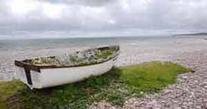
Walk 2 along the coast, the river Otter & a disused railway track
| Walks near Budleigh Salterton | |
| Otterton | |
 | Tucked behind the Jurassic coast and on the river Otter, Otterton has become a favourite centre for walkers and hikers. |
| East Budleigh | |
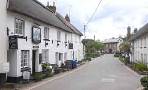 | Mentioned in the Doomesday Book this picturesque village with a car park is and a famous pub is ideal for exploring the delightful Raleigh country. |
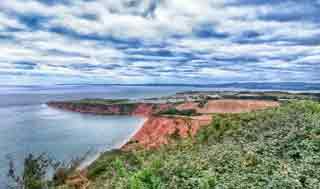
| Exmouth Coast | |
 | A superb and highly recommended coastal walk of moderate difficulty along the Jurassic Coast. |
| Hayes Barton | |
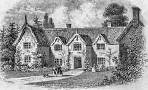 | This most enjoyable walk takes you near Hayes Barton, where Sir Walter Raleigh was born. |
Walk 3 Littleham (5.9 miles)
Difficulty:![]()
Our most popular 6 mile hike runs along the coast & into Littleham.
| Where to Eat? | |
| Clinton Arms , Littleham | |
It passes the Clinton Arms & follows part of the old railway line between Budleigh and Exmouth.
A fairly active golf course has to be crossed.
Short description:
Facing the sea turn right & follow the coastal path to Littleham Holiday Park.
Here turn right and inland towards Littleham Village - the caravan site is a bit a maze but head for the main entrance.
At Littleham church turn right into Castle Lane then take a foot path on left which partly goes through a church yard then finally joins the old railway , now a cycle path.
Turn right and continue for almost a mile.
Just before bridge take foot path on right and turn right at lane; continue for 300 m then join a footpath ahead of you ;go through a gate and into the woods (part of the golf course )
From here the route on the map is quite different and more involved.
The easiest will be to continue following this public Foot Path through the golf course and rejoin the south west coastal path -
Turn left and return to Budleigh.
Download Route
| Download GPX | Mobile or GPS | |
| Download FIT | Watches | |
| Google Earth | ||

There are two steady climbs.
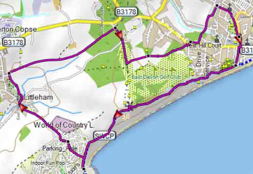
Walk 3
Walk 4 Knowle Hill Plantations & moorland (2.1 miles)
Difficulty:![]()
This short but quite invigorating walk is something different and explores the often forgotten beauty of woods and moorland near Budleigh.
Park on Castle lane just after the bridge across a disused railway - spaces are limited.
| this walk crosses two busy roads |
Download Route
| Download GPX | Mobile or GPS | |
| Download FIT | Watches | |
| Google Earth | ||
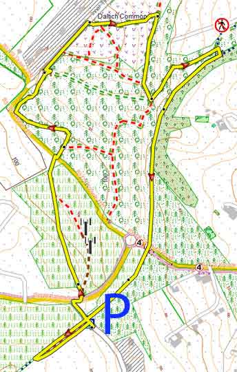
Map of Walk 4
Walk 5 Coastline & dismantled railway (4.4 miles)
Difficulty:![]()
This scenic , varied & easy route is most enjoyable with its coastline, golf course, forests, moor land, dismantled railway and old lanes.
Take care when crossing two busy roads.
Download Route
| Download GPX | Mobile or GPS | |
| Download FIT | Watches | |
| Google Earth | ||
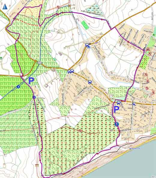
Walk 5 Parking :Links Road
Walk 6 East Budleigh (5.5 or 8.2 miles)
Difficulty:![]()
A lovely river and pub walk to East Budleigh.
Check out this walk.
| Free Budleigh car Park, next to the Pay carpark |