Dartmouth Walks | where once the Pilgrim's Mayflower sailed |
| Walk 1 (4.5 miles) | Walk 2 (3.3 miles) | Walk 3 (1.2 miles) |
| Compass Cove | Little Dartmouth | Town Trail |
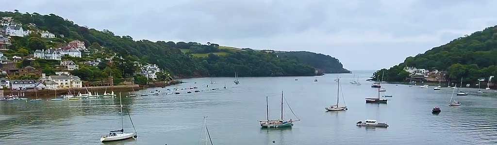
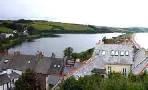
Dartmouth with its narrow streets and ye olde buildings offers the walker many places of interest including the Boat Float and Castle.
The Mayflower & Speedwell 'docked' here on their journey to America.
| Best Southhams Walks |
| Boat Float, Dartmouth's architecture Dartmouth Castle , Mayflower & Speedwell | |
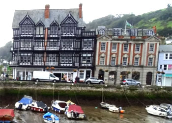
 | Singing Kettle, 6 Smith Street & Dartmouth Castle |
| See below | |
| SATNAV Park & Ride Postcode:TQ6 0JL |
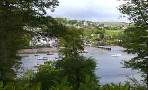
Walk 1 to Castle & coast around Compass Cove (4.5 miles)
Difficulty:![]()
| Coast Line, Dancing Beggars |
A delightful but quite strenuous coastal walk offering spectacular views.
The Walk
AIt starts at the Boat Float (inner harbour) and passes the lower ferry to Kingswear.
It then joins Warfleet Road to the Castle (with cafe) .
B From here it joins the South West Coast Path.
Parts of the path are quite steep but the views are most spectacular.
C After 1.5 miles you take a right path and climb to a track. At the junction , turn right and you eventually will join Castle Road.
Download Route
| Download GPX | Mobile or GPS | |
| Download FIT | Watches | |
| Google Earth | ||

| download PDF |
| Park & Ride opposite Sainsburys (A3122) | |
| SATNAV :TQ6 0JL |
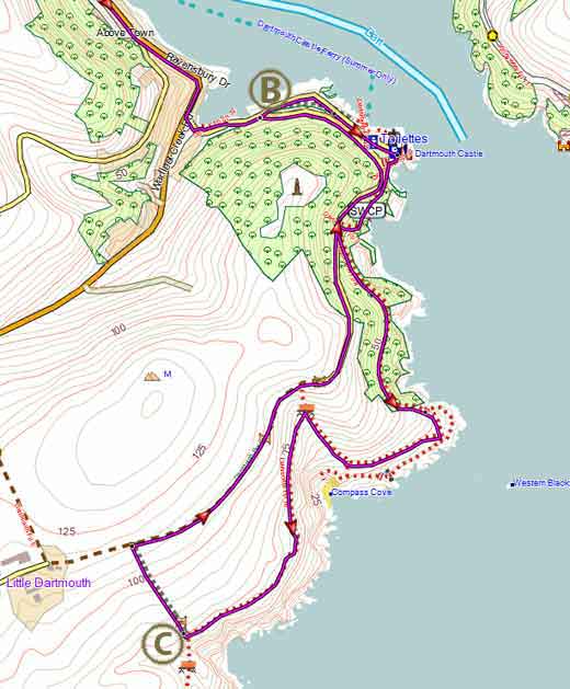
Map of Walk 1
| Walks near Dartmouth | |
| Dittisham | |
 | Scenic walks from a most picturesque village along the river Dart. |
| Totnes | |
 | Town Trail & Best Circular Pub Walks around Totnes and along the river Dart |
| Greenway | |
 | A most enjoyable Circular Walk around Agatha Christie's Greenway. The tranquility and beauty of the estate gave her the inspiration for many a plot. |
| Torcross | |
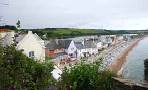 | Great coastal walks from Torcross to Widdicome House, Beesands or the lost village of Hallsands . |
| Slapton | |
 | Great pub walks from Slapton Sands, a popular tourist attraction. |
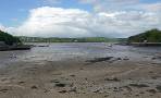
Walk 2 Little Dartmouth & Compass Cove (3.2 miles)
Difficulty:![]()
This equally pleasant but somewhat energetic walk explores the same coastline as walk 1 but bypasses Dartmouth.
You can visit the castle on your way back.
The walk starts in a National Trust Car Park, nr Little Dartmouth - see below.
Download Route
| Download GPX | Mobile or GPS | |
| Download FIT | Watches | |
| Google Earth | ||
| National Trust Car Park nr Little Dartmouth Take A379 to Stoke Fleming | |
| SATNAV :TQ6 0JP |
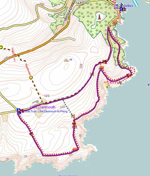
Map of Walk Walk 2
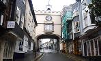
Walk 3 Dartmouth Town Trail (1.2 miles)
![]() Difficulty:
Difficulty:![]()
| Best Devon Town Trails |
A pleasant short amble through Dartmouth taking in its key historical features.
The Walk
A Trail starts at the Quay with 'the Boat Float' on your right. Continue past Royal Avenue Gardens , Dartmouth Visitors Centre and Dartmouth Car Park. The road curves right and becomes Mayor's Avenue.
B Turn left into King's Quay then right into Clarence Street. Continue to the Ship in Dock Inn then retrace steps.
Where Clarence street splits into Clarence Hill and Broadstone turn into Clarence Hill.
C After Mount Boone Hill take some steps on left and follow the Dart Valley Way. Where steps fork take left fork.
Cross Broadstone into Fosse Street then Anzac Street. Continue with St Saviours Church on left.
D Pass Singing Kettle into High Street - this cafe is recommended for its cream teas - see below.
High Street joins Newcombe Road; turn right.
E Ignore the first flight of steps but take the second one, down into Lower Street.
F Turn left, past Lower Ferry Slip then right into Coles Road and continue back to the Boat Float.
Download Town Trail
| Download GPX | Mobile or GPS | |
| Download FIT | Watches | |
| Google Earth | ||
| Singing Kettle, 6 Smith Street & Dartmouth Castle | |
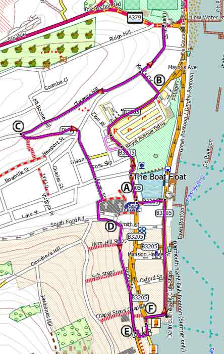
Map of Walk 3