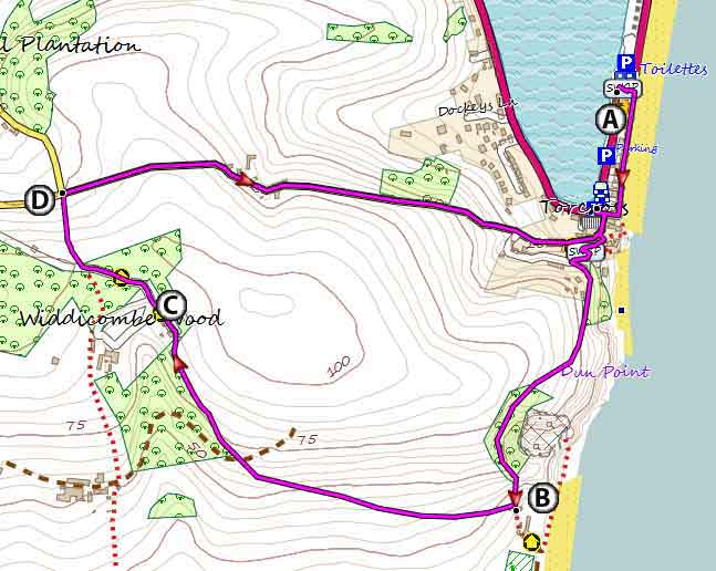
Torcross Walks | exploring a stunning coastline |
| Walk 1 (2.5 miles) | Walk 2 (3.9 miles) | Walk 3 (5 miles) |
| Torcross to Widdicombe Estate | Torcross to Beesands | Torcross to Hallsands |
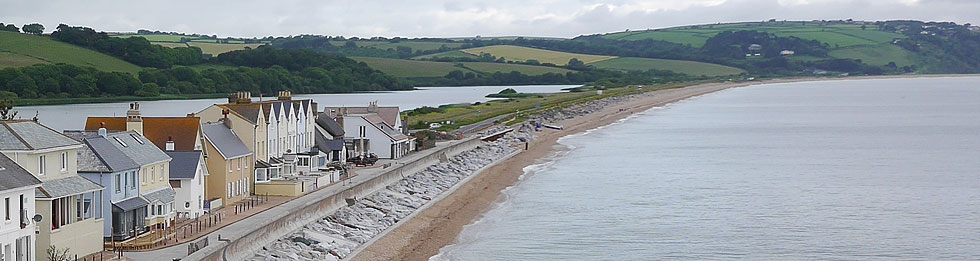
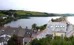
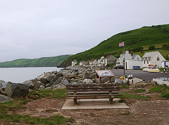
Torcross lies on the edge of Slapton Ley, a natural freshwater lake with a rich and varied wildlife.
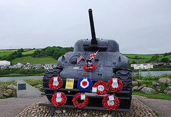
During WWII the village became the centre for Exercise Tiger. A Sherman tank salvaged from the sea commemorates the ill fated operation.
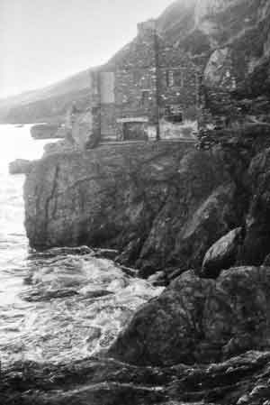
Hallsands , once a prosperous fishing village , was destroyed by storms in 1917.
| Sherman Tank Memorial Lost Village of Hallsands Widdicombe Estate, Eisenhower | |
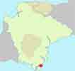
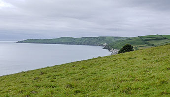
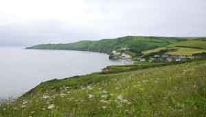
| spectacular views of Devon's coast line | |
| Seabreeze Cafe, Torcross | |
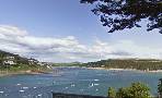
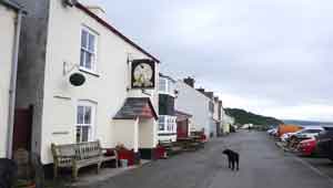
| The Start Bay Inn at Torcross | |
| Torcross Pay & Display Long stay - check website for charges | |
| SATNAV Postcode: TQ7 2TQ |
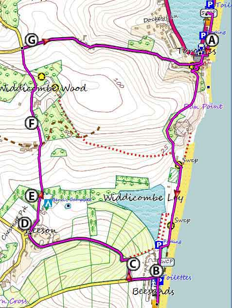
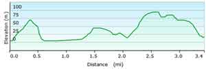
Walk 1 Torcross to Widdicombe Estate (2.5 miles)
Difficulty:![]()
A great short walk to sample the history and landscape around Torcross.
All walks require firm footwear as parts of the coastal footpaths are rocky and could be slippery.
During WWII General Eisenhower used Widdicombe House as his Combined Services Headquarters.
Captain Cook is also said to have stayed here on his return from Tahiti.
The gardens are preserved by the Devon Garden Trust.
The Walk
A From the Long stay car park join the coastal path towards Beesands.
B Just after Beesands quarry at the edge of a wooded area turn right into another public footpath.
C Footpath becomes a drive past Widdicombe House.- not visible
D At the end of this path turn right into a lane leading back to Torcross.
There are no pubs en route.
| Seabreeze Cafe |
Allow 1 hour and 45 minutes.
Download Route
| Download GPX | Mobile or GPS | |
| Download FIT | Watches | |
| Google Earth | ||

Map of Walk 1
| Walks near Torcross | |
| Slapton | |
 | Great pub walks from Slapton Sands, a popular tourist attraction. |
| Salcombe | |
 | South Sands makes an ideal centre for walking to enjoy stunning views of Devon's most dramatic coastline. |
| Dartmouth | |
 | Dartmouth with its narrow streets and ye olde buildings offers the walker many places of interest including the Boat Float and Castle. |
| South Hams Walks | |
 | Top walks of various lengths through the delightful South Hams countryside. |
Walk 2 Torcross to Beesands (3.9 miles)
Difficulty:![]()
Similar to the first walk but longer.
Beesand has a ![]() pub named the Cricket.which Keith Richards from the Rolling Stones used to frequent.
pub named the Cricket.which Keith Richards from the Rolling Stones used to frequent.
It also has a cafe called Brittania @ the Beach.
This makes an ideal pub walk.
The Walk
A From the Long Stay car park follow coastal path south to Beesands.
Most would probably return the way you came but for the more adventurous you may consider the following return journey.
B From Beesands, the route takes you inland via a lane to the village of Beeson.
C There is a steep climb up a the narrow lane which could be busy.
| This stretch may have heavy traffic |
D In the pretty village of Beeson take a public foot path North ;this skirts a campsite then enters part of the Widdicombe Estate.
E Caution, the path is narrow in places with tall wild flowers competing for space.
F Widdicombe House on right but not visible from path.
G Turn right at end of drive and continue back to Torcross.
Download Route
| Download GPX | Mobile or GPS | |
| Download FIT | Watches | |
| Google Earth | ||
Map of Walk 2
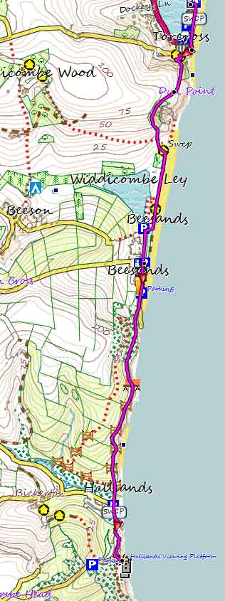
Walk 3 Torcross to Hallsands (5 miles)
Difficulty:![]()
The dramatic Ruins of Hallsands, the lost village, have become a popular place to visit.
You are unable to visit the village
but a special platform has been constructed to view the ruins.
You can drive to what used to be the village using narrow lanes. However, for those preferring wider roads the nearest place to park is Torcross.
The coastal route from Torcross to Hallsands is well marked - distance 2.5 miles.
The stretch between Beesands and Hallsands is maintained by the National Trust and a delight to walk, no ups and downs!
Use the same route on your way back.
There are opportunities to vary the route by walking along the beaches at Beesands and Hallsands.
There is no pub at Hallsands but on your return journey you could stop at the Cricket Inn (Beesands)
For more information on downloads of long distance hiking routes in Devon click here.
| Torcross Pay & Display Long Stay- check website for charges |
Download Route
| Download GPX | Mobile or GPS | |
| Download FIT | Watches | |
| Google Earth | ||
Map of Walk 3