Axminster Walks | exploring a historic landscape |
| Walk 1 (3.8 miles) | Walk 2 (4.8 miles) | Walk 3 (4.5 miles) |
| Axminster & the river Axe | River Axe & Wyke Green | Trinity Hill Nature Reserve |
Explore Axminster beyond its famous carpet industry.
The name means Monastery near the Axe.
| What to explore? |
- Site of MORIDUNUM, a Roman fort
- Roman Roads
- River Axe
- Museum
| Numerous pubs in Axminster | |
| West Street Car Park Axminster (free on Sundays) |
Walk 1 Axminster & the river Axe (3.8 miles)
Difficulty:![]()
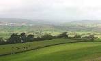
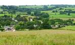
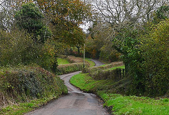
This pleasant and fairly easy walk takes in a hilly landscape, Abbey Gate and the river Axe.
The Walk
A The starts in West Street Car Park then meandering through the old part town it joins a footpath on the outskirts of Axminster.
Turn right and head towards Woodbury Farm, behind which lies a Roman fort - only the ditch has been preserved. A Roman 'map' refers to a small town called Moridunum somewhere in the area ; more than likely it developed from the fort.
B Standing in front of Woodbury farm , you could be standing in front of a hostelry for travellers coming from Exeter, Honiton, Lyme Regis or Ilchester.
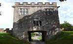
Follow the track , which must date back to the Romans , until eventually you reach Abbey Gate Lane. Turn right and continue until Lower Abbey Farm.
C Behind the farm are the scant remains of an abbey dating back to the 13th century - unfortunately, you cannot see it from the road.
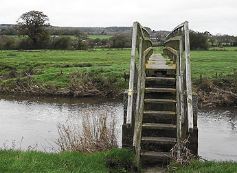
Turn left, crossing the railway lines through a small tunnel, then head towards two foot bridges.
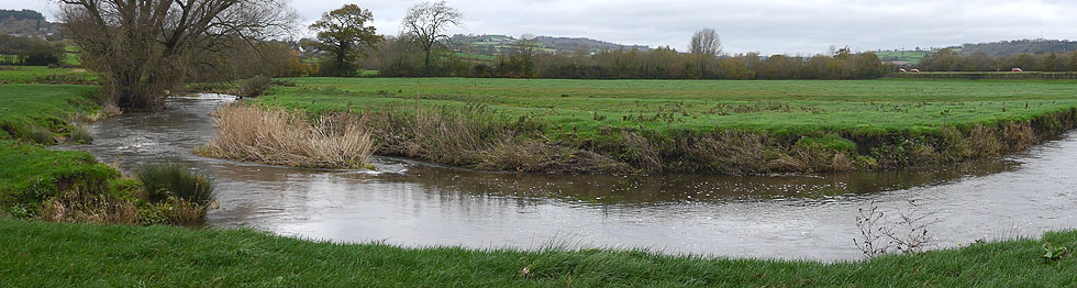
D Take the one the right and follow & enjoy the peace of a beautiful meandering river.
During the winter or after heavy rainfall wellingtons are recommended.
There is one steady climb and descent.
Download Route
| Download GPX | Mobile or GPS | |
| Download FIT | Watches | |
| Google Earth | ||
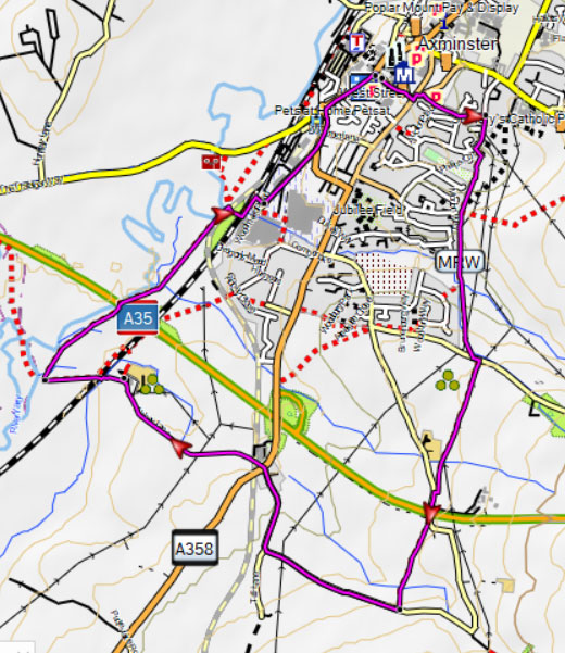
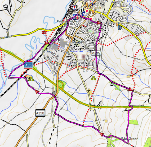
Map of Walk 1
| Walks near Axminster | |
| Membury | |
 | Three rural walks through an Area of Outstanding Beauty. |
| Uplyme | |
 | Walks of various lengths to explore a totally abandoned viaduct! |
| Kilmington | |
 | A delightful dog friendly walk, mainly through woods, to the old beacon house where a lookout was posted to keep a wary eye for Armada ships |
| Musbury | |
 | A delightful but quite strenuous walk towards Musbury castle, an Iron Age Hill fort with spectacular views of East Devon and the Axe valley |
| Dalwood | |
 | Dalwood offers the walker a network of public footpaths to enjoy Devon's unspoilt rolling hills. |
| Axmouth | |
 | Axmouth is a very picturesque village at the end of the Roman Fosse Way with 2 pubs and magnificent views of the Axe estuary. |

Walk 2 River Axe & Wyke Green (4.8 miles)
Difficulty:![]()
Similar to the first walk but longer. It follows part of a Tony Robinson walk - see England's last Battle.
For more information on downloads of long distance hiking routes in Devon TAP here.
Download Route
| Download GPX | Mobile or GPS | |
| Download FIT | Watches | |
| Google Earth | ||
| this walk crosses a busy road |
Map of Walk 2
Walk 3 Trinity Hill Nature Reserve (4.5 miles)
Difficulty:![]()
| EX13 5SL Limited to 4 vehicles |
Trinity Hill Local Nature Reserve is an area of lowland heath near Axminster with lots of footpaths allowing easy exploration of this beautiful nature reserve.
The heath supports a vast number of different moths, including True Lovers Knot, Peppered Moth or the Drinker.
Common lizards, linnets and nightjars thrive in this nature reserve.
After heavy rain some stretches can become muddy.
Download Route
| Download GPX | Mobile or GPS | |
| Download FIT | Watches |
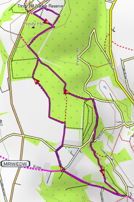
Map of Walk 3