Creating Contours
Contours are quite fiddly to create involving a lot of acquiring and processing of data. There is NO MAGIC WAND! It involves reading STRM data and turning this into lines or polygons. Fortunately, there is an excellent website where you can quickly download blocks of data For our purposes,contours are based on .hgt files - low resolution (3 arc) and high resolution (1 arc) .
. |
||
Thickness,texture and colours of contour lines
Contours are saved as 0x20, 0x21 and 0x22 : To change the default colours,pattern (ie dots) & thickness of contour lines you need to add these polylines to your TYP file - TYPWiz can do this quickly
For more info on using mkgmap look for Elevation on StyleTricks 5.
On nuvis contour lines can look too chunky and quite ugly. Change the pattern to a dotted line and set zoom level (resolution . if your using mkgmap style files) to a higher number.
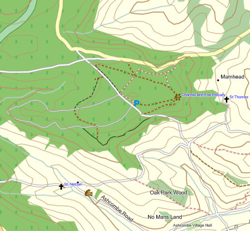 |
| Part of Haldon Hill on Mapsource |