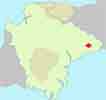
Best Honiton Walks | a delightful old market town |
| Select Your Walk | Walk 1 (1 m) | Walk 2 (2, 3 m) | Walk 3 (3.1 m) | Walk 4 (5.3 m) |
| North Honiton & River | Town Trail | Littletown | Offwell |
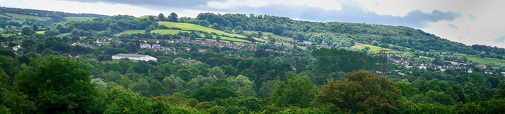
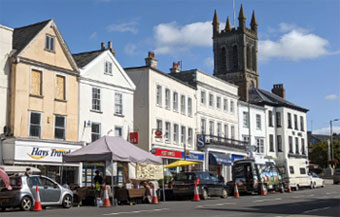
Honiton, known for its lace, is a fascinating market town built around a Roman Road.
Honiton's main attractions are:
- High Street Market on Tuesday, Thursday and Saturday
- High Street Antique Shops
- Allhallows Museum of Lace and Antiquities - a museum that showcases local lacework and pottery exhibits, as well as other local history exhibits.
- The Beehive - a theatre that hosts live music, comedy and drama performances.
- Thelma Hulbert Gallery - an art gallery that features local art and national exhibitions.
Four top walks from Honiton, all carefully selected.
| Market along High Street on Tuesday, Thursday & Saturday | |
| Free Museum | |
| Numerous pubs in Honiton No Pubs in Offwell | |
| Several public toilets | |
| See Below |
| Town Centre Car Park Postcode:EX14 1LT |
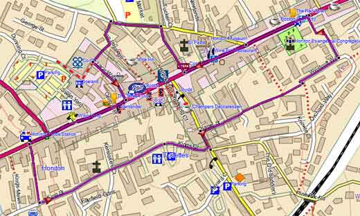
Walk 1 Honiton Town Trail (1 mile)
![]() Difficulty:
Difficulty:![]()
| Best Devon Town Trails |
| This is one of our 'Thirty Minute Walks' |
A pleasant town trail visiting key historic places, including High Street, Antique shops, main pubs and restaurants.
| Pay & Display Lace Walk Car Park | |
| Postcode: EX14 1LT |
Walk 2 Honiton town trail (25 mins)
Walk 2 Coombe Wood (2.3 miles)
![]() Difficulty:
Difficulty:![]()
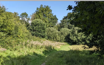
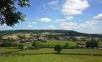
This pleasant walk passes through Coombe Woods, known for its blue bells, and offers great views of the Otter Valley.
Some stretches of the route follow pavements.
The Walk
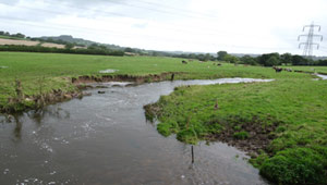
A From Honiton's High Street , an old Roman Road, turn left into Clapper Lane which in the past would have taken you to a clapper bridge across the Otter.
B Entrance to Coombe Wood, known for its carpets of bluebells, is a small gap at the beginning of the wood.
C Take stile on left just before the entrance to a private house.
D A chance to see the river Otter.


Walk 3 Honiton to Littletown (3.1 miles)
| Difficulty |
A delightful varied walk that can be enjoyed at any time of the year.
Explore several parks, including Honiton Bottom Community, & old town.
Download Route
| Download GPX | Mobile or GPS | |
| Download FIT | Watches | |
| Google Earth | ||
| Littletown Road | |
| Postcode: EX14 2RW |
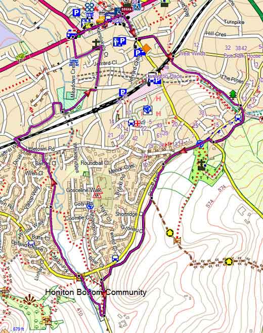
Map of Walk 3
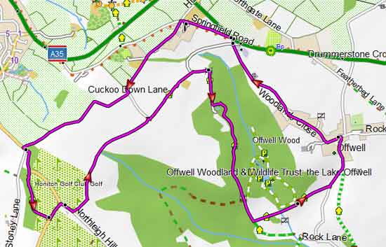
Walk 4 Honiton to Offwell Revised (5.3 miles)
| Start : Near Honiton Golf Course |
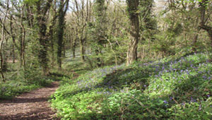
A 5 mile hike to Offwell, famous for its fauna, particularly its bluebells.
We suggest you download the GPX file and follow it on your mobile.
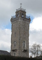
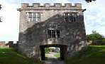
You pass the Bishop's tower, an eighty foot tall square tower built by Bishop Edward Copplestone in 1828.
He was appointed Bishop of Llandaff in South Wales, and decided that if he could see his diocese from the top of the tower he would save himself the journey of having to visit it! He must have been blessed with enviable vision!
Some spectacular views of Honiton.
| Off Road near Honiton Golf Course |
| Postcode: EX14 9TR |
Download Route
| Download GPX | Mobile or GPS | |
| Download FIT | Watches | |
| Google Earth | ||
Map of Walk 4
Offwell woods, famous for it's fauna
| Walks near Honiton | |
| Gittisham | |
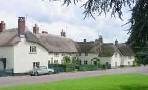 | Gittisham is an old picture postcard village known for its cob and stone cottages & the Pig |
| Stockland | |
 | Stockland , only accessible via lanes , is a favourite starting point for peaceful hill walking and spectacular views. |
| Kilmington | |
 | A delightful walk, mainly through woods, to the old beacon house where a lookout was posted to keep a wary eye for Armada ships |
| Awliscombe | |
 | Great country walks with spectacular views |
| Offwell | |
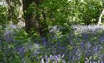 | Two popular walks through Bluebell Woods |
 |
| FREE SOUTH WEST HIKING MAP |
|