Best Offwell Walks | bluebells and woods teeming with wildlife |
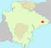
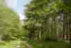
Offwell Woods, known for its bluebells and rich wildlife, are managed by the Offwell and Woodland and Wildlife Trust.
Offwell refers to a Well once belonging to Offa.
 | Bluebells Woodland Centre |
 | Village hall or limited residential parking near church |
FAQ
Is there a walk with a pub en route?
No? There are no pubs en route or in the village.
Is there a longer walk from Offwell?
Yes. A 4.5 mile walk via Colwell Barton (walk 2)
Can I download the Offwell walking routes To my GPS?
Yes. The routes have downloadable GPX files for compatible GPS devices And mobile navigation applications, as well as FIT files for compatible sports watches.
Where can I park To start a walk In Offwell?
There Is a free car park near the village community centre
Where can I find out more about GSX or FIT files?
Check out this link.
Walk 1 Short Walk (2 miles)
 Difficulty:

A popular woodland walk entering part of the Wetlands, a conservation area .
It follows public and permissive footpaths and quiet lanes.

There is no official car park in Offwell but there is some space west of the village, nr Woodland Close, see P on larger map.
Download Route
| Download GPX | Mobile or GPS | |
| Download FIT | Watches | |
| Google Earth | ||


| Walks near Offwell | |
| Honiton to Offwell Circular | |
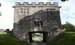
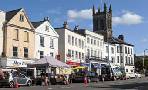 | You pass the Bishop's tower, an eighty foot tall square tower built by Bishop Edward Copplestone in 1828. |
| Kilmington | |
 | A delightful dog friendly walk, mainly through woods, to the old beacon house where a lookout was posted to keep a wary eye for Armada ships |
| Dalwood | |
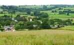 | Dalwood offers the walker a network of public footpaths to enjoy Devon's unspoilt rolling hills. |
Walk 2 Colwell Barton Walk (4.5 miles)
Difficulty:


This enjoyable walk takes you through remote woodlands and past the Woodland Centre where 107 different species of lichens have been recorded.
Most of the tracks are well maintained but be prepared for some boggy areas and a fairly steep climb.
terrain: | tracks paths lanes |
styles | yes |
main roads | 0% |
altitude range | 78 - 202 m |
Download Route
| Download GPX | Mobile or GPS | |
| Download FIT | Watches | |
| Google Earth | ||

There is one steep climb.