Best Culmstock Walks
| Select Your Walk | Walk 1 (2.8 miles) | Walk 2 (3.9 miles) | Walk 2 (5.5 miles) |
| Culm Valley | Culmstock to Culmstock Beacon | Culmstock to Culmstock Beacon |
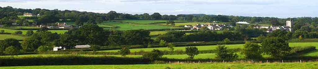
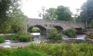
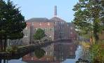
Culmstock , split by the river Culm, is joined by an impressive 5 arched bridge dating from the Middle Ages.
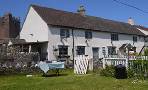
- The village had a long tradition of cloth making with the Fox Brothers building a mill here in 1822 to spin yarn.
- Part of a mill can still be seen from Blackwater Road, just past the village hall.
- The Old Station no longer exists - it was sited beyond the Culm Valley Inn car park.
- The name means Farm on the river Culm
| The Church and Yew Tree - see below The Old Bridge Disused Railway Old Mill | |
| Culm Valley Inn | |
| Culmstock residential parking , Hunter's Hill |
Walk 1 Culm Valley (2.8 miles)
Difficulty:![]()
This fairly easy river walk includes a steady climb and descent.
| Where to Eat? | |
| Culm Valley Inn, Culmstock | |
There are two bridges with steepish steps.
The Walk
A Go up Hunters Hill with primary school on your left. Continue past the new recreation grounds, also on your left.
At a road sign for Woodgate & Beacon , take the right fork.
B Continue for 790 m until - just after a bungalow on your right and before a farm - turn right onto a grassy path. If you have gone into the farm you have gone too far!
Follow this path , through a white gate standing almost on its own. Bear left keeping in line with the house you have passed until you reach the corner of a hedge
C Here you will notice a gap with a stile. Continue descending until you see a gate at the bottom with hedge on right.
D Turn right , then , almost immediately after house, turn left and follow footpath signs to the river. Cross bridge and turn right keeping river on your right. Aim towards the church.
E Keep slightly to the left to a gate then up some steps .
At the T junction near the church turn right.
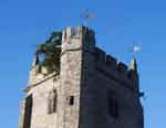 | Look out for a yew tree sprouting out of the church tower ! It dates back to around 1750. |
At the memorial turn left then right into Silver Street.
After 470 m where you meet a track on left and a drive to Woodhayne Barton on right turn right and take the footpath on right of drive.
Follow this to the river. Cross river and turn right ,
F Caution:aim towards a line of trees (an abandoned railway line) on your left - you can walk along the river for a short while but not all the way!
Keep trees on left until you join a track and follow the track until you reach Culmstock's bridge.
Turn left and continue back to the school, past the ![]() pub!
pub!
Walk 1
| Walks near Culmstock | |
| Hemyock | |
 | Although the walk contains one of the steepest climbs, the views and the well marked footpaths through rolling and remote landscapes make it a most enjoyable experience. |
| Uffculme | |
 | A delightful and gentle walk following a well defined footpath along the river Culm |
| Burlescombe | |
 | A delightful and easy walk using part of the Grand Western Canal to Holcombe Rogus - Holcombe means Wooden Valley. |
Download Route
| Download GPX | Mobile or GPS | |
| Download FIT | Watches | |
| Google Earth | ||

Walk 2 Culmstock to Culmstock Beacon (3.9 miles)
Difficulty:![]()
| Extensive views of the village and beyond |
This delightful and somewhat invigorating 5+ mile walk starts from the village and steadily climbs up to the Beacon.
Wellies are recommended after heavy rain!
It follows quiet lanes, public footpaths & bridlepaths.
| The beacon was used to spot enemies, ie the Armady ships .A fire would be lit to raise the alarm. |
| Culmstock Hunter's Hill, near school |
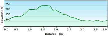
There is one steep descent.
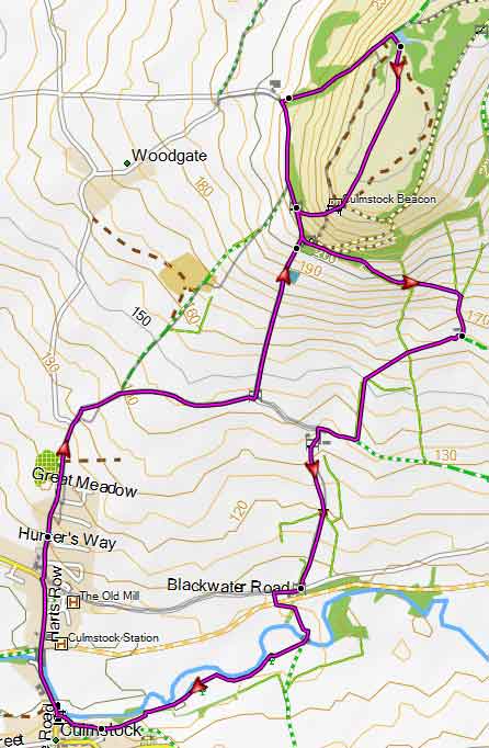
Map of Walk 2
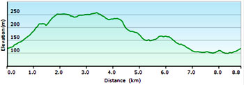
Walk 3 Culmstock Beacon & Culm Davy (5.5 miles)
Difficulty:![]()
A longer and equally delightful walk to the Beacon following quiet lanes and public footpaths.
Download Route
| Download GPX | Mobile or GPS | |
| Download FIT | Watches | |
| Google Earth | ||
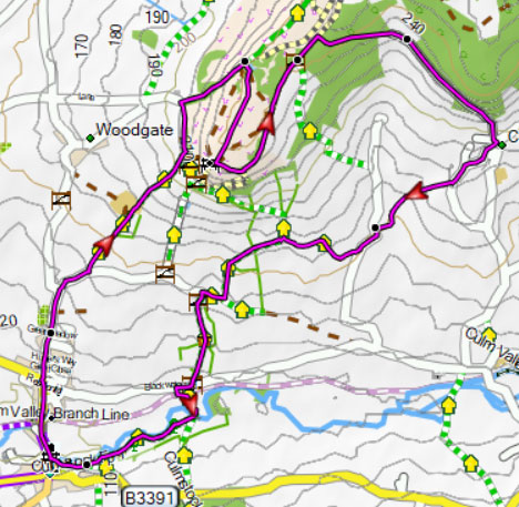
Map of Walk 3