

OSMChecker Beta
OSMChecker does not attempt to compete with more powerful 'error detectors',like Keepright,OpenStreetBugs etc, but hopes to fill a vacuum by highlighting (not just pointing to) problematic highways,areas or POIs. Regularly used POIs are displayed as icons and highlighted when tagging is incomplete; you can even see the stiles,kissing gates,benches etc dotted along a walk, or streets with addresses, grit bins,individual trees... In addition,routes can be created and saved as a GPX file and imported into Google Earth.. | 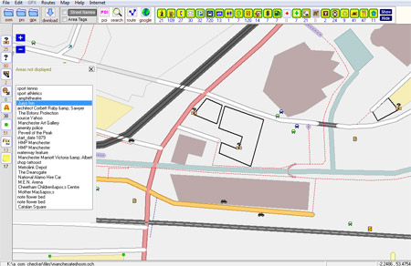 |
What it checks
- 'lines' without a highway tag
- areas not rendered in Mapnik
- incomplete areas
- residential highways without names .
- highways that are not connected
- bridges without highways
- POIs that lack a crucial tag ,ie places of worship without a religion or shops,bus stops, amenities etc without a name tag. OSMChecker displays all essential POIs as clickable icons, giving you a quick overview of what has and hasn't been mapped.
 | You can also
|