Slapton Walks

Slapton and Slapton Sands have long been a favourite tourist attraction.
All our walks start from Slapton Sands as parking in the village is problematic.
 There are two pubs pub in Slapton :
Walk 1
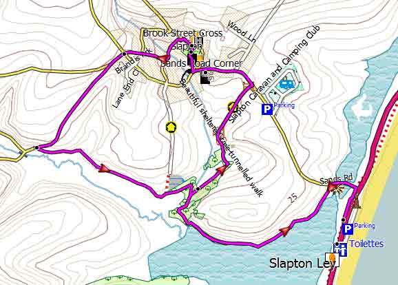
| Walk 1 Slapton Sands to Slapton (3.1 miles) | Time:1h 20 mins |
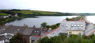 Slapton Ley |  Tap map for larger version | ||||
| Slapton Monument Car Park, Pay & Display | |||||
| see main parking area | |||||
A This popular walk starts in Slapton Memorial Car Park.
Cross the busy road and turn right following part of the South West Coast Path until you come a lane to Slapton Village. Contine along the lane until you have crossed a bridge then turn left into a footpath. This takes you along Slapton Ley,a large natural freshwater lake. B Continue along Slapton Ley following footpath and after 0.6 miles ignore a public footpath on left but continue until reaching a lane C Turn left then continue for 0.2 miles then after Slapton Village Shop turn right into Prospect Hill. This takes you past both pubs. D Behind the Tower Inn pub are the tower ruins of what once was a Chantry College.dating back to the 14th century. Turn left into Brook street . At the crossroads continue in the direction of a public footpath sign. The lane turns into a footpath. Continue through a wooded area until you reach another footpath. Turn right and return the way you came. | |||||
| Show on Google Earth | |||
| GPX for GPS | |||
| How to view a GPX file |
| Walks near Slapton: | |
| Noss Mayo | |
 | Two Popular Walks with superb coastal views. |
| Loddiswell | |
 |
Popular walks through the Avon valley. |
| Torcross | |
 | Great coastal walks from Torcross to Widdicome House,Beesands or the lost village of Hallsands - |
Walk 2
| Walk 2 Slapton Sands to Slapton (3.6 miles) | Time:1h 30 mins |
 Tap map for larger version | Similar to the first walk but slightly longer and more varied. | ||
| Download route for GPS See on Google Earth | |||
| see main parking area | |||
| GPX for GPS | |||
| Show on Google Earth | |||
Walk 3
| Walk 3 Slapton to Torcross (6.8 miles) | Time:2h 50 mins |
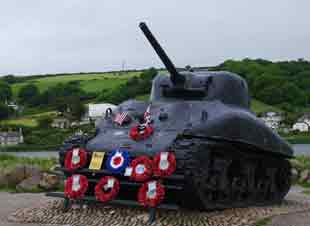 Sherman Tank | 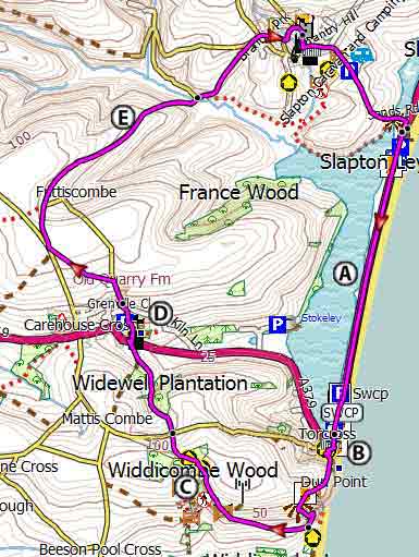 Tap map for larger version | ||
This invigorating pub walk takes you to Torcross along Slapton Sands. It returns via Widdicombe House,Stokenham village with its 15th century church, Slapton Castle and Slapton.A From the car park cross the road and turn left following the South West Coast Path. In April 1944 this stretch was used for the ill fated Exercise Tiger - a lot had to be hushed up due to the D Day preparations. The path to Torcross is 1.4 miles long and requires a great deal of stamina following a straight line for over 30 minutes through an exposed landscape that barely changes!B However , Torcross provides ample opportunities for refreshments! CWiddicombe House ,used by Eisenhower as his headquarters. D E Not much remains of Slapton Castle , an Iron Age hill fort.Download route for GPSSee on Google Earth | |||
| Show on Google Earth | |||
| GPX for GPS | |||