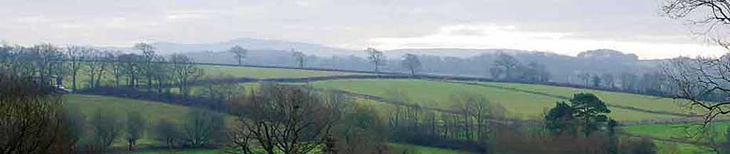
Best Hatherleigh Walks | through a peaceful, saxon landscape |
| Select Your Walk | Walk 1 (4 miles) | Walk 2 (2.1 miles) | Walk 3 (3.2 miles) |
| East Pulworthy | Hatherleigh Community Trail | Hatherleigh Common |
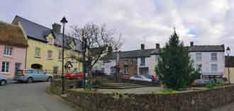
Every Tuesday, farmers gather to sell or buy livestock & produce at Hatherleigh Market.
Hatherleigh is Saxon for 'Hawthrown Glade' .
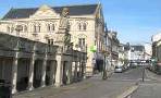
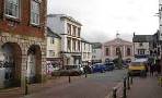
| Hatherleigh Market | |
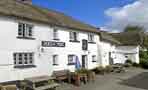
| The George, The Tally Ho | |
| Pay & Display off Bridge Street | |
| SATNAV Postcode:EX20 3HY |
Walk 1 to East Pulworthy (4 miles)
Difficulty:![]()
A very popular walk following quiet lanes and public footpaths through a most tranquil and undisturbed part of West Devon.
There are no pubs en route.
After rainfall some stretches may be muddy.
Firm footwear is essential.
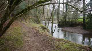
Caution :the route is unsuitable for young children due to a precarious narrow public footpath along a steep river bank ; there are also several high stiles to be negotiated.
It includes a steep climb and a steady descent.
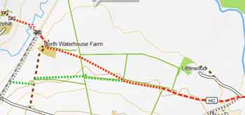
The Walk
A From the Car Park walk past the Sheep Farmers sculpture; then at the junction turn left into Bridge Street.
Turn left into Bridge Street, past the George.
Continue into what looks like a farm yard and follow foot path signs . Cross stile and continue in the same direction ignoring footpath on right.
B Notice the colourful friezes on either side of the tunnel.
C Precarious stretch of footpath.
The path was created by the citizens from Hatherleigh taking the shortest route from town to the station.
When joining lane, turn left and continue for 0.7 miles - part of this stretch includes a steep climb.
D Turn left onto a track and continue for .0.7 miles Just before hedge with ladders either side turn left onto a public footpath. Keep hedge on right. Cross style and continue along a track
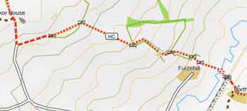
Take track on left after Pangkor House.
E At the end of the track take footpath on left. From here the route zigzags towards Hatherleigh through various small fields - see maps.
Download Route
| Download GPX | Mobile or GPS | |
| Download FIT | Watches | |
| Google Earth | ||
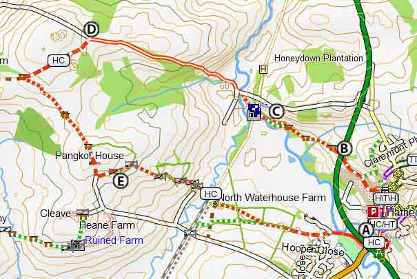
Map of Walk 1
| Walks near Hatherleigh | |
| Dolton & Iddesleigh | |
 | A great pub walk from Dolton to the famous Duke of York at Iddesleigh with links to Michael Morpergo and Rick Stein. |
| Barnstaple | |
 | Two Best Walks with superb coastal views. |
| Great Torrington | |
 | Great Torrington, second oldest Saxon market town in devon, makes an ideal centre for walking offering extensive views of a dramatically meandering Torridge. |
Walk 2 Hatherleigh Community Trail (2.1 miles)
Difficulty:![]()
A pleasant trail designed by the pupils of a local primary school taking in Hatherleigh Common & St Johns Well, an ancient monument.
The route follows sections of the Two Moors Way.
Part of the route across the moor can be boggy.
Download Route
| Download GPX | Mobile or GPS | |
| Download FIT | Watches | |
| Google Earth | ||

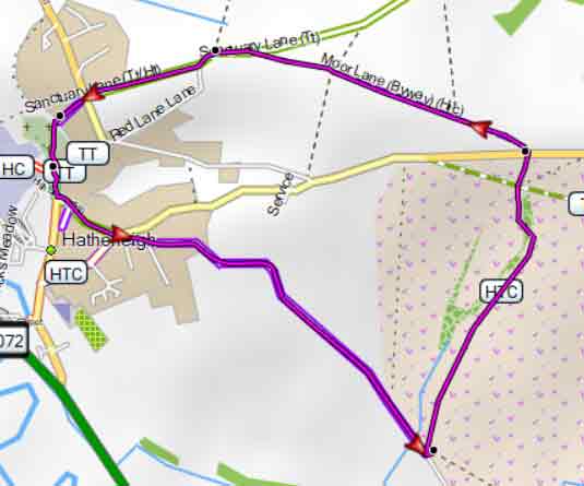
Map of Walk 2
Walk 3 Hatherleigh Common (3.2 miles)
Difficulty:![]()
A pleasant moorland walk exploring Hatherleigh Common.
The route follows mainly public footpaths and bridleways and includes some steady climbs and descents.
There is nowhere to shelter so a fine day would be ideal!
Download Route
| Download GPX | Mobile or GPS | |
| Download FIT | Watches | |
| Google Earth | ||
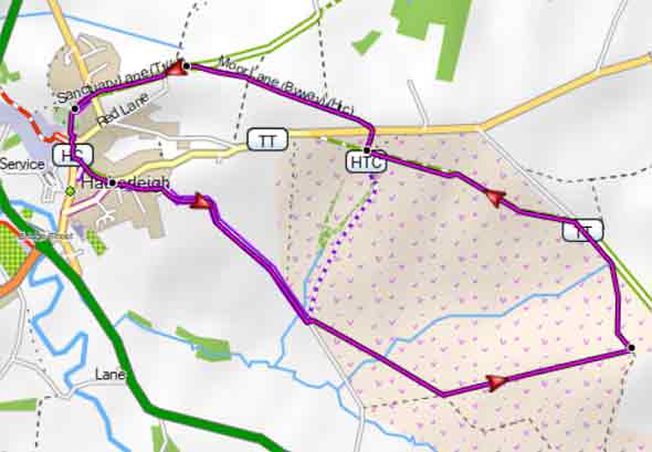
Map of Walk 3