Chulmleigh Walks |
| Select Your Walk | Walk 1 (1.8 miles) | Walk 2 (5.3 miles) | Walk 3 (3.7 miles) | |
| Chulmleigh Trail | Beacon & Horridge Moor | Brookland |

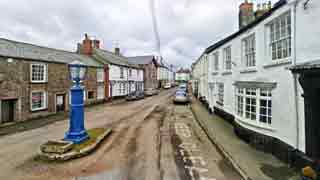
A friendly market town in North Devon with thatched cob cottages and narrow cobbled streets.
- Chulmleigh Fair was protected by Henry III's 'white gauntlet' as a warning to those who ignored the rules of the fair.
- Chulmleigh:'Ceolmund's leafy hill'.
| What to explore? |
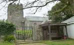
- Church , shops, cobbled streets
- Old Fair Mosaic
- 19th century Town Pump
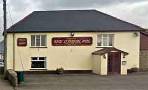
| Red Lion Hotel | |
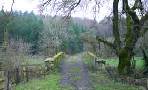
| Kings Park Near St Mary Magdalene Church |
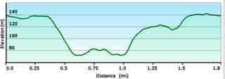
Walk 1 Chulmleigh Trail (1.8 miles)
| Where to Eat? | |
| Red Lion Hotel , Chulmleigh | |
Difficulty:![]()
A short trail designed by the pupils of Chulmleigh Primary School.
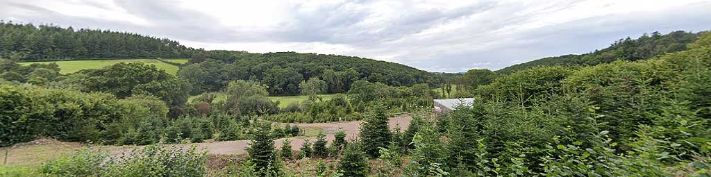
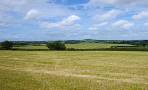
The route offers some spectacular views of Dartmoor.
Many old buildings reflect a thriving woolen trading centre as the village lay on the main Exeter to Barnstaple route.
Download Route
| Download GPX | Mobile or GPS | |
| Download FIT | Watches | |
| Google Earth | ||

| PDF of Walks in this area |
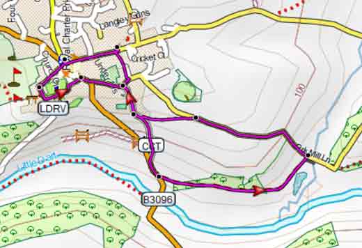
Map of Walk 1
| Walks near Chulmleigh | |
| Eggesford | |
 | A most varied & scenic walk, partly following the Tarka trail to the river Taw and crossing chulmleigh Forest. |
| Lapford | |
 | A lovely country walk from a village with character so typical of 'old' Devon. |
| Zeal Monachorum | |
 | The tranquil hills around Zeal 'Monachorum' have changed little since the Middle Ages when they were cultivated by the monks of Buckfast Abbey. |
| Morchard Bishop | |
 | Morchard (Large Wood) Bishop lies almost halfway on the Two Moors Way . In the village you will find a detailed map of all the footpaths in the area , a welcome sign to all walkers and hikers. |
Walk 2 Beacon & Horridge Moor (5.3 miles)
Difficulty:![]()
A popular rural 5 mile hike using mainly public footpaths.
Some stretches can be quite muddy.
The route takes you into a most undisturbed part of Devon & offers some spectacular views of Dartmoor.
The Walk
A From the entrance Kings Park Car Park turn right and continue east then north for 1500 m ignoring 3 residential roads on your right .
Turn right into Langley then where the road bends north turn right on to a footway.
B At the junction take footpath ahead on your right.
There is a steady climb ahead of you. At the end of the path turn left onto a lane then right.
This stretch can be busy at times.
Continue for 10 minutes until you see an island of trees & Chulmleigh Beacon, ideal for a picnic
C Turn right. Where a lane joins on your left take footpath on right.This crosses part of Horridge Moor .
After 1000m you join a lane. Continue past some houses and where it bends to the left take footpath on your right.
D Soon, in the woods take another footpath on your right and follow this heading south.
Where it joins a lane turn right. Continue downhill and take the first lane on your right
E After 150m take footpath on your left.
Where it joins a lane cross over and follow this public footpath heading south west for 1.1 miles.
Where it joins a lane turn right, and continue back to Chulmleigh.
Download Route
| Download GPX | Mobile or GPS | |
| Download FIT | Watches | |
| Google Earth | ||
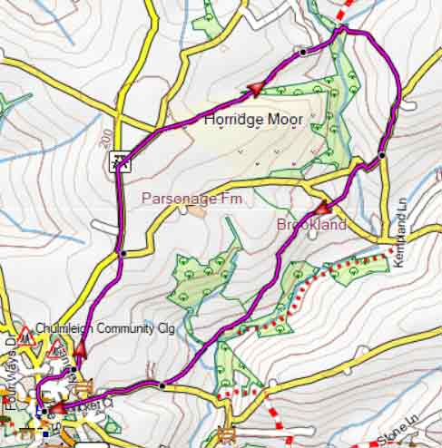
Chulmleigh Walk 2
Walk 3 Brookland (3.7 miles)
Difficulty:![]()
A pleasant (dog) walk which is a shortened version of walk 2.
It uses mainly public footpaths and quiet lanes.
Some stretches can be muddy.
Download Route
| Download GPX | Mobile or GPS | |
| Download FIT | Watches | |
| Google Earth | ||
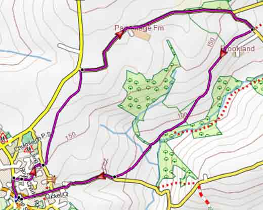
Chulmleigh Walk 3