Best Beer Walks
Beer , meaning a clump of trees , with its charming little harbour owes a lot to its smuggling past.
- Beer Stone was used to outline windows and doors of many churches and cathedrals.
- The Romans used it for their villas and important buildings.
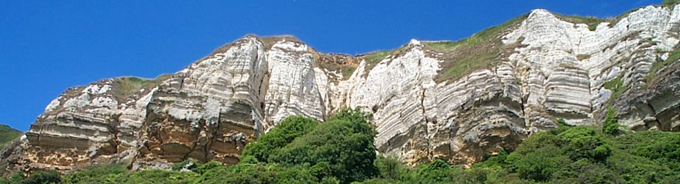
- The sea removed fossils from the limestone, making it unique and ideal for carving fine details.
| What to explore? |
- Beer Village & Harbour
- Jurassic Coast
- Beer Quarry Caves
| in Beer : Anchor , Dolphin | |
| Pay & Display Main Car ParkM | |
| what3words///counts.registers.daunted | |
| SATNAV Postcode: EX12 3EF |
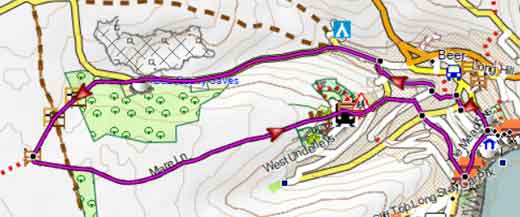
Walk 1 Quarry Caves & Pecorama (3.1 miles)
Difficulty:![]()
This walk uses public footpaths and quiet lanes and takes you past the famous Beer Quarry Caves dating back to the Romans.
More information about the tours
| Where to Eat in Beer? | |
| Smugglers Kitchen, Flipside | |
It continues inland then returns via Mare Lane, an ancient track.
You pass Pecorama - a family attraction and descend towards the sea and Beer harbour.
Download Route
| Download GPX | Mobile or GPS | |
| Download FIT | Watches |

Walk 2 Branscombe (4.5 miles)
Difficulty:![]()
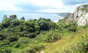
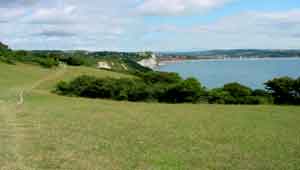
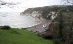
This is a must walk - it will involve some climbing but views of coastline are breathtaking.
| Where to Eat ? | |
| Branscombe Mouth Masons Arms, Branscombe | |
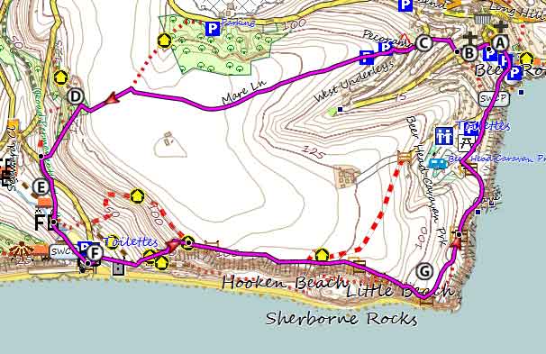
The Walk
| Start :Clapps Lane |
A From the car park turn left into Clapps Lane.
B Just before Higher Meadows turn right onto a footpath. Diagonally cross a residential road onto another public footpath.
C Turn left into Mare Lane and continue past the school. The lane changes into a track then becomes a path.
D In woods take path left and descend somewhat steeply into the outskirts of Branscombe.
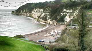
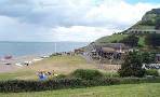
E Turn left towards the sea then take a footpath to the river. Continue to Branscombe Mouth ![]() cafe.
cafe.
F At entrance to car park take South West coast path right and continue back to Beer.
G Stunning views of coast line.
Toilets at Branscombe Mouth - a good halfway spot.
Download Route
| Download GPX | Mobile or GPS | |
| Download FIT | Watches |
There is one steep climb.
Walk 2 to Branscombe
| Walks near Beer | |
| Branscombe | |
 | This is a must walk if you are in this area - it will involve some climbing but views of coastline is breathtaking. |
| Seaton | |
 | Two great walks from this popular holiday resort combining sea and countryside. |
| Donkey Sanctuary | |
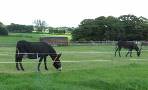 | A short but invigorating family walk from the Donkey Sanctuary to the Jurassic Coast where in 2007 the Napoli ran aground. |
length: | 4.5 miles |
terrain: | tracks bridle/ paths |
| lanes | |
altitude range | 0 - 153 m |
quality of track | *** |
stiles | several |
| yes |