| Select Your Walk | Walk 1 (3.9 miles) | Walk 2 (1.6 miles) | |
| Owlacombe Cross | Town Trail |
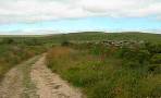
Ashburton, an old stannary (tin mining) town, boasts numerous pubs and a variety of old-fashioned shops.
Name means 'settlement near the ash tree stream'.
| Main Car Park Kingsbridge Ln | |
| SATNAV Postcode:TQ13 7DX | |
| Hound of the Baskervilles The Silent Whistle the Old Exeter Inn |
| What to explore? |
- old-fashioned shops
- Ashburton Museum
- Ashburton Antiques Trail (2020 )
- St. Lawrence's Chapel 14th century
- Ashburton Arts Centre
Walk 1 Owlacombe Cross (3.9 miles)
Difficulty:![]()
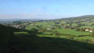
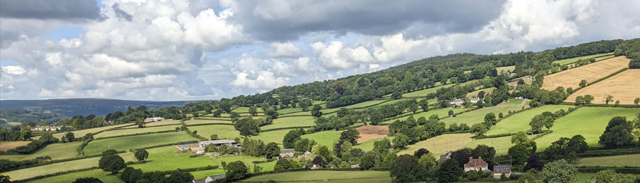
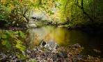
This is one of our most popular walks following part of the Dartmoor Way along the river Ashburn into Whiddon Scrubbs.
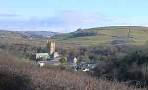
It climbs steadily towards Owlacombe cross offering magnificent views of the rolling Dartmoor moors.
Due to construction of a service highway to quarry a permissive footpath has been created.
| Start : Balland Lane |
The Walk
A From Roborough lane turn into a public footpath called Terrace Walk.
Alternatively, from the town centre, continue along North Street. After 400m turn right onto Terrace Walk and follow hedge on left.
B At Cuddiford Cross cross road into another footpath - do not cross bridge - and follow the river into the woods.
C Where the path crosses the river turn right into a track.
D Continue past Lower Whiddon Farm - some stretches here can be muddy after heavy rain. When you join a lane turn right.
E Take left fork and continue down a lane.
F At public footpath sign turn right.
G Turn right at the end of this footpath into a lane then almost immediately right again into Rew Road. Continue past Sports Hall and take first lane on left back to Roborough lane.
Download Route
| Download GPX | Mobile or GPS | |
| Download FIT | Watches | |
| Google Earth | ||

| Balland Lane or Pay & Display Car Park in Ashburton (free on Sundays) |
| What3Words:///best.observes.dislikes | |
| Balland Lane SATNAV :TQ13 7BX |
There is one steady climb.
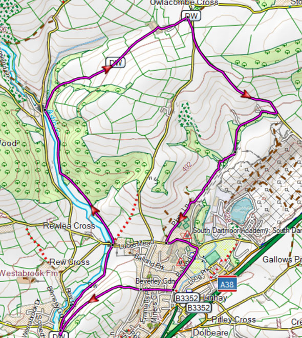
Map of Walk 1
terrain: | tracks bridle/ paths |
| lanes | |
main roads | 0 % |
yes after heavy rain | |
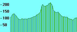
altitude range | 87 - 217 m |
stiles | several |
| Walks near Ashburton | |
| South Brent | |
 | A great walk to explore Bent Moor & the river Avon following public footpaths and green lanes.- stunning views at the top |
| Buckfastleigh | |
 | Various popular and scenic walks to explore the beautiful area around Buckfast Abbey |
| Dartmoor | |
 | Carefully selected walks with easy car access! |
| Bovey Tracey | |
 | This popular and fairly easy walk follows well maintained footpaths through the beautiful Parke estate, near Bovey Tracey, now belonging to the National Trust. |
Walk 2 Town Trail (1.6 miles)
![]() Difficulty:
Difficulty:![]()
| Best Devon Town Trails |
| Taylors , 5 North St |  |
| This is one of our 'Thirty Minute Walks' |
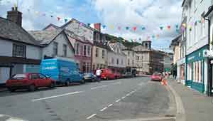
A short but enjoyable walk exploring Ashburton.
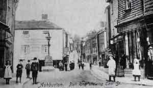
Picture was taken more than 100 years ago showing 'the Bull Ring' , named after a sport which was banned in 1835. Notice the gas street light and island.
Download Route
| Download GPX | Mobile or GPS | |
| Download FIT | Watches | |
| Google Earth | ||
Pay & Display Town Centre (Free on Sundays) |
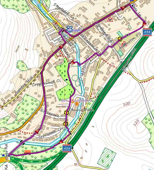
Map of Walk 2