The "Pomeroy" part of the name comes from the de Pomeroy family, a prominent Norman family who settled in Devon after the Norman Conquest of 1066.
The family held lands across Devon, including Berry Pomeroy, a better-known location associated with their name.
| |
| No Pubs |
Walk 1 Cheriton Cross (2.2 miles)
Difficulty:![]()
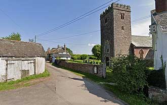
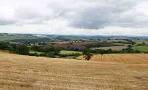
A peaceful circular walk around Stockleigh Pomeroy
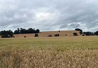
The route follows quiet lanes and public footpaths through a rolling country side and wheat fields in the summer.
Download Route
| Download GPX | Mobile or GPS | |
| Download FIT | Watches |

Limited spaces near church | |
| What3Words:////lawful.long.sourcing | |
| SATNAV Car Park Postcode:EX17 4AT |
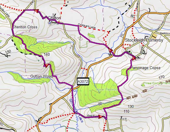
Map of Walk 1
| Walks near Stockleigh Pomeroy | |
| Cheriton Fitzpaine | |
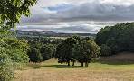
 | Explore winding lanes, ancient footpaths, and green pastures that lead to breathtaking views over the surrounding hills. |
| Shobrooke | |
 | Shobrooke, East of Crediton, is a most popular centre for walkers. Two great walks with extensive views of tranquil rolling hills. |
| Newton St Cyres | |
 | A delightful country walk through orchards and along a golf course following part of the Devonshire Heartland Way. |
| Crediton | |
 | Many great walks of varying lengths to choose from. |
Walk 2 Cheriton Fitzpaine (4.8 miles)
Difficulty:![]()
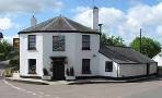
This quite strenuous but rewarding pub walk to Cheriton Fitzpaine, a charming village , also unaffected by change.
The Walk
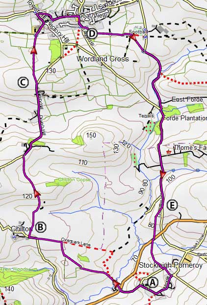
AWith back to church turn right & head northwest for a short 45 feet. Take a sharp left . At the T junction turn right and carefully cross over - you will see a foot path sign. Follow the A3072 for a short time then turn left onto a public footpath, between 2 houses - path at times can become overgrown.
Proceed 18m on this path, and in a moment, bear left, over a small footbridge and curve on the edge of the field until you join a lane.
Veer right onto Chilton Lane.
BJust before a barn on left, turn right onto a track with a foot path sign.
Follow this stretch for 1/2 a mile until you reach a lane. Turn right and continue for another half mile.
CJust after Perry Farm turn left onto a footpath which eventually leads into Cherriton Fitzpaine.
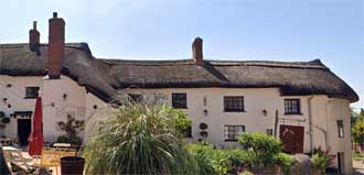
Turn left at the church onto Barton Close then take the next lane on right which passes The Ring of Bells.
Follow this Laneand at the T junction turn left
Continue along this lane for a while until you reach the Half Moon Inn. Turn Right into Lagge Hill for an 260m trek.
DAt then end of the village turn left onto a signed public footpath. Follow this through various gates and turn right onto a lane, called Coffintree Lane !, near the soccer pitch.
EAfter a mile ignore lane on right but take next foot path on right.
Cross the A3072 diagonally right and continue along footpath back to Stockleigh Pomeroy .
Download Route
| Download GPX | Mobile or GPS | |
| Download FIT | Watches |
Map of Walk 2