| Best Devon Walks |
| Best Devon Walks |
| Best Uplyme Walks |
| 4 TOP Walks |
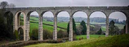
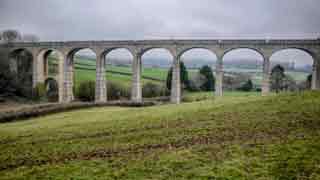
| Walk 1 | Cannington Viaduct |
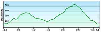
| 2 miles (50 mins) | |
| 4000+ steps | |
| Walk 2 | Cannington Viaduct & Prescot Pinetum |
| 3.2 miles (1h 20) | |
| 6400+ steps | |
| Walk 3 | Cannington Viaduct |
| 3.7 miles (1h 30) | |
| 7400+ steps | |
| Walk 4 | Cannington Viaduct & Lyme Regis |
| 5.2 miles (2h 10) | |
| 10400+ steps | |
| Nearby |
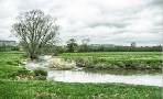
Although you cannot walk across the viaduct, unlike the one in Tavistock, you can walk underneath it.
| Cannington Viaduct Prescot Pinetum (Woodland Trust) Roman Villa | |
| Talbot Arms Uplyme | |
| Uplyme Village Hall |
| Walk 1 Cannington Viaduct (2 miles) |
Difficulty:![]()
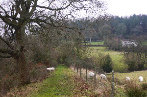
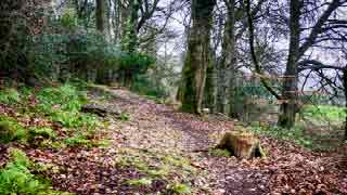
A very pleasant walk through a tranquil landscape following public footpaths & bridlepaths and quiet lanes. Allow at least an hour.
The Walk
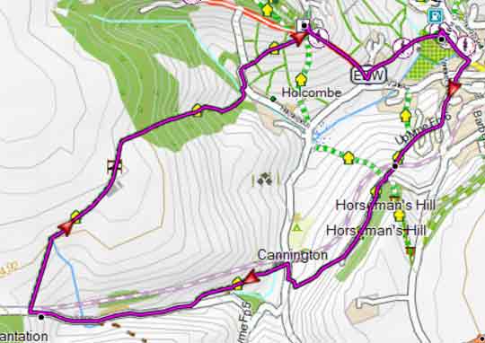
A From the car park, facing the road , turn right and continue towards The Talbot. Turn Right onto Gore Lane and continue climbing steadily until Hook Farm Campsite.
B Turn right onto a service road through the campsite , past the reception and down to the bottom.
C Turn left and soon right onto a public footpath; cross stile and climb diagonally left to an opening where old railway used to be.
Continue right and aim for some woods to some stiles in a gap.
Turn right onto a lane (public bridlepath) and follow this along Horseman's Hill for 0.3 miles.
D At the end continue onto a narrow bridle path to the right of a house.
Soon you should be able to see the viaduct. on your right. The path is not very clear but head for a gate to the right of a house.
E Turn right in the direction of the viaduct.
Continue along this lane past Cannington Farm. Where the lane bends to the right in the fields on your left a Roman Villa was discovered.
F Ignore a lane on your right which leads to Holcombe but continue until the road forks near some houses.
G Take left fork, At the cross roads cross over onto a narrow lane and soon right, onto a footpath that takes you back to the Village Hall.
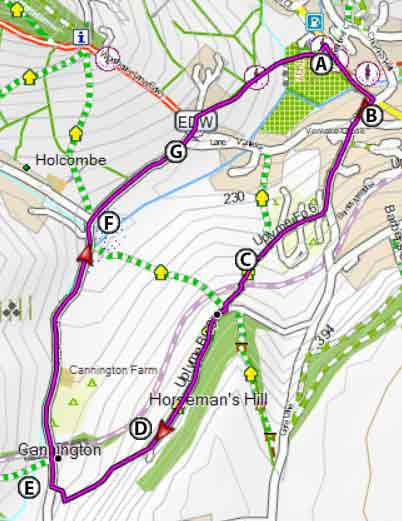
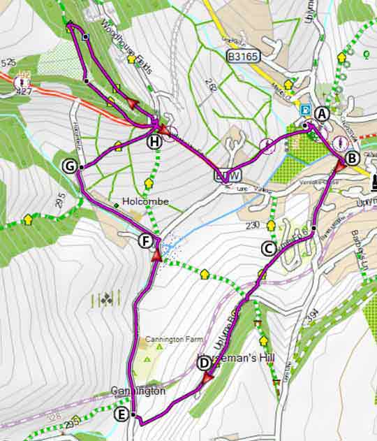
Map of Walk 1
Download Route
| Download GPX | Mobile or GPS | |
| Download FIT | Watches | |
| Google Earth | ||
| Walk 2 Cannington Viaduct & Prescot Pinetum (3.2 miles) |
Difficulty:![]()
A most enjoyable ,varied and somewhat strenuous circular walk - it includes some steady climbs and a steepish descent.
Follow instructions of walk 1 up to F .
F Take lane on your left past Lower Holcom's Farm.
G Beyond the farm take a public footpath on your right in a North Easterly direction.
At the end of the footpath cross lane and take a permissive footpath into Prescot Pinetum.
H At the end of the path after some steps go through a narrow gap marked by 2 posts and turn left on to a public bridleway.
Continue downhill on a track left of a wood joining the East Devon Way, a long distance hiking route from Exmouth to Lyme Regis.
For more information on long distance hiking routes including free downloads of routes click here.
From here can catch glimpses of the viaduct.
Follow lane down and turn left at the next crossroads . Take footpath on your right to return to the village hall.
Map of Walk 2
Download Route
| Download GPX | Mobile or GPS | |
| Download FIT | Watches | |
| Google Earth | ||
 | En RouteNo pubs |
| Walk 3 Cannington Viaduct (3.7 miles) |
Difficulty:![]()
A most enjoyable ,varied and somewhat strenuous circular walk - it includes some steady climbs and a steepish descent. and some stretches can be muddy,
Follow instructions for walk 1 but take footpath on your left, just before the viaduct.
Use map or follow gpx route on your mobile/gps device.
Map of Walk 3
Download Route
| Download GPX | Mobile or GPS | |
| Download FIT | Watches | |
| Google Earth | ||
| Walk 4 Cannington Viaduct & Lyme Regis (5.2 miles) |  | |
| MAP |
Difficulty:![]()
A delightful 5 mile hike combining the viaduct with Lyme Regis and the Cobb.
The walk uses quiet lanes, public footpaths and bridleways.
It joins the south west coast path leading into Lyme Regis ; then follows the East Devon Way back to Uplyme.
| This walk crosses the busy A 3052 road |
Download Route
| Download GPX | Mobile or GPS | |
| Download FIT | Watches | |
| Google Earth | ||
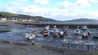
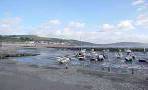
| Walks near Uplyme |
| Lyme Regis |
 |
| A most invigorating pub walk to the Talbot Arms in Uplyme involving some steep hills, partly following the scenic Liberty Trail & East Devon Way. |
| Musbury |
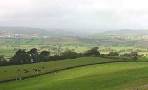 |
| An invigorating and rewarding walk with breathtaking views of East Devon. |
| Axminster |
 |
| Explore the many walking opportunities from Axminster beyond its famous carpet industry. |
 |
| East Devon Walks |
| (©) Pinns UK |