| Best Devon Walks |
| Best Devon Walks |
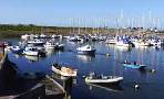
| Best Seaton Walks |
| 3 TOP Walks |
| Walk 1 | Beer & Holyford Woods |
| 7.9 miles (3h 20) | |
| 15800+ steps | |
| Walk 2 | Shorter walk to Beer |
| 4.2 miles (1h 50) | |
| 8400+ steps | |
| Walk 3 | Seaton to Colyton |
| 3.8 miles (1h 40) | |
| 7600+ steps | |
| Nearby |
| What to explore? |
| Beer and Seaton | |
| See below |
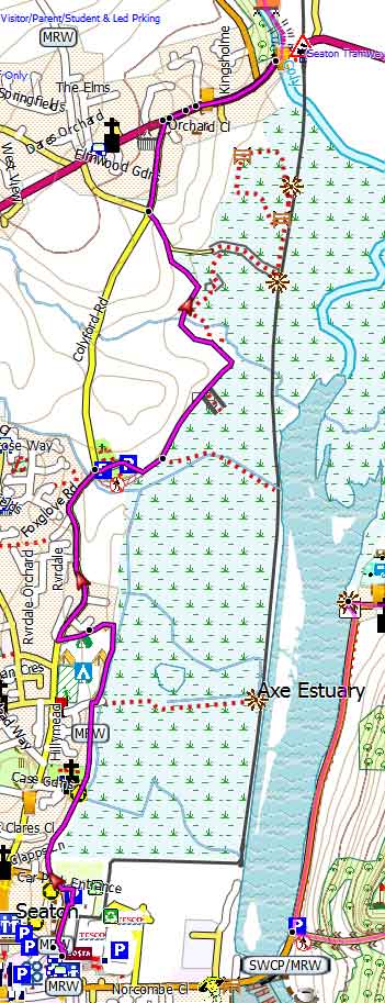
| Walk 1 Beer & Holyford Woods (7.9 miles) |
| Start :Small Parking Area off B3172 see map |
Difficulty:![]()
This varied walk starts at Seaton and takes you through Holyford Nature reserve where in spring the woodland floor is carpeted in bluebells and the air is filled with the aroma of wild garlic. Oak, ash and hazel abound in Holyford Woods and birds nest in holes in trees, bats roost in handy crevices and tangled roots can provide nest sites for weasels and wood mice. A goyle, or sunken stream runs through the heart of the woodland,
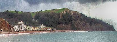
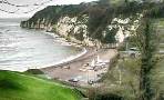
The journey continues via Beer, a most picturesque coastal village that grew up around a smugglers' cove and caves which were once used to store contraband goods.
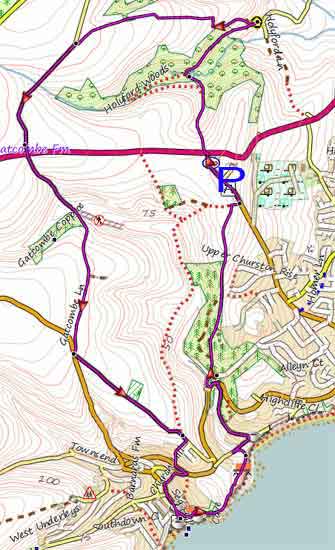
Map of Walk 1
Download Route
| Download GPX | Mobile or GPS | |
| Download FIT | Watches | |
| Google Earth | ||
| Small Parking Area off B3172 - see map Seaton Down Hill, | |
| What3Words: ///shameless.sprinkler.clay | |
| SATNAV Southern part of Postcode: EX12 2TF |
| Walk 2 Shorter walk to Beer (4.2 miles) |
| Start :Seaton, Castle Hill |
Difficulty:![]()
A most enjoyable walk (4.2 miles) leading to Beer along the coast returning via Seaton Down Hill and some residential roads.
Please note that it follows stretches of the Southwest Coast Path which are subject to diversions due to possible landslides.
From Beer you may also like to return the way you came, ie along the coast:
total distance: 2.4 miles
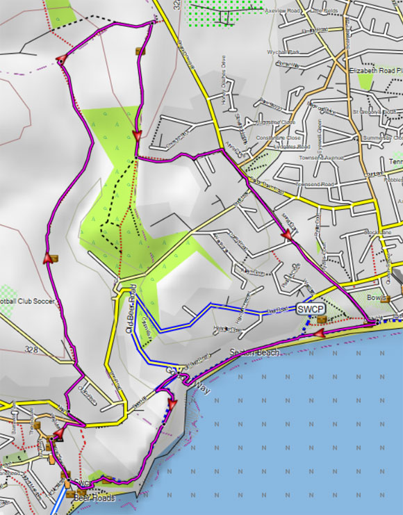
Map of Walk 2
Download Route
| Download GPX | Mobile or GPS | |
| Download FIT | Watches |
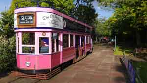
| Walk 3 Seaton to Colyton (3.8 miles) |
Difficulty:![]()
Various options combining a tram journey with a walk.
Click here for details.
| How to view a GPX / FIT file | |
| Jurassic Car Park, near the Toilets | |
| SATNAV Southern part of Postcode: EX12 2WD |
There is one steep climb.
Map of Walk 3
| Walks near Seaton |
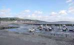
| Beer |
 |
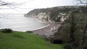
| This is a must do walk if you are in this area - it will involve some climbing but views of coastline are breathtaking. |
| Lyme Regis |
 |
| A most invigorating pub walk to the Talbot Arms in Uplyme involving some steep hills, partly following the scenic Liberty Trail & East Devon Way. |
| Uplyme |
 |
| Walks of various lengths to explore a totally abandoned viaduct! |
| Musbury |
 |
| An invigorating and rewarding walk with breathtaking views of East Devon. |
| Axmouth |
 |
| Axmouth is a very picturesque village at the end of the Roman Fosse Way offering the walker 2 pubs and magnificent views of the Axe estuary. |
| (©) Pinns UK |