| Best Devon Walks |
| Best Devon Walks |
| Best Killerton Walks |
| 4 TOP Walks |
| Walk 1 | Dolbury Hillfort ,a Missing Mansion & Columbjohn |
| 2.8 miles (1h 10) | |
| 5600+ steps | |
| Walk 2 | Killerton to Ashclyst |
| 3.5 miles (1h 30) | |
| 7000+ steps | |
| Walk 3 | Killerton to Broadclyst |
| 4.2 miles (1h 50) | |
| 8400+ steps | |
| Walk 4 | Killerton to Silverton |
| 6.8 miles (2h 50) | |
| 13600+ steps | |
| Nearby |
 |
| Free National Trust Estate Walks |
| Best Devon National Trust Walks | |
| Best Family Walks in Devon | |
| Killerton Car Park (Free to National Trust members) | |
| Killerton |
| Postcode:EX5 3LE |
| Walk 1 Dolbury Hillfort ,a Missing Mansion & Columbjohn (2.8 miles) |
 |
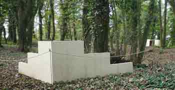
| Killerton's Lost Buildings |
![]() Difficulty:
Difficulty:![]()
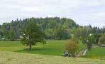
A delightful walk on the edge of Killerton Gardens, given to the National Trust by Sir Richard Acland. It passes the ruins of a lost mansion.
In spring the woods are almost flooded with bluebells and ramsons. Many trees are over 300 years old.The forest itself once enjoyed Roman occupation.
The Walk
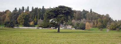
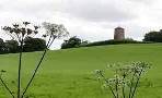
A There is a steady climb to Dolbury Hillfort, dating back to the early Iron Age. Nearby the Romans built a fort.
B One of the most spectacular Viewpoints in the area.
C Ruins of Killerton's Lost Mansion recently discovered and surveyed.
D Turn left then take a few steps and turn right to continue along the back of 'Killerton's Folly', with woods on your right.
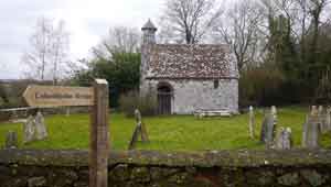
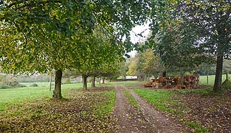
E Columbjohn Chapel built in on the lands owned by the Johannes de Culum.
| What to explore? |
The track from here along the farm can be muddy.
Nearest Pubs: Silverton or Broadclyst.
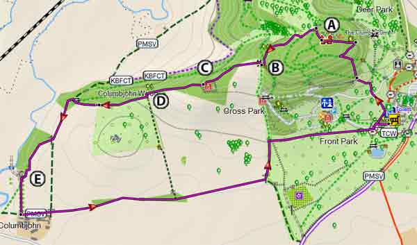
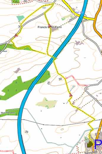
Map of Walk 1
Download Route
| Download GPX | Mobile or GPS | |
| Download FIT | Watches | |
| Google Earth | ||
| Walk 2 Killerton to Ashclyst (3.5 miles) |
![]() Difficulty:
Difficulty:![]()
This most popular walk combines Ashclyst Forest with Killerton.
Check out Killerton to Ashclyst (3.5 miles)
Map of Walk 2
| Walk 3 Killerton to Broadclyst (4.2 miles) |
Difficulty:![]()
Serenity in a rich rolling landscape.
For more information check out Killerton to Broadclyst
Map of Walk 3
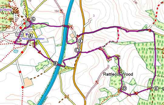
| Walk 4 Killerton to Silverton (6.8 miles) |  | |
| MAP |
![]() Difficulty:
Difficulty:![]()
A great pub,country and river walk to an idyllic village.
Check out Killerton to Silverton
Nearest café : Stables Café ,Killerton
| Walks near Killerton |
| Broadclyst - Killerton |
 |
| Two easy and pleasant circular walks from Broadclyst to Killerton. |
| Ashclyst Forest |
 |
| Various easy walks and trails through a forest now maintained by the National Trust |
| Broadclyst Windmill |
 |
| Gentle walks towards Broadclyst's windmill. |
| (©) Pinns UK |
