

Best Ivybridge Walks

| Walk 1 (7.8 miles) | Walk 2 (3.9 miles) | |
| Harford Church & Moorland | Longtimber Wood |

Gateway to Dartmoor, Ivybridge is perfect for nature lovers with delightful riverside trails and lush countryside views .

Proper footwear is essential as some stretches along the river are narrow and some can be muddy.
 | Trehill Arms Sportsman Inn Old Smithy |
 | Ivybridge,Leonards Car Park Limited Free spaces Top of Station Rd near Beacon Rd |
 | SATNAV Postcode:PL21 0RU |
Ivybridge is an active centre for walkers with several signed trails : Western Beacon Trail,Hen Lake Down Trail, Longtimber Woods Trail and a Town Trail (designed by the local primary schools) .
 | What to explore? |
- River Erme
- Harford Church,
- Brunel's Viaduct
FAQs
How difficult are the walks?
If you prefer a gentle walk then select walk 2 which is shorter and includes no steep hills.
Where can I park To start a walk In Ivybridge?
Ivybridge,Leonards Car Park
Are there any pubs or cafés en route?
Unfortunately not.
Is the walk suitable for wet weather?
The first walk provides little shelter, whereas Walk 2 is mainly a woodland walk giving some protection against rain.
Can I download the Ivybridge walking routes To my GPS?
Yes. The routes have downloadable GPX files for compatible GPS devices And mobile navigation applications, as well as FIT files for compatible sports watches.
Where can I find out more about GSX or FIT files?
Check out this link.
Walk 1 Harford Church & Moorland (7.8 miles)

 Difficulty:

This most varied walk combines riverside with moorland walking offering extensive views of undulating moorland , the sea and Plymouth.
The walk itself is not strenuous and follows public bridleways, footpaths and quiet lanes; however some paths are uneven and narrow.
The route initially follows the river Erme & includes Longtimber Woods, a favourite spot for a picnic and a swim.

It requires a day without rain or strong winds!
Download Route
| Download GPX | Mobile or GPS | |
| Download FIT | Watches | |
| Google Earth | ||

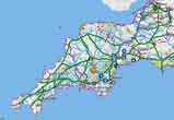 |
| FREE SOUTH WEST HIKING MAP |
+ Dartmoor, Exmoor, Bodmin Moor
|

| Walks near Ivybridge | |
| Plymouth | |
 | Discover Plymouth's historic landmarks including the Barbican,the Plymouth Gin distillery, the Mayflower Steps,the Elizabethan House and Smeaton's Tower. |
| South Brent | |
 | Explore the edge Dartmoor following well maintained footpaths and quiet lanes with stunning views of the South Hams. |
| Loddiswell | |
 | Delightful walks through the Avon Valley. |
| Noss Mayo | |
 | Two Walks with excellent coastal views from a most picturesque village. |
| Yealmpton | |
 | Two great walks from a village that boasts Old Mother Hubbard's Cottage! |
| Salcombe | |
 | South Sands makes an ideal centre for walking to enjoy magnificent views of Devon's most dramatic coastline. |







Walk 2 Longtimber Woods (3.9 miles)
Difficulty:


This is a most popular and easy dog walk along the river Erme and through Longtimber Wood.
It includes one flight of steps.
Download Route
| Download GPX | Mobile or GPS | |
| Download FIT | Watches | |
| Google Earth | ||

