

Aylesbeare Walk


Aylesbeare is picturesque village with a delightful church.
The name means Aegel's grove (small wood) .
The church dates back to the 13th century.
 | Extensive views of Haldon & Exeter |
 | the Nightjar Inn was opened in October 2017. |
 | near the church or residential |
 | SATNAV Postcode:EX5 2BU |
FAQs
Is there a walk with a pub en route?
No, but there is a pub,the Nightjar, in Aylesbeare.
Is there a longer walk from Aylesbeare?
Yes. To Aylesbeare Common. Check out Aylesbear Common
Can I download the Aylesbeare walking routes To my GPS?
Yes. The routes have downloadable GPX files for compatible GPS devices And mobile navigation applications, as well as FIT files for compatible sports watches.
Where can I park To start a walk In Aylesbeare?
Parking is residential,near the church
Where can I find out more about GSX or FIT files?
Check out this link.

Walk 1 Perkin's Village (2.7 miles)
Difficulty:

Please note:
Wellies are needed after heavy rainfall when fields are likely to be wet.
A stretch through a wood contains large pebbles.
A great walk with no steep hills exploring the rural and peaceful life around Aylesbeare and Perkin's Village using quiet lanes and public footpaths - ideal for a spring or summer's day.
- Two centuries ago Perkin's Village was called Parkyns Village, which was named after the 'end' of an 11th century deer park , west of the village.
- Sadly, the park no longer exists.
- Expect to see freely wandering chickens or turkeys on a farm nearby.
- Also, look out for the thatched 'Old Farmhouse' in the same village.
- The route offers some extensive views of Exeter & Haldon.

There are several stiles to negotiate, some in poor repair.





| Walks near Aylesbeare | ||
 |  | |
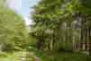
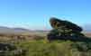
| Aylesbeare Common | West Hill | |

Download Route
| Download GPX | Mobile or GPS | |
| Download FIT | Watches | |
| Google Earth | ||
 | yes |
