Best Dulverton Walk
| More Exmoor Walks |
Difficulty:![]()
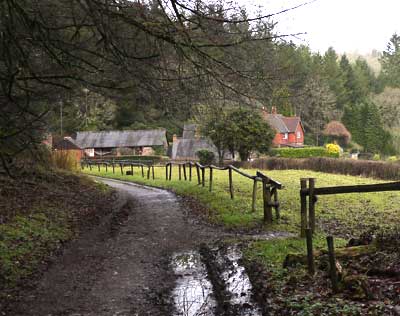
A very pleasant walk from a delightful town , boasting several pubs, restaurants , cafes and shops. Ideal during seasonal celebrations.
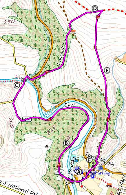
A From the Car Park walk towards the river. Cross the bridge then turn right into Oldberry lane
B The walk joins the Exe Valley Way and follows the river Barle on the edge of a forest.
C At the next junction turn right into Windball Hill.
Cross this charming bridge then turn right to join a B road. Here, turn left then almost immediately, right into a track, intriguingly called Looseall Lane.
D After quite a steep climb turn left into a track , then right into another track to a survey point - the views are quite spectacular.
EReturn via a bridleway heading South. This joins a pubic footpath.Continue along this path.
F The route finally descends to Dulverton church which is well worth a visit.
| Pay & Display Car Park Kemps Way | |
| SATNAV Postcode:TA22 9HL |
length: | 3.8 miles |
time: | 1 hr 50 mins |
terrain: | tracks , paths |
| lanes | |
Points of Interest | River Barle Dulverton |
main roads | 0 % |
2% | |
altitude range | 125 - 260 m |
quality of track | *** |
Download Route
| Download GPX | Mobile or GPS | |
| Download FIT | Watches | |
| Google Earth | ||

There is one steep climb and a steep decent to the church.
FREE HIKING MAP of UK, South West
- More up to date than OS maps
- Designed for Walkers & Hikers
- PRINT YOUR OWN WALK IN DEVON!
No Login or Membership required!
Dulverton Walk