| Best Devon Walks |
| Best Devon Walks |
| Best Totnes Walks |
| 6 TOP Walks |
| Walk 1 | Sharpham & Ashprington |
| 6 miles (2h 30) | |
| 12000+ steps | |
| Walk 2 | Along the Dart |
| 2.8 miles (1h 10) | |
| 5600+ steps | |
| Walk 3 | To Dartington |
| 4.5 miles (1h 50) | |
| 9000+ steps | |
| Walk 4 | Totnes Town Trail |
| 1.1 miles (30 mins) | |
| 2200+ steps | |
| Walk 5 | Franklin Totnes Trail |
| 5.6 miles (2h 20) | |
| 11200+ steps | |
| Walk 6 | Long Distance walk to Buckfastleigh |
| 8 miles (3h 20) | |
| 16000+ steps | |
| Nearby |
The name means a 'ness' (high land surrounded by a river) 'belonging to Totta .
| Best Southhams Walks |
 | Charles Babbage,computer pioneer, went to King Edward VI Grammar school in Totnes. |
| more heritage walks |
| |
|
| Walk 1 Sharpham & Ashprington (6 miles) |
Difficulty:![]()
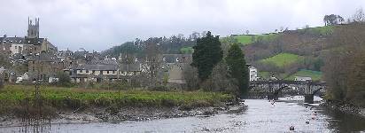
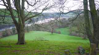
This superb 6 mile hike starts in Totnes and takes you along the Dart to Ashprington, returning mainly via country lanes.
| What to explore? |
The Walk
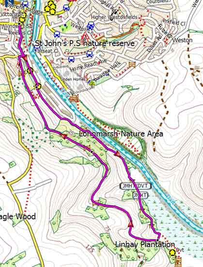
A The route starts at The Plains and follows part of the John Musgrave heritage trail - free download trail here .
B You can either take the foot path down to the river or continue along the old carriage way.
C Stretches from here can be quite muddy ; you may wish to rejoin the carriage way by turning right and following a path up hill.
D You may wish to return the way you came.
Both Totnes and Ashprington are worth visiting in their own right, enjoying good pubs.
main roads | 0 % |
1% | |
altitude range | 1 - 141 m |
quality of track | **** |
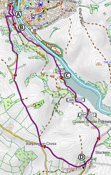
Map of Walk 1
Download Route
| Download GPX | Mobile or GPS | |
| Download FIT | Watches | |
| Google Earth | ||
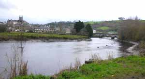
| Walk 2 Along the Dart (2.8 miles) |
Difficulty:![]()
This very pleasant walk is a shorter version of the first walk and follows mainly tracks and public footpaths.
It joins part of the popular Dart Valley Trail .
There are no pubs en route as does not enter Ashprington.
Map of Walk 2
Download Route
| Download GPX | Mobile or GPS | |
| Download FIT | Watches | |
| Google Earth | ||
| Walk 3 To Dartington (4.5 miles) |
Difficulty:![]()
Another very popular walk from Totnes to Dartington & Cider Press following part of the River Dart.
| What to explore? |
Dartington Cider Press
River Dart wild life
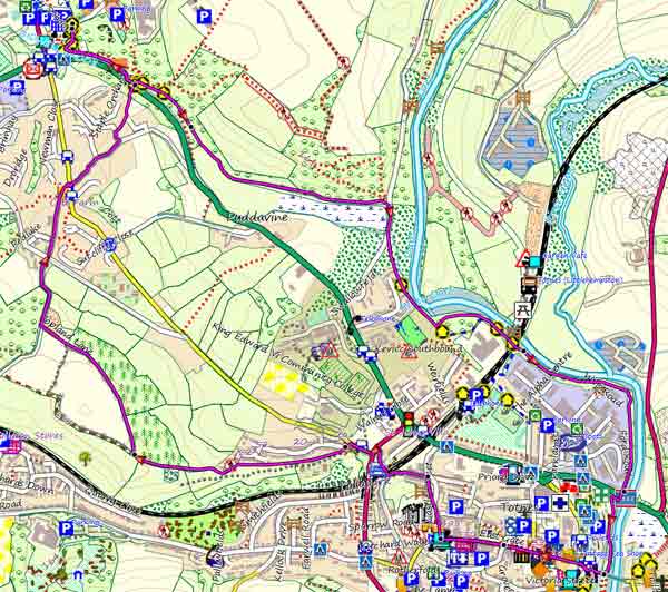
Map of Walk 3
Download Route
| Download GPX | Mobile or GPS | |
| Download FIT | Watches | |
| Google Earth | ||
| Walk 4 Totnes Town Trail (1.1 miles) |  | |
| MAP |
![]() Difficulty:
Difficulty:![]()
| Best Devon Town Trails |
| What to explore? |
Totnes Museum
Totnes Castle
Allow 1 hour. The trail includes
The Walk
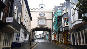
A Fore Street (Totnes' main shopping street)
B East Gate
C St Mary Church
D the Guild Hall,
E North Gate and Totnes Castle.
Download Route
| Download GPX | Mobile or GPS | |
| Download FIT | Watches |
| Town Trail PDF |
| Walk 5 Franklin Totnes Trail (5.6 miles) |  | |
| MAP |
Difficulty:![]()
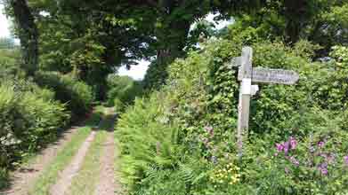
In 2017 an exciting & highly recommended 5+ mile trail was created by the Totnes Ramblers, called the Franklin Totnes Trail - see map .
It was named in memory of Edward Franklin who donated £100,000 towards the project ; the funds have been used to make the tracks, footpaths and bridle paths more accessible during the winter.
| Some stretches along country lanes are subject to heavy traffic. Because of this, we propose the following variation (marked YELLOW). Take care crossing the A381! |
Where Bowden Lane joins a busy lane , turn left (not right) and after 2 minutes turn right into a quiet lane and continue ,crossing the A381, until you rejoin the trail at Tristford Cross.
The views are quite magnificent!
This ranks as one of the most exhilarating walks in the South Hams.
Download Route
| Google Earth | ||
| Download FIT | Watches |
| Walk 6 Long Distance walk to Buckfastleigh (8 miles) |  | |
| MAP |
Difficulty:![]()
Using mainly quiet lanes and public footpaths this pleasant walk via Dartington Cyder Press and Staverton connects the Dartmoor Way with the John Musgrave Heritage Trail.
| Totnes Pay & Display |
| Walks near Totnes |
| Dartington |
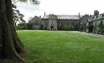 |
| Four top scenic walks of different lengths exploring a region that has attracted artists, musicians and walkers alike. |
| Berry Pomeroy |
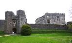 |
| Two great walks from Marldon to Berry Pomeroy Castle through rural countryside which has changed little since the middle ages. |
| Cornworthy |
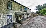 |
| Great pub walks through a most scenic landscape to the famous Malsters Arms atTuckenhay. |
| Dittisham |
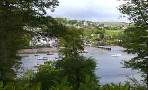 |
| Scenic walks from a most picturesque village along the river Dart. |
| Dartmouth |
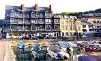 |
| Dartmouth with its narrow streets and ye olde buildings offers the walker many places of interest including the Boat Float and Castle. |
| (©) Pinns UK |
