| Best Devon Walks |
| Best Devon Walks |
| Best Dittisham Walks |
| 3 TOP Walks |
|
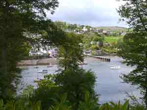
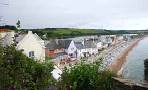
| Dittisham From Greenway |
| Walk 1 | Dittisham to East Cornworthy |
| 3.6 miles (1h 30) | |
| 7200+ steps | |
| Walk 2 | Dittisham to Capton Mill |
| 6.1 miles (2h 30) | |
| 12200+ steps | |
| Walk 3 | Dittisham to Dartmouth |
| 3.8 miles (1h 40) | |
| 7600+ steps | |
| Nearby |
| Best Southhams Walks | |
| Dittisham Pay & Display Car Park - see below. | |
| what3words ///something.extremes.relegate | |
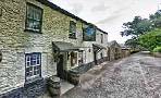
| Dittisham: The Red Lion & the Ferry Boat Inn | |
| SATNAV Postcode: TQ6 0ES |
Car access to Dittisham is somewhat tricky - we recommend the turn off from the A3122 to Dowton.
When entering Dittisham do not take a lane to the ferry but follow directions for Car Park and toilets.
Alternatively, you can walk to Dittisham from Dartmouth - see below.
| Walk 1 Dittisham to East Cornworthy (3.6 miles) |
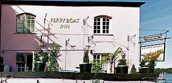 |
| Ferry Boat Inn |
Difficulty: ![]()
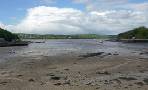
| spectacular views of the river Dart |
A lovely country walk through an ancient landscape with spectacular views of the river Dart.
The Walk
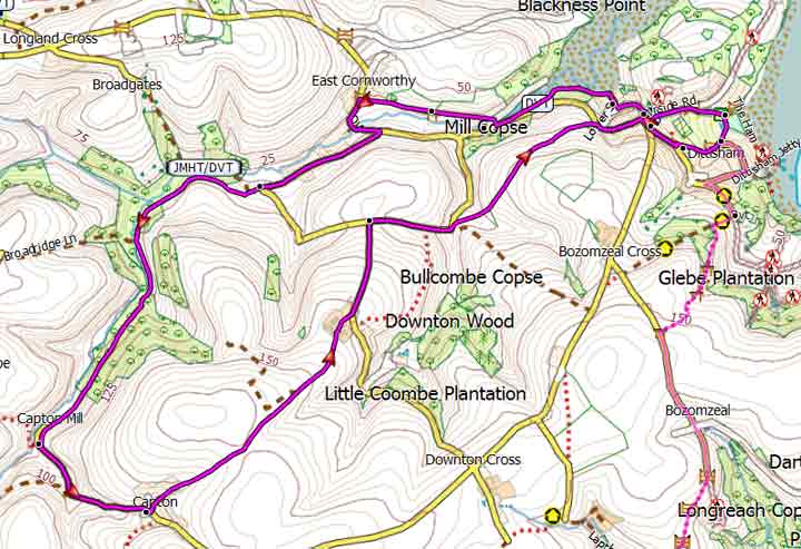
A As you exit the car park turn right into Ham Lane. Continue in land for miles . At T junction turn right then take steps on right down to Lower Street. Continue past church yard through a residential area until you reach Higher street.
Turn right. following the John Musgrave Trail.
B If the tide is low turn right across a small foot bridge then cross lane into a foot path else continue and take next bridge then take foot path on left.
C At East Cornworthy turn left into a lane ; continue and after crossing a bridge take the next lane right; this takes you past Old Coombe Mill.
At the next junction with fingerpost marked Barberry follow signs for Kingston ; do not turn off towards Kingston but continue along this green lane for 0.7 miles.
D Where the lane bends sharply to the left with track and footpath on right take the public footpath between hedges back towards Dittisham.
E Turn right into Higher Street. Continue past Post Office and ![]() the Red Lion into The Level.
the Red Lion into The Level.
F After 0.2 miles turn left towards the Ferry.
Follow path along the beach passing the ![]() Ferry Boat Inn back to the car park.
Ferry Boat Inn back to the car park.
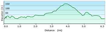
There are several climbs and descents.
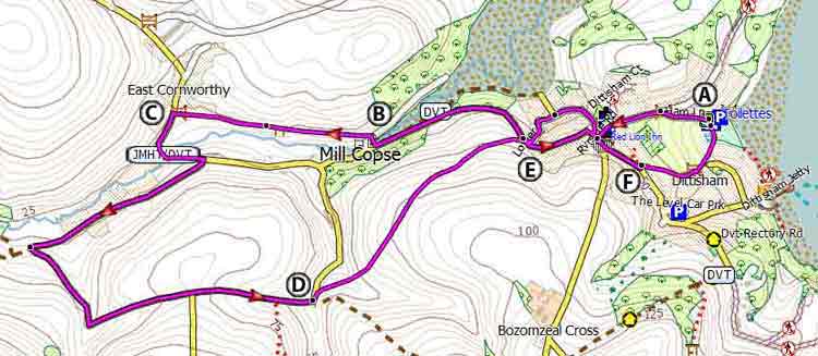
Map of Walk 1
Download Walk 1
| Download GPX | Mobile or GPS | |
| Download FIT | Watches | |
| Google Earth | ||
| Walk 2 Dittisham to Capton Mill (6.1 miles) |
This delightful but strenuous 6 mile hike starts and ends like walk 1 but explores the rolling landscape surrounding Dittisham.
Difficulty: ![]()
For more information on downloads of long distance hiking routes in Devon click here.
Map of Walk 2
Download Walk 2
| Download GPX | Mobile or GPS | |
| Download FIT | Watches | |
| Google Earth | ||
| Walk 3 Dittisham to Dartmouth (3.8 miles) |
Difficulty: ![]()
This makes an ideal pub ; start either from Dartmouth or Dittisham.
The walks follows part of the Dart Valley Trail using lanes, public foot and bridle paths and some residential roads.
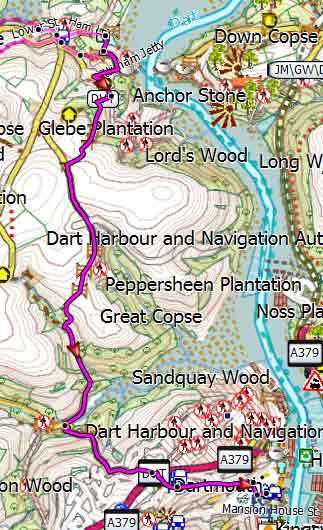
Map of Walk 3
Download Walk 3
| Download GPX | Mobile or GPS | |
| Download FIT | Watches | |
| Google Earth | ||
| Walks near Dittisham |
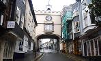
| Dartmouth |
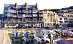 |
| Dartmouth with its narrow streets and ye olde buildings offers the walker many places of interest including the Boat Float and Castle. |
| Cornworthy |
 |
| Great pub walks through a most scenic landscape to the famous Malsters Arms atTuckenhay. |
| Totnes |
 |
| Town Trail & Best Circular Pub Walks around Totnes and along the river Dart |
| Torcross |
 |
| Great coastal walks from Torcross to Widdicome House, Beesands or the lost village of Hallsands - |
| Greenway |
 |
| The tranquility and beauty of this estate gave Agatha Christie the inspiration for many a plot. Two varied and most scenic walks. |
| (©) Pinns UK |
