| Best Devon Walks |
| Best Devon Walks |
| Pinhoe to Clyst Honiton Walk |
|
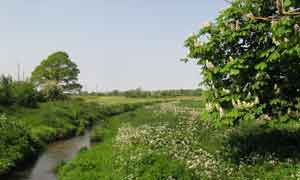
| Path Along the River Clyst |
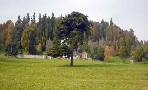
| Mosshayne , River Clyst | |
| Mosshayne small farm shop with 'honesty box' | |
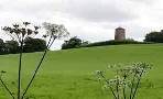
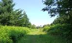
| Strawberry Fields |
Difficulty ![]()
Distance:4.7 miles
This popular (updated recently) route includes Gent's farm shop, the river Clyst, Strawberry Fields Cafe, a Roman Road and the 'Blue Bridge'.
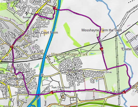
Map of Walk 1
Country lane names like Mill Lane, Tithebarn, Mosshayne, Langaton, Blackhorse hint at a fascinating past threatened by modern development. .
Roman coins have been found in the area and it is said that Blackhorse lane dates back to pre roman times.
Unfortunately, much of the present countryside has been earmarked for future development.
River Walk
This delightful walk takes you through Mosshayne (an old farm) ,along the Clyst ,Tithebarn lane and Monkerton.
The (updated 2026) Walk
A Start from the Station. Cross Railway lines and turn right into Causey Lane. After a while turn left into Orchard Close. At T junction turn right into a new estate.
B Follow Coaker Road for 150m (3 mins) then turn right into Pardon Rise . At the end of this road turn right onto newly opened path through a park along the edge of a new estate. At the end of this path turn right onto a lane.
C Small Farm shop at Gent's Farm with honesty box.
Cross railway bridge and turn left onto a permissive path which follows the railway to the river Clyst . After 0.4 miles turn right onto a track .
Follow this public footpath which leads towards a lane.
D Continue for a short while then turn left into Moshayne Lane. Cross a residential road. At the end of the residential estate turn right into a field and follow a permissive path running paralel to the lane.
When you reach a gate on the left, turn right onto the public footpath.Follow this path as it runs beside an old thatched house and then skirts the line of a Roman road.
At the end turn right and continue along a footpath back towards the estate.
EAs you approach the houses, look for a gap in the hedge ; go through this to join a residential road (Bailey Place). Follow this road which eventually leads to Strawberry Fields - a popular cafe with its own shop.
Head towards the front of this building and turn left onto Tithebarn Way
Follow this for a short while with extensive views of Exeter Airport on left.
At the pelican crossing turn right onto a joint cycle and foot path.
F After crossing the Blue Bridge turn right past the Gypsy Hotel.
Download Route
| Download GPX | Mobile or GPS | |
| Download FIT | Watches |
Other Walks
| Walks near Pinhoe |
| Broadclyst Windmill |
 |
| Gentle walks towards Broadclyst's windmill. |
| Killerton |
 |
| A delightful family walk skirting Killerton Gardens to Columbjohn's chapel. |
| Ashclyst Forest |
 |
| Various easy walks and trails through a forest now maintained by the National Trust |
 |
| Walks in East Devon |
| (©) Pinns UK |