| Best Devon Walks |
| Best Devon Walks |
| Best Morchard Bishop Walks |
| 2 TOP Walks |
|
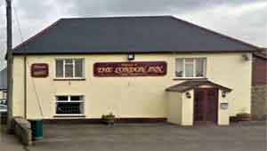
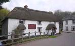
| London Inn |
| Walk 1 | to Morchard Bishop |
| 5.4 miles (2h 20) | |
| 10800+ steps | |
| Walk 2 | From Morchard Bishop |
| 4.8 miles (2 hours) | |
| 9600+ steps | |
| Nearby |
In the village you will find a detailed map of all the footpaths in the area ,a welcome sign to all walkers and hikers.
Some stretches may be muddy after heavy rainfall.
The name means Large Wood held by the Bishop of Exeter
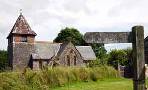
| Village of Morchard Bishop | |
| London Inn | |
| See below |
| Coming from Crediton Car Park is on left, A369, opposite Devonshire Dumpling pub Post Code:EX17 5LP |
| Walk 1 to Morchard Bishop (5.4 miles) |
Difficulty:![]()
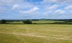
This pleasant country 5 mile hike follows part of the Two Moors Way, a long distance hiking route.
It is well signed and well maintained and offers some spectacular views of Dartmoor.
Parking : For those who prefer to walk to the pub : Car Park at turn off to Downs St Mary from the A377 opposite a pub.
There is a short 5-10 mins stretch along the busy road.
| There is a short 5-10 mins stretch along the busy road. |
| Start : Car Park | |
| Free Car Park see map EX17 5LP |
terrain: | tracks bridle/ paths |
| lanes | |
main roads | 5-10 mins |
yes | |
altitude range | 85 - 290m |
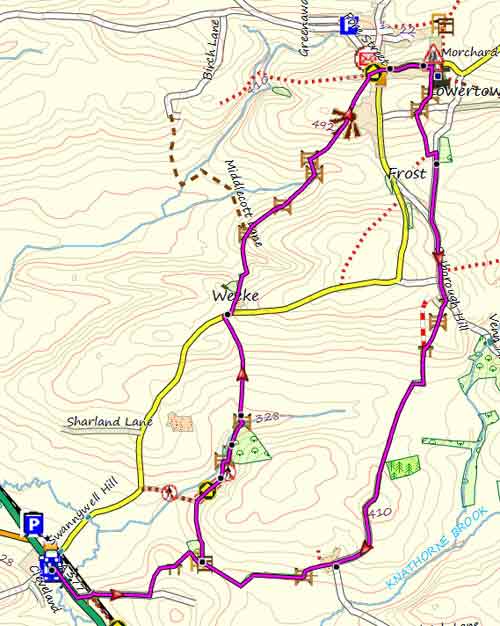
Map of Walk 1
Download Route
| Download GPX | Mobile or GPS | |
| Download FIT | Watches | |
| Google Earth | ||
| Walk 2 From Morchard Bishop (4.8 miles) |
Difficulty:![]()
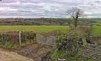
A slightly shorter walk avoiding busy road.
There is no pub en route.
| Start : Foot Path opposite Primary School into the church yard |
| Free Car Park on Church Street near school at Morchard Bishop |
 |
| FREE SOUTH WEST HIKING MAP |
|
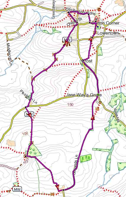
Map of Walk 2
| Walks near Morchard Bishop |
| Lapford |
 |
| A lovely country walk from a friendly village so typical of 'old' Devon. |
| Kennerleigh |
 |
| Several walks into Deepest Devon with many views to enjoy. |
| Colebrooke |
 |
| The landscape around has not been changed for centuries and is dotted with old Devon cottages and manor houses. A very pleasant pub walk. |
| Witheridge |
 |
| A pleasant rural (pub) walk exploring the hidden and more secluded areas, the woodlands and streams tucked between the ridges.It follows part of the Tarka Trail. |
| (©) Pinns UK |
