Which is the best
GPS device for me?
|
 |
| Which Way? |
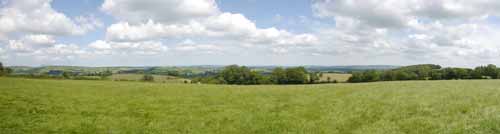
Why Use a handheld GPS for walking?
Yes, your smartphone does have GPS — but it's not always up to the task when you're out walking in the countryside
Here’s why handheld GPS devices are still worth considering:
📱 Why Phones Fall Short:
- Limited sensitivity & accuracy — especially in dense forests or remote areas.
- Lack of detailed maps — many phones don’t show footpaths, bridleways, or lesser-known trails.
- Screen visibility — smartphones often suffer from sun glare, making them hard to read outdoors.
🧭 The Case for a Handheld GPS
:
A handheld GPS isn't essential if you're walking in a region with clearly marked trails and signs.
But, when you’re:
- Crossing vast forests or open fields,
- Navigating farmland with barking dogs or curious cows,
- Unsure where the next stile or gate is...
...
the reassurance of an arrow pointing the way can be a real comfort.
🚨 Safety & Convenience
- :
Always shows your exact location and ETA — vital in an emergency.
- Can help navigate through towns and cities, guiding you to a specific point of interest (pub, café, shop… even a loo!).
🚗 Why Not Use a Car Sat Nav?
- Not designed for footpaths or trails.
- Awkward to carry.
- Most don’t let you follow a custom route you've planned on your computer.
🥾 What a Walking GPS Can Do
- :
Follow circular or custom routes with ease.
- Track your exact journey, including any deviations or detours.
- Export your route to view later in Google Earth or other mapping software.
📱 A Middle Ground
:
Apps like OSMAnd (based on TOPO maps) are a great option for mobile users — they offer good detail, including paths and tracks.
What to Look for When Choosing a GPS Device for Walking or Hiking
Choosing the right GPS device can make a huge difference in your outdoor experience. Here’s a checklist of key features to consider:
🗺 Map Coverage & Route Planning
- Does it show public footpaths, bridleways, and cycle routes?
Not all GPS devices include detailed walking maps by default — ensure yours does.
- Can it find the quickest or most suitable route from A to B?
Some devices support smart routing depending on your mode of travel (walking, hiking, cycling).
- Can it avoid busy roads or suggest scenic alternatives?
A good walking GPS should offer multiple routing options — safety and enjoyment matter!
🔍 Search & Navigation Features
- Can you easily search for addresses or points of interest?
Look for devices that let you find places like the nearest bus stop, station, pub, café, museum, or shop with ease.
- Does it perform well in forests or remote areas?
Devices with high-sensitivity receivers (like Garmin’s GPSMAP or Oregon series) are better at maintaining signal under dense canopy.
🌞 Screen Visibility & Usability
- Is the screen readable in bright sunlight?
Some screens wash out completely in glare — look for models like the Oregon 600 with a bright color display.
- Can you operate it with gloves on?
Button-operated models like the GPSMAP series are easier to use in cold or wet weather than touchscreen devices.
- How big is the screen?
Smaller devices are compact but can be hard to read. Balance portability with clarity.
📍 Waypoints & Interface
- Is it easy to mark a waypoint during your walk?
Some devices make this awkward — test how quickly you can save a location for later reference.
- Are menus intuitive and quick to navigate?
Clunky interfaces can become frustrating over time, especially when you're tired or in poor weather.
🔋 Battery Life
Look for at least 10+ hours of continuous use.
Battery-saving modes can help extend this further on longer hikes.
💰 Map Costs & Compatibility
- Be cautious about map licensing!
Many devices tie maps to a specific unit, so if you upgrade or replace your GPS, you may need to buy your maps again — which we find quite unreasonable.
- Free maps are available — if your device supports them.
Garmin devices that accept .img files can load free OpenStreetMap (OSM) maps, which are regularly updated and surprisingly detailed.
📡 Signal Accuracy & Limitations
- All GPS devices struggle in certain environments:
Tall buildings, dense tree cover, even umbrellas can interfere with satellite signals, causing your position to appear ‘off-track.’
- Look for a ‘Lock on Road’ function
This feature can help correct inaccuracies when walking near roads or in built-up areas. (Note: car sat navs lock on roads by default.)
- GPS does not work in tunnels — something to keep in mind for urban or mountain hikes.
📡 Getting Satellites
When you switch on your GPS, it begins searching for satellites to determine your location. This can take up to two minutes, depending on factors such as your surroundings (e.g. being between buildings or trees), your activity (moving or stationary), and even the weather.
Tip:
- To speed up satellite acquisition, turn on your device and place it on your car dashboard — open sky above helps a lot!
- Select Satellites Menu to reveal current satellites - this often speeds up satellite acquisition
Extra Help: Enabling EPO (Extended Prediction Orbit) downloads can also reduce the time it takes to get a fix.
On many devices, you can improve GPS accuracy by selecting additional satellite systems like GLONASS, GALILEO, or WAAS/EGNOS.
To ensure the best reception:
- Avoid standing between tall buildings or dense trees.
- Try to remain stationary while your GPS acquires satellites.
Surprisingly, in our experience, Sundays often yield poorer accuracy, almost as if the satellites are taking a day off!
Once the necessary satellites are found, your GPS will automatically re-centre the map around your current location. If the screen appears blank, it may mean:
- Your device doesn’t have map data for your area, or
- You may need to zoom in to see the map details.
You’ll typically follow a track (usually in GPX format) saved on your device. This track appears as a highlighted line superimposed on your map.
When you start navigation, your GPS will notify you if you're on or off track.
⚠️ Be aware that poorly created tracks can give the impression of a path running through buildings or dense forests!
Most tracks aren't 100% accurate, and GPS precision is often within 3 meters — with experience, you’ll learn to mentally filter out these small inaccuracies.
Note: The OS50 map isn't ideal when accuracy is crucial. If you're using a Garmin device, you're in luck — high-quality, free OSM maps are readily available and much more detailed - - see example.
How does it work?
- A GPS needs a map of the area you are walking.
Maps can come with the device ; more often they have to be bought separately.
- If you have a Garmin you are able to take advantage of free Openstreetmap maps which, depending on the area, may or may not contain all footpaths.
- A GPS device generally does not include a selection of routes/tracks.
These you need to create yourself using software supplied with your maps.
Alternatively, you can download routes; the most common are in a gpx format.
- Some TOPO maps include a database of long distance hiking routes, ie TOPO Germany.
- Routes contain a set of instructions from one waypoint to another.
- Tracks are trails left behind by the walker - they are more detailed and can be more accurate.
- Routes are saved as a GPX (or FIT file for watches)
- All our walks include free GPX and FIT files
- You use the software to create routes and upload them to your device via a USB connection. Today,this is quite a straightforward process.
- You can use a GPS without routes/tracks but you will not have an ETA.
OS50 Maps
- Some GPS systems come with or can import OS50 maps.
- These might look a good option if you prefer OS50 maps - however,it is our experience that such maps are not as accurate as they should be , particularly , when following foot paths - you could be out by 30 feet.
- When you zoom in you get a blurry image.
- Again, footpaths change rapidly in response to local developments and may have been diverted or even removed !.
- We've developed a detailed OS-style map of the South West, tailored for walkers and cyclists, fully compatible with Garmin GPS devices.
Check out here
Create your own maps
- There is another solution but its a bit 'techy'.
If you want to upload the latest maps for free and your gps supports 'img' import then we would recommend:OpenStreetMap.
Such maps are created by volunteers - you could be one of them - and may not include all the public footpaths . Remember , they are free and can be very detailed!
- Countries can be downloaded and uploaded to your gps.
- Try our most popular & free:mapuploader 6