| Best Devon Walks |
| Best Devon Walks |
| Best Bowermans Nose Walks |
| 2 TOP Walks |
| Walk 1 | Bowerman's Nose |
| 2 miles (50 mins) | |
| 4000+ steps | |
| Walk 2 | Hound Tor & Bowermans Nose |
| 4.4 miles (1h 50) | |
| 8800+ steps | |
| Nearby |
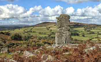
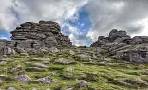
Legend has it that Bowerman, a huntsman, and his hounds were turned to stone by witches as a punishment for disturbing their peace.
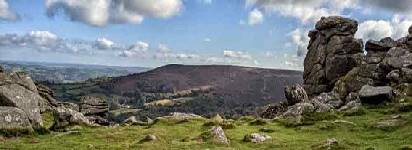
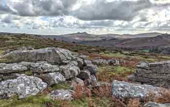
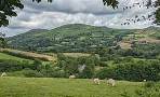
The scenery is both breathtaking and magical !
| Bowerman's Nose Hound Tor | |
| Small Car Park | |
| what3words:///forks.newsstand.relies | |
| |
| Please note : Car Park can be full during the weekend! |
| Walk 1 Bowerman's Nose (2 miles) |
Difficulty:![]()
| Start : Car Park SX740792 |
A short and pleasant walk to explore the dramatic landscape around Bowerman's Nose, a stack of weathered granite.
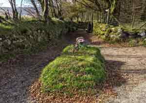
There is an option to visit the famous Kitty Jay's Grave following the yellow route - this adds an extra mile to the total journey.
In the 19th century, Kitty Jay , a young pregnant girl expelled from the community, was buried where she hung herself. Legend has it that bunches of flowers mysteriously appear on her grave.
The Walk
A From the small car park turn right onto a lane then at the next junction turn right and continue along the lane for half a mile then turn right onto a public bridleway.
B Continue along this path climbing steadily towards some rocks.
C Here turn left and head North West towards Bowermans Nose - there is no obvious path.
The 'nose' is on the west side of the tor.
In the distance looking west you can often see paragliders lifting off near Chinkwell Tor.
D Return the way you came back to the lane or take a shorter route - see map.
E To visit the famous Kitty Jay's Grave cross lane and continue on bridleway following the yellow route.
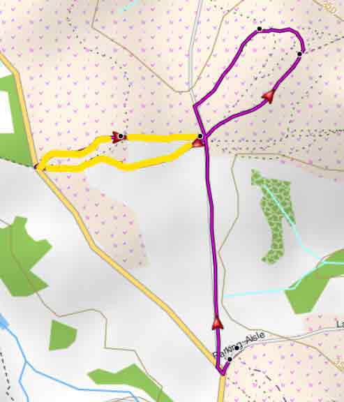
Map of Walk 1
Download Route
| Download GPX | Mobile or GPS | |
| Download FIT | Watches |
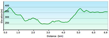
| Walk 2 Hound Tor & Bowermans Nose (4.4 miles) |
Difficulty:![]()
This delightful and varied walk follows public footpaths and bridleways ; apart from one steep climb it is not too strenuous and most of the paths are clearly defined - some between small rocks.
From the Car Park cross lane and follow a footpath towards Hounds Tor.
From here you descend to the site of a medieval village.called Hundaford. You can still see the outline of various buildings and their rooms.
It continues through a typical Dartmoor wood & after Leighon, a very picturesque hamlet, crosses a park like landscape to Southcott.
The route returns via a bridlepath to the dramatic site of Bowerman's nose.
Use the GPX file to follow route on your mobile or GPS device.
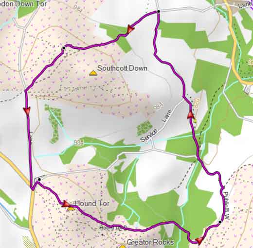
Map of Walk 2
Download Route
| Download GPX | Mobile or GPS | |
| Download FIT | Watches | |
| Google Earth | ||
| Walks near Bowermans nose |
| Emsworthy Mire |
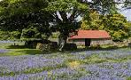 |
| Two easy walks through this stunning nature reserve known for its magnificent display of bluebells |
| Manaton |
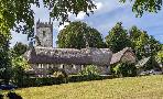 |
| Enjoy one of the most scenic walks on Dartmoor! |
| Widecombe |
 |
| Two walks from Uncle Tom Cobley's village with extensive views exploring Tors, gift and tea shops and perhaps a pub! |
| Haytor |
 |
| There is much more to Haytor than a steep climb to the Tor and back again! Two very popular and fairly easy walks in search of a lost village. |
| (©) Pinns UK |
