Wiveliscombe Walks |
| Select Your Walk | Walk 1 (4.5 miles) | Walk 2 (6.2 miles) | |
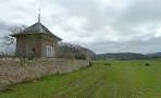
| King's Castle | Washbattle Bridge |
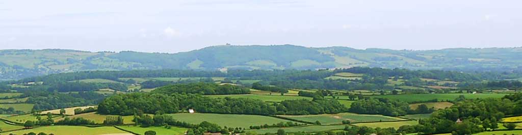
Wiveliscombe ('Wivey') offers a unique mix of historic trails, local breweries, and countryside escapes—perfect for a relaxed, culturally rich visit.
Note:Because numerous paths around Wiveliscombe have patches which have become heavily overgrown, we’ve chosen routes that steer clear of the worst sections.
| North Street (Walk 1) | |
| SATNAV Postcode:TA4 2LJ | |
| Croftway, Wiveliscombe (Walk 2) | |
| SATNAV Postcode:TA4 2JP | |
| The Bear Inn |
Walk 1 King's Castle (2.9 miles)

This pleasant walk free from overgrown sections follows a mixture of public footpaths and lanes with several steady climbs.
Some patches may get muddy!
Difficulty:![]()
- With back to signed car park on North Street and turn left and take very small lane beside the carpark on left - this continues as a footpath.
- Continue along Spring Gardens
- At cross roads turn left into Style Road.
- Turn left into Luxton Road
- When reaching some fields turn left onto a public footpath
- Where the footpath splits take the Right fork.
- Turn left when you join a lane.
- Where the lane bends 90 degrees , turn Right onto Billy Lane and continue along a public footpath.
- When you reach Forde Farm follow the footpath signs turning right towards the B3188.
- Turn Right onto the B3188 and continue - there might be some traffic so take care.
- Take the next turning Left signed 'Milverton 2 miles'
- Follow Castle lane uphill until the start of the woods and turn right onto a drive marked 'Castle Rock'
- Soon turn Right onto a signed public footpath and head back towards Wiveliscombe.
- Follow path all the way to Ford Road.
- Turn Right and soon Left into Burges Lane.
- Follow this until you reach Golden Hill. Turn Left and continue to High Street
- At the square turn right and back to North Street.
Download Route
| Download GPX | Mobile or GPS | |
| Download FIT | Watches | |
| Google Earth | ||


Map of Walk 1
FREE HIKING MAP of South West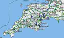
|
Walk 2 Washbattle Bridge (6.2 miles)

Difficulty:![]()
This classic & popular walk has become problematic as certain paths during the summer become impassable.
One option is to follow the ‘Blue’ diversion route shown on the map. Please note that it includes a section of the B3227 (0.5 miles) , which can be quite busy at times.
Expect muddy stretches after heavy rain.
| Croftway, Wiveliscombe | |
| SATNAV Postcode:TA4 2JP |
Download Route
| Download GPX | Mobile or GPS | |
| Download FIT | Watches | |
| Google Earth | ||