Tarr Steps
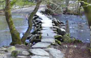
Tarr Steps , a clapper bridge, dating back to the Middle Ages is a very popular tourist attraction.
Walk 1
| Walk 1 Tarr Steps & River Barle (2.2 miles) | Time:1h |
 |  Tap map for larger version | ||
| Tarr Steps | |||
| see main parking area | |||
An easy and very pleasant walk along the river Barle following public footpaths. At the half way point you cross the river using a newly constructed footbridge. Should the steps be impassable, walk to the footbridge then retrace your steps. | |||
| Show on Google Earth | |||
| GPX for GPS | |||
| How to view a GPX file |
| Walks near Tarr Steps: | |
| Dulverton | |
 | Dulverton delightful town, boasting several pubs,restaurants , cafes and shops is a most popular centre for walkers |
| Dunster | |
 | The historic & picturesque village of Dunster on the edge of Exmoor & the Quantocks has been the setting for many films. |
Walk 2
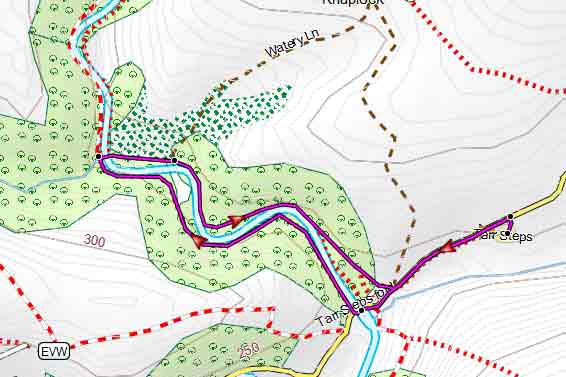
| Walk 2 Tar Steps to Knaplock (5 miles) | Time:2h 10 mins |
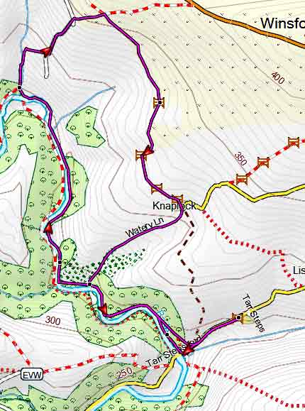 Tap map for larger version | This walk does not cross the river but follows the Exe Valley Way with the Barle on your left. | ||
| After a steepish ascent onto Winsford Hill (moorland) it returns using public foot and bridle paths via the hamlet of Knaplock. After heavy rainfall some tracks may become muddy - the bridle path after Knaplock is called 'Watery Lane' ! | |||
| see main parking area | |||
| GPX for GPS | |||
| Show on Google Earth | |||