Ashburton
Ashburton,an old stannary (tin mining) town, boasts numerous pubs and a variety of old-fashioned shops.
Walk 1
| Walk 1 Owlacombe Cross (3.9 mile) | Time:1h 40 mins |
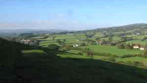 Terrace Walk | 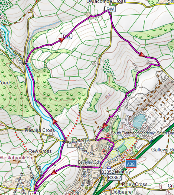 Tap map for larger version | ||
| Ashburton Town & glimpses of Dartmoor | |||
| Roborough Lane or Fee Paying Car Park in Ashburton (free on Sundays) | |||
This is one of our most popular walks following part of the Dartmoor Way along the river Ashburn into Whiddon Scrubbs; it then climbs steadily towards Owlacombe cross offering magnificent views of the rolling Dartmoor moors. A From Roborough lane turn into a public footpath called Terrace Walk. Alternatively, from the town centre, continue along North Street. After 400m turn right onto Terrace Walk and follow hedge on left. B At Cuddiford Cross cross road into another footpath - do not cross bridge - and follow the river into the woods. C Where the path crosses the river turn right into a track. D Continue past Lower Whiddon Farm - some stretches here can be muddy after heavy rain. When you join a lane turn right. E Take left fork and continue down a lane. F At public footpath sign turn right. G Turn right at the end of this footpath into a lane then almost immediately right again into Rew Road. Continue past Sports Hall and take first lane on left back to Roborougfh lane. There is one steady climb. | |||
| Show on Google Earth | |||
| GPX for GPS | |||
| How to view a GPX file |
| Walks near Ashburton: | |||
.jpg) | South Brent | ||
| A great walk to explore Bent Moor & the river Avon following public footpaths and green lanes.- stunning views at the top. | |||
.jpg) | Buckfastleigh | ||
| Various popular and scenic walks to explore the beautiful area around Buckfast Abbey. | |||
.jpg) | Dartmoor | ||
| Carefully selected walks with easy car access! | |||
.jpg) | Bovey Tracey | ||
| This popular and fairly easy walk follows well maintained footpaths through the beautiful Parke estate, near Bovey Tracey, now belonging to the National Trust. | |||
Walk 2
| Walk 2 Town Trail (1.6 miles) | Time:40 mins |
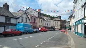 Ashburton | 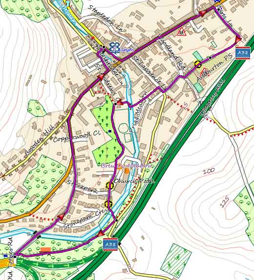 Tap map for larger version | ||
A short but enjoyable walk around Ashburton. Picture was taken more than 100 years ago showing 'the Bull Ring' , named after a sport which was banned in 1835. Notice the gas street light and island.See on Google Earth | |||
| Show on Google Earth | |||
| GPX for GPS | |||
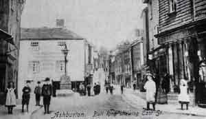 | Ashburton Bull Ring |