| Best Devon Walks |
| Best Devon Walks |
| Ilfracombe Walks |
| 2 TOP Walks |
| Walk 1 | Ilfracombe & Drewerstone |
| 4.2 miles (1h 50) | |
| 8400+ steps | |
| Walk 2 | Ilfracombe to Hillsborough |
| 1.6 miles (40 mins) | |
| 3200+ steps | |
| Nearby |
The name means Valley with grassy slopes belonging to Aelfred.
| Ilfracombe Hillsborough Pay & Display Car Park | |
| SATNAV Postcode: EX34 9QJ |
| What to explore? |
| The George & the Dragon The Thatched Inn |
| Walk 1 Ilfracombe & Drewerstone (4.2 miles) |
![]() Difficulty:
Difficulty:![]()
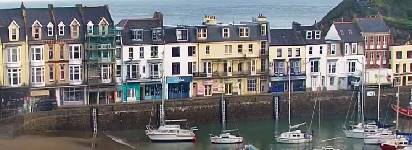
This trail explores Ilfracombe's key attractions: its coastline, harbour, aquarium, museum & shops.
It also passes Ilfracombe's famous Tunnels Beaches , a series of Victorian tunnels leading to secluded beaches.
Allow at least 1 hour.
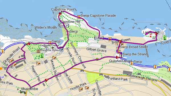
Map of Walk 1
Download Route
| Download GPX | Mobile or GPS | |
| Download FIT | Watches | |
| Google Earth | ||
| Walk 2 Ilfracombe to Hillsborough (1.6 miles) |
Difficulty:![]()
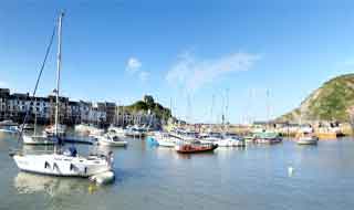
| Extensive views of the coastline |
This delightful and somewhat invigorating walk starts from Hillsborough car park and steadily climbs up to Hillsborough initially following the South West Coast Path.
The Walk
A Keep swimming pool on your right and follow a path towards the sea. Ignore path on right at the back of the pool but continue towards Ilfracombe.
B Just before Larkstone Lane take path on right towards the sea. Continue under bridge (leading to car park) and turn right when you join the SW Coast Path.
Continue along the coast , past the golf.
C Once at the top, enjoy the spectacular views then continue down. After 160 metres take a path on right, back to the car park
Allow 1 hour+ .
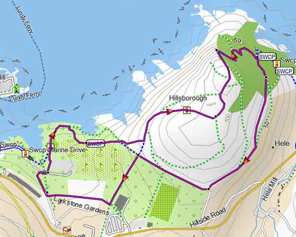
Map of Walk 2
Download Route
| Download GPX | Mobile or GPS | |
| Download FIT | Watches | |
| Google Earth | ||
| Walks near Ilfracombe |
| Combe Martin |
 |
| Exploring the highest point of the South West Coast Path. |
| Hunter's Inn |
 |
| Hunter's Inn, a walker's favourite pub, lies secluded in the river Heddon valley. |
| Arlington Court |
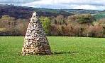 |
| Delightful scenic walks through wooded valleys and rolling countryside. No Trust membership required. |
| Barnstaple |
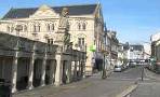 |
| Two Best Walks with superb coastal views. |
| (©) Pinns UK |
