| Best Devon Walks |
| Best Devon Walks |
| Best Barnstaple Walks |
| 3 TOP Walks |
| Walk 1 | Barnstaple Heritage Trail |
| 1.6 miles (40 mins) | |
| 3200+ steps | |
| Walk 2 | River Walk |
| 1.7 miles (50 mins) | |
| 3400+ steps | |
| Walk 3 | River & Barnstaple |
| 2.6 miles (1h 10) | |
| 5200+ steps | |
| Nearby |
The annual Barnstaple Fair Ceremony is taking place on the 3rd Wednesday in September.
These walks are intended to capture its historic charm.
| What to explore? |
| |
| Pay & Display Car Park at Barnstaple | |
| SATNAV Holland Street Postcode:EX31 1DT |
| Walk 1 Barnstaple Heritage Trail (1.6 miles) |
![]() Difficulty:
Difficulty:![]()
| Best Devon Town Trails |
This delightful and easy walk explores its key attractions.
Barnstaple can be traced back to the Romans who may have given it its name (Barum).
The Walk
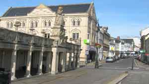
A Building of 'Queen Anne's Walk', now a Heritage Centre, is well worth a visit when open! Merchants used to conduct their business between the columns.
B Albert Memorial Clock Tower built in 1862 , a year after Prince Albert died.
C Rock Park named after William Frederick Rock a wealthy printer and benefactor.
D The Inn on the Square (Victorian)
E Butchers Row & Pannier Market .based on the Victorian idea of having butchers on one side of the road, and a place for marketers with baskets (panniers) on the other.
F South Gate on High Street
G Castle Green & Castle Mount - not much remains of the motte and bailey castle dating back to William the Conqueror.
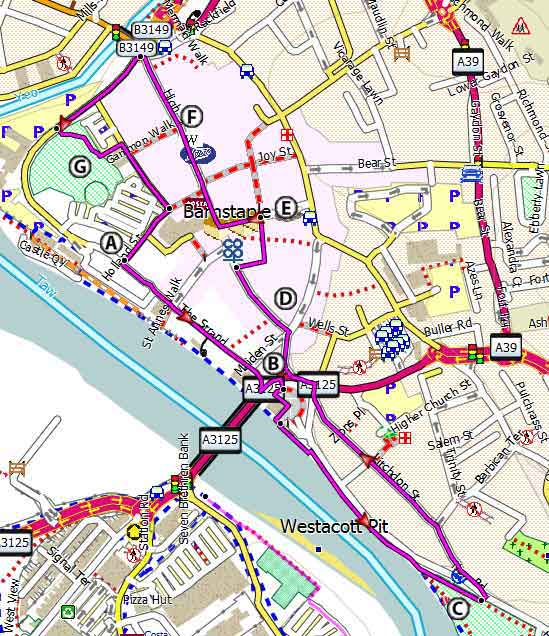
Map of Walk 1
Download Route
| Download GPX | Mobile or GPS | |
| Download FIT | Watches | |
| Google Earth | ||
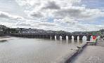
| Walk 2 River Walk (1.7 miles) |
Difficulty:![]()
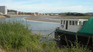
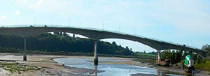
An easy and most enjoyable walk along the river Taw following public footpaths and cycleways.
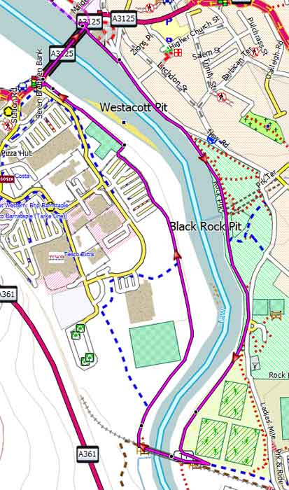
Map of Walk 2
Download Route
| Download GPX | Mobile or GPS | |
| Download FIT | Watches | |
| Google Earth | ||
| Walk 3 River & Barnstaple (2.6 miles) |
Difficulty:![]()
This delightful and easy walk combines walks 1 & 2 ; it follows the river Taw and explores Barnstaples historic sites.

Map of Walk 3
Download Route
| Download GPX | Mobile or GPS | |
| Download FIT | Watches | |
| Google Earth | ||
| Walks near Barnstaple |
| Clovelly |
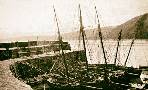 |
| A popular walk to this famous village with its cobbled, traffic-free street so steep that sledges are used to transport goods up and down the hill. |
| Ilfracombe |
 |
| Enjoy short and easy walks along a dramatic coastline. |
| Combe Martin |
 |
| Exploring the highest point of the South West Coast Path. |
| Bideford |
 |
| Find out about Bideford's exciting past by following our Town Trail and enjoy a pub walk to Appledore. |
| Arlington Court |
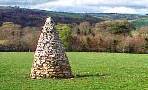 |
| Exploring a scenic countryside |
| Appledore |
 |
| Great walks through a landscape designated as a Site of Special Scientific Interest. |
| (©) Pinns UK |
