| Best Southwest Walks |
| Best Southwest Walks |
| Best Exford Walks |
| 3 TOP Walks |
|
| Walk 1 | Exford & River Exe |
| 5 miles (2h 10) | |
| 10000+ steps | |
| Walk 2 | Exford & River Exe |
| 1.3 miles (40 mins) | |
| 2600+ steps | |
| Walk 3 | Exford & Prescott Down |
| 3.4 miles (1h 30) | |
| 6800+ steps | |
| Nearby |
| Village Green,15th century church | |
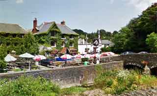
| The Crown Hotel Exmoor White Horse Inn | |
| Exford | |
| Exford Car Park follow signs from Crown Hotel | |
| SATNAV Postcode:TA24 7PP |
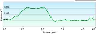
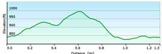
| Walk 1 Exford & River Exe (5 miles) |
Difficulty:![]()
| Start : Car Park |
This popular rural walk joins the Exe Devon Way, a long distance hiking route from the source to the mouth of the river Exe.
The Exe Devon Way route can be downloaded here.
The walk follows mainly public footpaths and quiet lanes.
There is one steady climb and a fairly steep decent.
At the end of the car park join a foot path along the Exe.
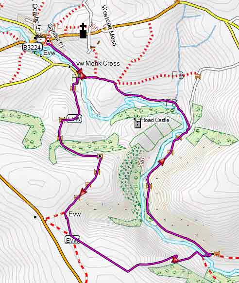
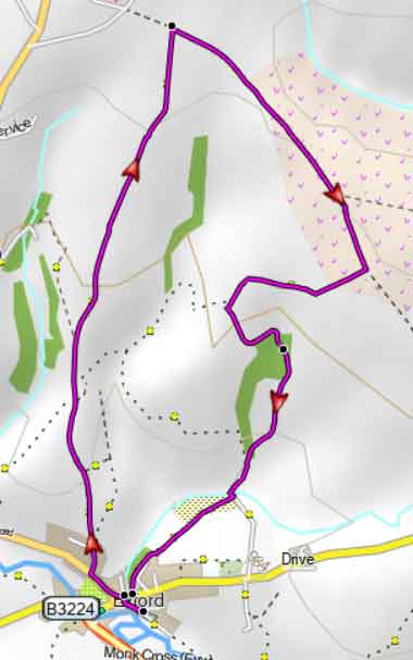
Map of Walk 1
Download Route
| Download GPX | Mobile or GPS | |
| Download FIT | Watches | |
| Google Earth | ||
| Walk 2 Exford & River Exe (1.3 miles) |
Difficulty:![]()
| Start : Car Park |
A shorter dog friendly walk following public footpaths and quiet lanes. Allow at least 1 hour.
From the Car Park head back to the village.
At the Crown Hotel turn right then , after 30 metres , take the next (almost hidden) footpath on your left opposite the old school.
Climb steadily for 0.3 miles then urn right onto a lane. Follow this lane , cross the B3324 and continue on a lane .
Just before the lane bends to the left take a track on your left then soon a footpath on your right.
Follow this down hill. When you join another foot path turn right and just before the river Exe , turn right and continue along the river,back to the car park.
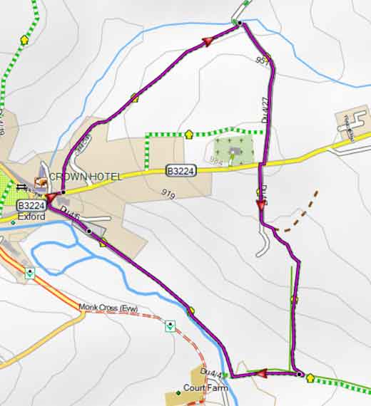
Map of Walk 2
Download Route
| Download GPX | Mobile or GPS | |
| Download FIT | Watches | |
| Google Earth | ||
| Walk 3 Exford & Prescott Down (3.4 miles) |
A popular route to the top following mainly public footpaths.
Difficulty:![]()
| Start : Car Park |
From the car park head towards Exford then at the T junction turn left then almost immediately turn right into Edgcott Road.
At the end of the village green take footpath on right.
Map of Walk 3
Download Route
| Download GPX | Mobile or GPS | |
| Download FIT | Watches | |
| Google Earth | ||
| Walks near Exford | |
 | |
| Dulverton | |
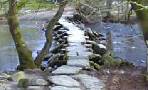 | |
| Tarr Steps | |
| (©) Pinns UK |
