| Best Devon Walks |
| Best Devon Walks |
| Best Dawlish Walks |
| 5 TOP Walks |
| Walk 1 | Classic Dawlish |
| 2.5 miles (1h 10) | |
| 5000+ steps | |
| Walk 2 | Dawlish Warren |
| 3.6 miles (1h 30) | |
| 7200+ steps | |
| Walk 3 | Town Trail |
| 1.7 miles (50 mins) | |
| 3400+ steps | |
| Walk 4 | Dawlish to Holcombe |
| 2.5 miles (1h 10) | |
| 5000+ steps | |
| Walk 5 | Pub Trail |
| 1.5 miles (40 mins) | |
| 3000+ steps | |
| Nearby |
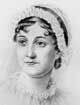
Jane Austen visited Dawlish in 1802 for a long holiday.
She seemed to have been unimpressed with its library.
| Black Sawns, stunning views & beach |
| Witches Bowl, 11Queen Street |
The name Dawlish means 'settlement on the black river'
 | How to Follow GPX Routes on your mobile. |
| Walk 1 Classic Dawlish (2.5 miles) |
Difficulty:![]()
| Start :Station Road or West Cliff Rd |
This gentle walk follows part of small river, the Dawlish Water, with its famous black swans introduced from Australia.
The Walk
AWith back to station, turn Left onto Richmond Close
.
After crossing bridge, turn Left following the SW Coastal Path
.
Continue along the sea front passing some Public Toilets and head towards Cove Cafe.
BJust before cafe, turn Right onto steps (SW Coastal Path) - quite a steep climb
.
When path splits , turn Left
.
When you have reached the top, turn Right and continue along Teignmouth Hill - enjoy the views!
C Turn Left into West Cliff Road
.
After 320m (4 mins) , turn Right onto a public footpath and descend towards the river
.
Continue along Barton Hill
.
Just before the river, turn Left onto a footpath next to the Car Park passing the back of the Hospital - do not cross the bridge
.
Continue following footpath into park
.
DIn the far corner of the park , bear Left near the �insect hotel� . The path now climbs steadily
.
When path reaches road , turn Right and continue along Barton Terrace
.
At the T Junction, turn Right
.
Next to church, turn Left on to a public footpath along side of church
.
Continue following path
.
At the end of path, turn Right along Aloler Hill
.
Continue ignoring Road to Ashcombe
.
When joining road to Ashcombe, bear Right
.
Continue passing Badlake Hill & Meadow Park on right
. Ignore public footpath on right.
EJust after the Humpy, a private rd , turn Right into small lane.
This leads to a public footpath. Follow this path & when joining another footpath on right, turn Left
.
Almost immediately , turn Right heading towards the sea
. You can enjoy some spectacular views along this stretch.
Continue going down hill
.
When joining a residential Rd, turn Right along Stockton Hill
.
FTurn Left onto a service road leading to a public footpath
.
Continue along this path & when joining Strand Hill, turn Right and descend back into Dawlish
.
length: | 2.5 miles |
time: | 1 hrs 15 mins |
main roads | 1 min |
altitude range | 1 - 97 m |
quality of track | **** |
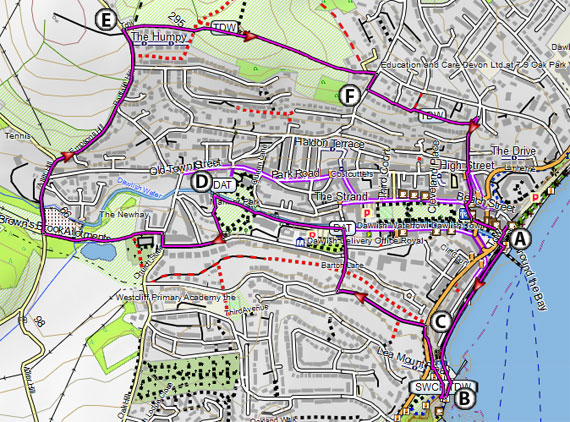
Map of Walk 1
Download Route
| Download GPX | Mobile or GPS | |
| Download FIT | Watches | |
| Google Earth | ||
| Residential West Cliff Road |
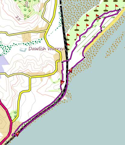
| Walk 2 Dawlish Warren (3.6 miles) |
Difficulty:![]()
A delightful & easy walk following mainly footpaths into Dawlish Warren Nature Reserve & sandy beaches to the mouth of the river Exe.
The route returns along the sea following the Southwest Coast Path to Dawlish town.
| 1 : Rainbows Cafe ,Dawlish Warren 2: A379 near shops |
Map of Walk 2
Download Route
| Download GPX | Mobile or GPS | |
| Download FIT | Watches | |
| Google Earth | ||
| map of Dawlish Warren |
|
| Walk 3 Town Trail (1.7 miles) |
![]() Difficulty:
Difficulty:![]()
| Best Devon Town Trails |
A pleasant town walk highlighting Dawlish's uniqueness and history.
| This is one of our 'Thirty Minute Walks' |
| Witches Bowl , 11 Queen Street |  |
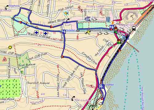
Map of Walk 3
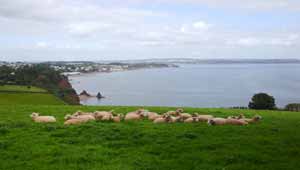
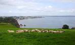
| Walk 4 Dawlish to Holcombe (2.5 miles) |  | |
| MAP |
Difficulty:![]()
A short & quite challenging but varied pub walk.to Holcombe with stunning views of the sea.
Check out Dawlish to Holcombe
 |
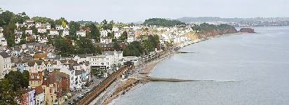
| View of Coast Line |
| Walk 5 Pub Trail (1.5 miles) |  | |
| MAP |
Difficulty:![]()
A great trail taking in all the 9 surviving pubs in Dawlish.
| Walks near Dawlish |
| Dawlish to Holcombe |
 |
| An ideal pub walk to Holcombe with magnificent views of the Devon coastline. |
| Ashcombe |
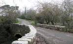 |
| This walk follows a lush and undisturbed valley of the 'Dawlish Waters' and retraces a route vividly described by the 18th century John Swete in his 'Journal Eleven' |
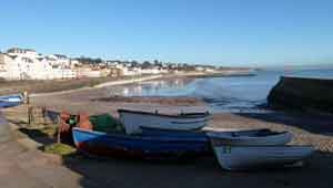
| Cockwood |
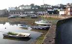 |
| Two pleasant walks from this picture postcard village. |
| (©) Pinns UK |