| Best Devon Walks |
| Best Devon Walks |
| Best Cullompton Walks |
| 5 TOP Walks |
| Walk 1 | to Knowle |
| 3.3 miles (1h 20) | |
| 6600+ steps | |
| Walk 2 | Russel Lane |
| 5.7 miles (2h 20) | |
| 11400+ steps | |
| Walk 3 | Town Trail |
| 1.2 miles (30 mins) | |
| 2400+ steps | |
| Walk 4 | Along the river |
| 2.3 miles (1 hour) | |
| 4600+ steps | |
| Walk 5 | Tiverton Cullompton Circular |
| 16 miles (6h 30) | |
| 32000+ steps | |
| Nearby |
Its main street is located away from the Culm and has lanes descending to long forgotten water mills.
The name means Settlement near the Culm
 | Bakehouse |
| See below |
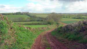
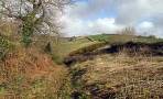
| Walk 1 to Knowle (3.3 miles) |
Difficulty:![]()
A delightful walk to the hamlet of Knowle, similar to second walk but shorter.
Map of Walk 1
Download Route
| Download GPX | Mobile or GPS | |
| Download FIT | Watches | |
| Google Earth | ||
| Park & Display Forge Way |
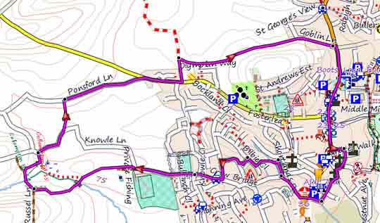
| Walk 2 Russel Lane (5.7 miles) |
Difficulty:![]()
A gentle 6 mile hike through an unspoilt tranquil countryside.
The Walk
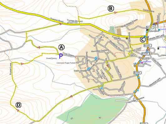
A From the Rugby Football club Car Park turn left and follow Knowle Lane until a footpath on right crossing some fields.
B Goblin lane runs past the location of a mobile Roman Fort and may have existed during the Roman occupation.
C Turn right into an alley (almost opposite CO-OP) .
D There is a gentle climb to the top of Russel Lane where the views are breathtaking.
| Rugby Football Club Crow Green | ||
| map of walk |
Map of Walk 2
Download Route
| Download GPX | Mobile or GPS | |
| Download FIT | Watches | |
| Google Earth | ||
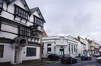
| Walk 3 Town Trail (1.2 miles) |
![]() Difficulty:
Difficulty:![]()
| Best Devon Town Trails |
| This is one of our 'Thirty Minute Walks' |
A varied and easy Town trail taking in key historical features.
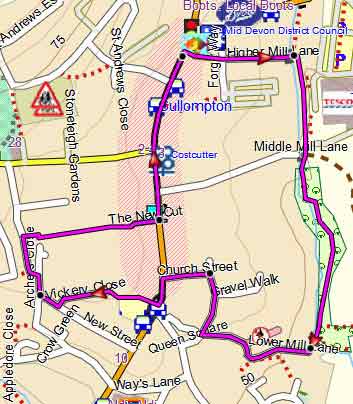
Map of Walk 3
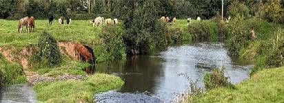
| Walk 4 Along the river (2.3 miles 1 hour) |  | |
| MAP |
Difficulty:![]()
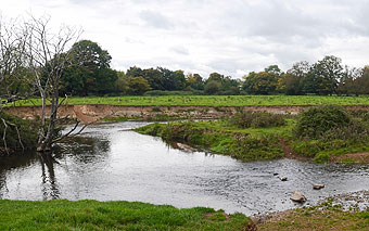
Dip your toes into the river Culm! There are some wide views of St Andrews Church as you walk along the river.
The walk includes some busy roundabouts.
| Download PDF |
| Walk 5 Tiverton Cullompton Circular (16 miles) |  | |
| MAP |
Difficulty:![]()
A long distance walk linking Tiverton and Cullompton using lanes and public footpaths.
There are 2 routes:
Northern Route (7.3 miles)
This follows part of the tow path along the Tiverton canal. Only village: Ash Thomas (no pub)
Sourhern Route (8.7 miles)
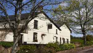
This joins the East Devon Way via Butterleigh
( ![]() Butterleigh Inn ) .
Butterleigh Inn ) .
Buses 1 or 1A run frequently between Tiverton and Cullompton.
For more information click here.
| Walks near Cullompton |
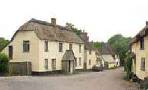
| Willand |
 |
| A short and easy walk following lanes and some footpaths, even a disused railway line, into the heart a charming old village. |
| Uffculme |
 |
| A delightful and gentle walk following a well defined footpath along the river Culm |
| Bradninch |
 |
| Although the walk contains one of the steepest climbs, the views and the well marked footpaths through rolling and remote landscapes make it a most enjoyable experience. |
| Broadhembury |
 |
| A very pleasant & most popular walk taking you past the Devon & Somerset Gliding club - refreshments are available, when open. |
| (©) Pinns UK |
