| Best Devon Walks |
| Best Devon Walks |
| Best Buckfastleigh Walks |
| 4 TOP Walks |
| Walk 1 | Buckfastleigh |
| 2.4 miles (1 hour) | |
| 4800+ steps | |
| Walk 2 | Buckfast Abbey to Holne |
| 6.5 miles (2h 40) | |
| 13000+ steps | |
| Walk 3 | Town Trail |
| 1.2 miles (30 mins) | |
| 2400+ steps | |
| Walk 4 | Long Distance walk to Totnes |
| 8 miles (3h 20) | |
| 16000+ steps | |
| Nearby |
| Where to Eat? | |
| Buckfast Abbey Restaurant | |
| What to explore? |
| Buckfast Abbey Free Car Park | |
| SATNAV Postcode:TQ11 0EG | |
 | Singing Kettle |
| Walk 1 Buckfastleigh (2.4 miles) |
Difficulty:![]()
A very pleasant short walk to Buckfastleigh and the ruins of a church destroyed by fire. There is an option to see some cave entrances.
There are some steep steps to climb.
The Walk
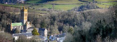
A This short walk starts at Buckfast Abbey and after a steady climb turn left at the crossroads then first right as it descends into Buckfastleigh.
BThe village , according to White, had 'about 300 woolcombers, several corn mills, and four blanket and serge mills; and has quarries of limestone and a sort of black marble.
C There are still ![]() 4 pubs in Buckfastleigh. The walk passes the famous Valiant Soldier, a place where time stood still; it was closed in the 1960s.
4 pubs in Buckfastleigh. The walk passes the famous Valiant Soldier, a place where time stood still; it was closed in the 1960s.
D Continue and cross a bridge across the Mardle. Next, turn left onto a public footpath and up some fairly steep steps .
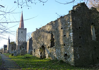
E The parish Church (Holy Trinity) stands on an eminence, ascended by 144 steps, and is a large antique structure, which has been restored and beautified since June, 1844.'
Unfortunately most of the church was destroyed in a fire on 21st July 1992.
You can still see the now metal barred tomb of the Cabells.
 | Sir Arthur Conan Doyle was inspired to write the 'Hound of the Baskervilles' after visiting the tomb of the Cabells. |
| more historic walks |
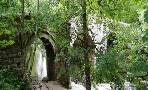
From here you can see the caves of Higher Kiln Quarry . Route shown from centre of church.
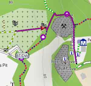
FThe caves are maintained by the Devon Wildlife Trust and not open to the public.
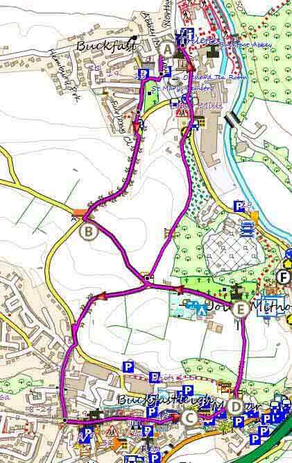
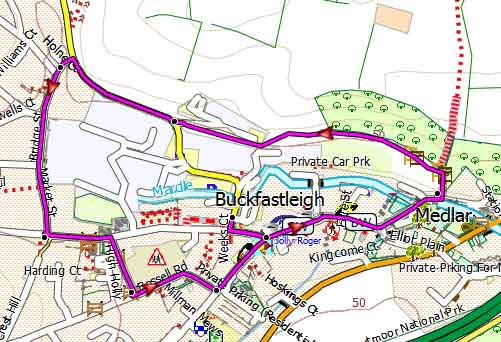
Map of Walk 1
Download Route
| Download GPX | Mobile or GPS | |
| Download FIT | Watches | |
| Google Earth | ||
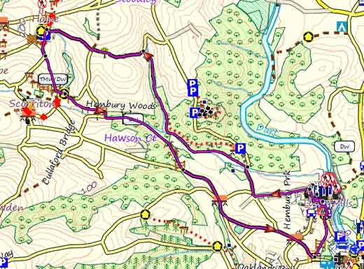
| Walk 2 Buckfast Abbey to Holne (6.5 miles) |
Difficulty:![]()
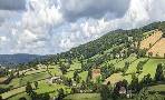
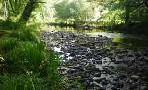
A longer but equally delightful walk follows the Dartmoor Way & Two Moor Way.The fauna can be stunning with yellow flags & blue bells in late spring.
| Part of the Dartmoor way follows a relatively busy country lane. |
| Where to Eat? | |
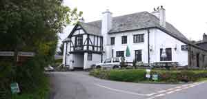
| Church House Inn, Holne | |
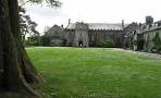
![]() Church House Inn at Holne has real character and is well worth a visit. This pub has recently been reopened but do check for possible closure.
Church House Inn at Holne has real character and is well worth a visit. This pub has recently been reopened but do check for possible closure.
 | Holne is the birthplace of Charles Kingsley, author of Westward Ho! & the Water Babies |
| more historic walks |
![]() . Restaurant, Buckfast Abbey
. Restaurant, Buckfast Abbey
Map of Walk 2
Download Route
| Download GPX | Mobile or GPS | |
| Download FIT | Watches | |
| Google Earth | ||
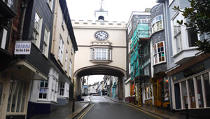
| Walk 3 Town Trail (1.2 miles) |
Difficulty:![]()
| This is one of our 'Thirty Minute Walks' |
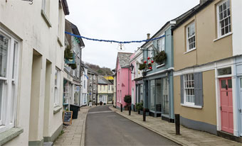
A pleasant walk to explore the charm of Buckfastleigh.
| Buckfastleigh Mardle Way P&D Car Park | |
| SATNAV Postcode:TQ11 0AA |
Map of Walk 3
| Walk 4 Long Distance walk to Totnes (8 miles) |  | |
| MAP |
Difficulty:![]()
Using mainly quiet lanes and public footpaths this pleasant walk via Staverton and Dartington Cyder Press connects the Dartmoor Way with the John Musgrave Heritage Trail.
| Walks near Buckfastleigh |
| Ashburton |
 |
| One of our most popular walks following part of the Dartmoor Way along the river Ashburn. |
| Hembury Woods |
 |
| Two delightful walks through this ancient oak wood and along a most enchanting stretch of the river Dart - a key attraction in Victorian Times! |
| New Bridge |
 |
| Explore a most idyllic and romantic landscape and enjoy a paddle in the Dart or a picnic nearby! |
| Dartington |
 |
| Four top scenic walks of different lengths exploring a region that has attracted artists, musicians and walkers alike. |
| (©) Pinns UK |
