| Best Devon Walks |
| Best Devon Walks |
| Best Maidencombe Walks |
| 5 TOP Walks |
| Walk 1 | Maidencombe |
| 3.5 miles (1h 30) | |
| 7000+ steps | |
| Walk 2 | Maidencombe less steep |
| 4 miles (1h 40) | |
| 8000+ steps | |
| Walk 3 | North Maidencombe |
| 1.3 miles (40 mins) | |
| 2600+ steps | |
| Walk 4 | South Maidencombe |
| 1.3 miles (40 mins) | |
| 2600+ steps | |
| Walk 5 | Valley of Rocks |
| 2.5 miles (1h 10) | |
| 5000+ steps | |
| Nearby |
Domesday Book records Maidencombe as having 1 villager, 2 smallholders & 1 slave (!). Today due to its locality it still consists of only a few houses.
Any walk to or from Maidenhead includes hills, some quite steep almost halving your walking speed.
Combe means a valley with grassy hills
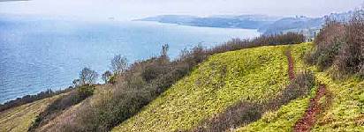
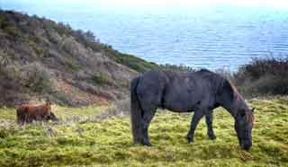
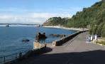
| Coast Line with wild ponies | |
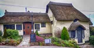
| Thatched Inn | |
| See below |
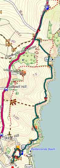
| Walk 1 Maidencombe (3.5 miles) |
Difficulty:![]()
A strenuous but most rewarding walk with magnificent views of the coast and very dramatic countryside grazed by ponies.
Caution: This walk includes some very steep descents and is as much a challenge as an ordeal depending on your knees and stamina - try walk 1b instead.
main roads | 0 % |
2 stretches | |
altitude range | 27 - 132 m |
quality of track | *** |
stiles | several |

Map of Walk 1
Download Route
| Download GPX | Mobile or GPS | |
| Download FIT | Watches | |
| Google Earth | ||
| Labrador Bay Car Park (free on Sunday |
| SATNAV Postcode:TQ1 4TP |
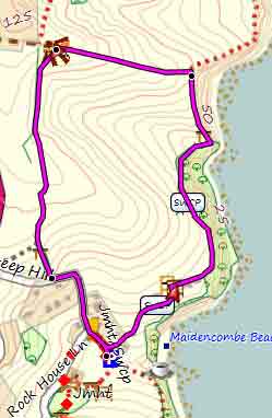
| Walk 2 Maidencombe less steep (4 miles) |
Difficulty:![]()
This Walk avoids the steep hills but you will still see the ponies!
Map of Walk 2
Download Route
| Download GPX | Mobile or GPS | |
| Download FIT | Watches | |
| Google Earth | ||
| Walk 3 North Maidencombe (1.3 miles) |
Difficulty:![]()
A fine walk North of Maidencombe.
|
Map of Walk 3
| Walk 4 South Maidencombe (1.3 miles) |  | |
| MAP |
Difficulty:![]()
A delightful walk South of Maidencombe.
|
| Walk 5 Valley of Rocks (2.5 miles) |  | |
| MAP |
Difficulty:![]()
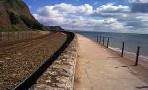
The walk takes you through the Valley of Rocks via the John Musgrave Heritage Trail into Maidencombe then follows a magnificent coastline.
Start from Car Park off Watcombe Beach Road.
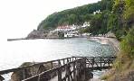
There is an option to descend to Watcombe Beach (during the summer a cafe might be open).
Download Route
| Download GPX | Mobile or GPS | |
| Download FIT | Watches | |
| Google Earth | ||
This walk can be combined with walk 2.
|
| Walks near Maidencombe | ||
 | ||
| Babbacombe | ||
 | ||
| Torquay | ||
 | ||
| Teignmouth | ||
| (©) Pinns UK |
