| Best Devon Walks |
| Best Devon Walks |
| Best Chagford Walks |
| 3 TOP Walks |
| Walk 1 | to Gidleigh |
| 9.5 miles (3h 50) | |
| 19000+ steps | |
| Walk 2 | along the Teign |
| 2.9 miles (1h 20) | |
| 5800+ steps | |
| Walk 3 | Chagford to Drogo |
| 3.3 miles (1h 20) | |
| 6600+ steps | |
| Nearby |
 | The Birdcage , Old Forge |
| Near the school or Chagford Pay & Display Car Park ,the Square | |
| The Square: SATNAV Postcode:TQ13 8BZ |
| What to explore? |
| Where to Eat? | |
| Rock Inn The Three Crowns | |
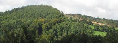
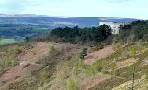
| Walk 1 to Gidleigh (9.5 miles) |
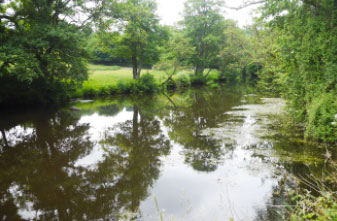
This delightful and varied walk follows the ever-babbling River Teign—a true must-do for any nature lover. It's no surprise that it's such a popular route!
Difficulty:![]()
The Walk
A Start from North Street and follow the B3206 out of Chagford. Take lane on left after primary school then at the bridge take public footpath and head diagonally to a gap in the hedge then bear left with hedge on left and cross footbridge.
Continue along footpath with river on your left.
At lane turn right the soon left following a footpath through some woods, steadily climbing to a lane.
Here turn left and continue along lane into Murchington then Gidleigh.
You follow part of the Two Moors Way and Dartmoor Way - see hiking routes.
B Gidleigh is worth seeing for its church and private ruins of a fortified medieval manor.
Retrace your steps from the church and at the next junction turn right. After 1150m take footpath on left and follow this all the way down to a footbridge
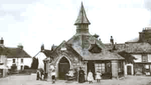
C Nearest pub to Gidleigh is the Northmore Arms in Wonson south of Throwleigh ( 20 mins walk from Gidleigh church).
It has lots of character with a large open fire, even in summer! - a visit is highly recommended.
| Northmore Arms |
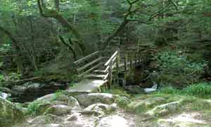
D Footbridge across the Teign. Cross bridge and climb to a lane.
Cross over onto a track. At the T junction turn left and rejoin a lane. Follow this for 320m then where the road bends to the right follow track ahead.
When you join a lane turn right and follow lane back into Chagford
| Best Chagford Walks | |
 | En Route No Cafe or Pub but see C above |
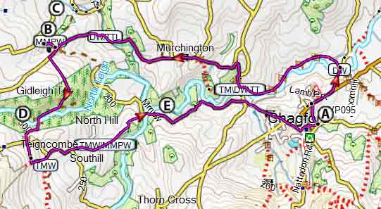
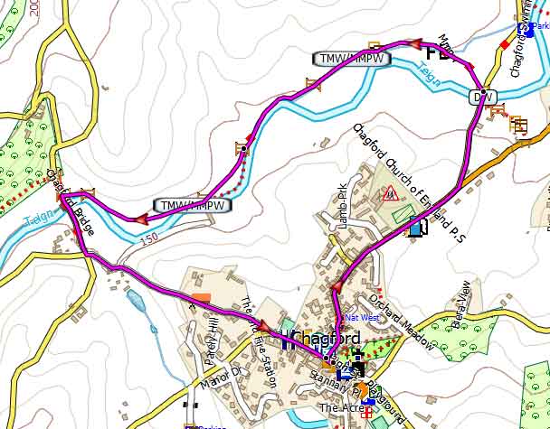
Map of Walk 1
| Walk 2 along the Teign (2.9 miles) |
A most pleasant 1 hour circular walk, partly along the river Teign, giving you a real flavour of the majestic Teign Valley.
Difficulty:![]()
Park at P&D Car Park |
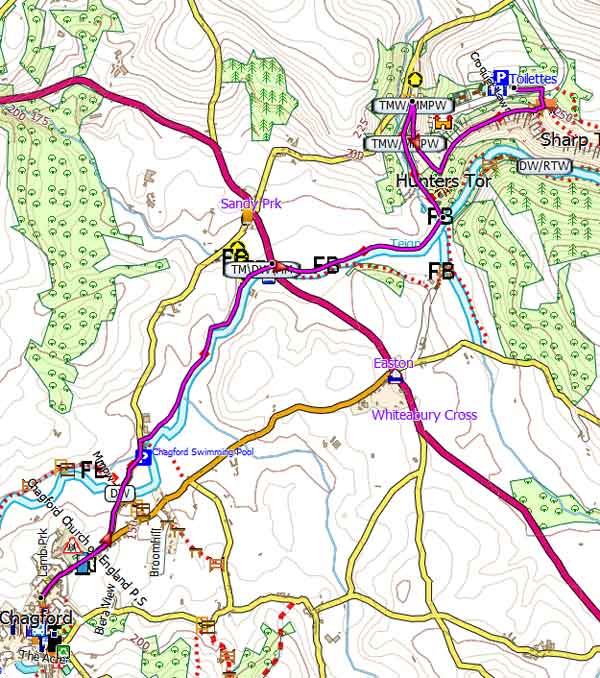
Map of Walk 2
Download Route
| Download GPX | GPS or Watches | |
| Download FIT | Watches | |
| Google Earth | ||
| Walk 3 Chagford to Drogo (3.3 miles) |
This is a delightful linear walk to castle Drogo following the river Teign, ideal if you want to have some refreshments at castle Drogo or see/visit the castle - see map to download route.
Difficulty:![]()
| Where to Eat? | |
| Fingle Bridge Inn Castle Drogo Restaurant | |
Map of Walk 3
Download Route
| Download GPX | GPS or Watches | |
| Download FIT | Watches | |
| Google Earth | ||
| En Route Mill End, on A382 |
| Walks near Chagford |
| Castle Drogo Walks. |
 |
| Three delightful walks near Castle Drogo, Drewsteignton, ideal any time of the year! |
| Moretonhampstead |
 |
| Moretonhampstead, gateway to Dartmoor, is an ideal town for walkers to explore the lush edge of the moor. |
| Fernworthy |
 |
| .Enjoy a peaceful forest walk around a trout filled reservoir & explore a prehistoric landscape of mysterious stone circles and rows. |
| Dartmoor Walks |
 |
| Carefully selected walks with easy car access! |
| (©) Pinns UK |
