| Best Somerset Walks |
| Best Somerset Walks |
| Best Cadbury Castle Walks |
| 2 TOP Walks |
|
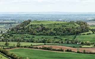
| Cadbury Castle |
| Walk 1 | Castle |
| 1.3 miles (40 mins) | |
| 2600+ steps | |
| Walk 2 | South Cadbury & Corton Denham |
| 5.5 miles (2h 20) | |
| 11000+ steps | |
| Nearby |
The name means :a fortified site belonging to a mythical 'Cada'.
| Queens Arms, Corton Denham | |
| Free Car Park Church Ln, South Cadbury | |
| what3words ///reports.unafraid.fans | |
| SATNAV Postcode:BA22 7HA |
| Walk 1 Castle (1.3 miles) |
A short and pleasant walk to an ancient capital with a steady climb promising breathtaking views over the Levels .
| What to explore |
Cadbury Castle dates back at least 4000 years.
It became the capital of a tribe who gave Dorset its name, and in the end lost against the Romans who burned down their wooden structures.
It was rebuilt by the Saxons to defend against the Vikings.
An already thousand year old legend has it that Cadbury castle is King Arthur's Camelot.
A From the main entrance to the car park turn right onto Church Road.
After the church take first left (Folly lane) and continue up hill.
B At the entrance of the fort turn right and continue along a footpath.
Difficulty:![]()
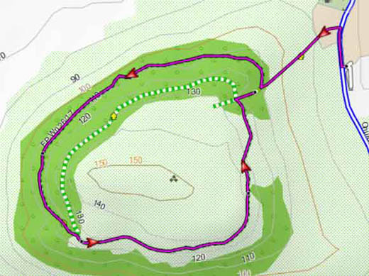
Map of Walk 1
Download Route
| Download GPX | Mobile or GPS | |
| Download FIT | Watches | |
| Google Earth | ||
FREE HIKING MAP of UK South West
No Login or Membership required!
| Walk 2 South Cadbury & Corton Denham (5.5 miles) |
Difficulty:![]()
This pleasant walk follows public footpaths and quiet lanes to Corton Denham.
There is one pub in Corton Denham: The Queens Arms but check web for opening hours.
A From the car park turn left onto Church Road.
B After Crangs Lane on left take the first footpath on left.
C After 530 m the path branches.
Take the path on right then at the lane turn left .
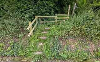
D After 320 m near some buildings (just before the lane curves to the left) climb the steps of footpath on left in between a hedge.
E After half a mile the path joins another path going back up.
There are 2 options:
Take next lane (Putts Lane) on right.
F After 320m turn left onto a track heading West and leading to an ancient ridgeway.
Turn right and follow the ridgeway and the Macmillan Way , a long distance hiking route. Enjoy magnificent views en route back to the Car Park.
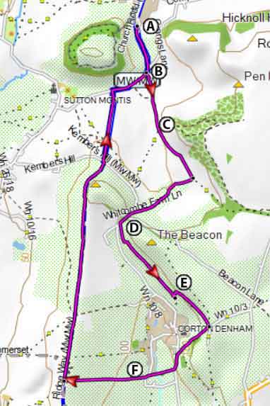
Map of Walk 2
Download Route
| Download GPX | Mobile or GPS | |
| Download FIT | Watches | |
| Google Earth | ||
| (©) Pinns UK |