| Best Somerset Walks |
| Best Somerset Walks |

| Best Taunton Walks |
| 4 TOP Walks |
| Walk 1 | Taunton Town Trail |
| 1.8 miles (50 mins) | |
| 3600+ steps | |
| Walk 2 | Taunton Pluto Walk |
| 1.5 miles (40 mins) | |
| 3000+ steps | |
| Walk 3 | along the river Tone |
| 4.4 miles (1h 50) | |
| 8800+ steps | |
| Walk 4 | Trull to Taunton Town Centre |
| 4 miles (1h 40) | |
| 8000+ steps | |
| Nearby |
| Walk 1 Taunton Town Trail (1.8 miles) |
Difficulty:![]()
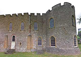
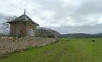
The official Taunton town trail taking in 42 historic sites/buildings, including the medieval Tone bridge, Taunton castle, the old Market centre, the old brewery.
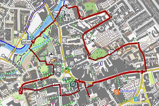
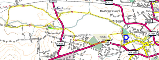
Map of Walk 1
Download Heritage Trail
| Download GPX | Mobile or GPS | |
| Download FIT | Watches | |
| Google Earth | ||
| Walk 2 Taunton Pluto Walk (1.5 miles) |
Difficulty:![]()
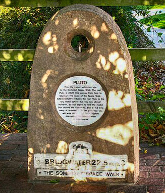
Pluto marks one end of the Somerset Space Walk routed along the Bridgewater & Taunton Canal. This easy short walk follows paths along the river Tone.
| Coal Orchard Pay & Display Car Park |
Map of Walk 2
Download Pluto Trail
| Download GPX | Mobile or GPS | |
| Download FIT | Watches |
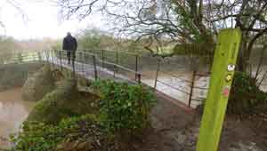
| Walk 3 along the river Tone (4.4 miles) |
Difficulty:![]()
This delightful river walk takes you out of Taunton (Tone town), along Weirside Riverside Local Nature Reserve , across the remains of the Grand Western Canal and past Longaller Mill's Waterwheel.
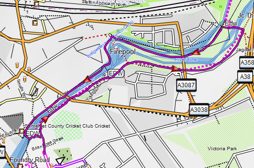
Map of Walk 3
Download Route
| Download GPX | Mobile or GPS | |
| Download FIT | Watches |
| Walk 4 Trull to Taunton Town Centre (4 miles) |  | |
| MAP |
Difficulty:![]()
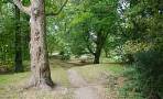
A very pleasant and easy walk following some residential roads but mainly footpaths and tracks.
Download Route
| Download GPX | Mobile or GPS | |
| Download FIT | Watches | |
| Google Earth | ||
| Residential Trull, South of Taunton. |
| Walks near Taunton: | |
 | |
| Battle of Sedgemoor Walk | |
 | |
| Creech St Michael | |
 | |
| Wellington | |
 | |
| Pitminster | |
 | |
| Neroche Forest | |
 | |
| Wiveliscombe | |
| (©) Pinns UK |
