
More Tricks
Intelligent routing for hikers
 |
 |
| Garmin Byke Map | mkgmap default style |
As a general comment , it has been very difficult to manipulate any meaningful routing when the hiking option has been set in Basecamp.
It seems the route preferred is always the shortest one!
However, it appears that 'hiking' avoids highways with class=3+.
So, setting speed to a maximum when class <3 does not appear to have much effect.
And yet, when route using Garmins Cycle Map, the routing seems far more intelligent, ie
it looks for paths rather than the shortest way!
You can create this effect by setting the shortest way to class=3 using the length() option.
This does not always work as long roads are often for various reasons split in OSM.
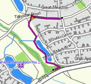
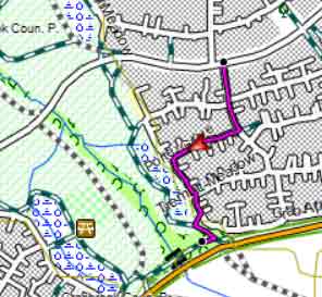
Routing problems with high speed roads
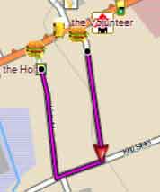
In Basecamp the 'hiking' option can produce curious results - see right. The shortest way seems to be the longest (A) ! If you add 'sidewalk' to your code you can 'force' it to join a primary Road by changing class and speed (B) . highway=primary & sidewalk!=* [0x3 road_class=3 road_speed=4 resolution 22] |
 |
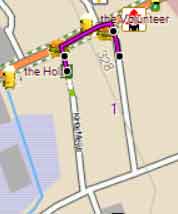 |
| A no sidewalk | B with sidewalk |
Use TYPWiz7 to add sidewalks parallel to the highway.
We added the following code to add our sidewalk line before the code above
highway=primary & sidewalk=* [0x1091f resolution 22 continue]
We selected 1091f as this line does not show labels.