Best Shaugh Prior & Dewerstone Walks |
| Select Your Walk | Walk 1 (1.1 miles) | Walk 2 (4.2 miles) | |
| Dewerstone Cottagel | Dewerstone & Cadover |
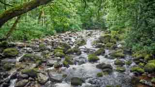
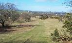
Shaugh Bridge , where the river Meavy joins the river Plym . has long been a favourite centre for walks.
The area is steeped in legends involving the 'Dewer', the devil
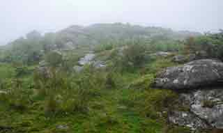
| Dewerstone Rock Old Mines Ruins Cobbled paths | |
| The White Thorn Inn in Shaugh Prior | |
| Drewerstone Carpark Limited Spaces near Shaugh Bridge |
| what3words ///spoil.frog.hears | |
| SATNAV Postcode:PL7 5HE |
Walk 1 Dewerstone Cottage (1.1 miles)
Difficulty:![]()
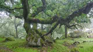
This is a delightful but somewhat demanding trail through a lush oak woodland with a beautiful stretch along the river Meavy.
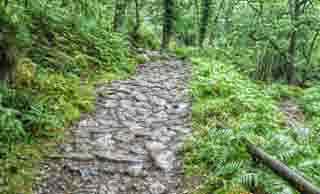
It includes a few climbs and many of the paths are rocky or cobbled.
Although short allow for an hour.
Download FIT for Watches / GPS

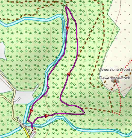
Map of Walk 1
| Walks near Shaugh Bridge | |
| Meavy | |
 | A great pub walk to Meavy and Burrator Reservoir with spectacular views of a dramatic landscape featured in the film 'War Horse' . |
| Buckland-Monachorum | |
 | Exploring a countryside loved by St Francis Drake and known for its extensive views |
| Princetown | |
 | Princetown offers the walker spectacular views of Dartmoor's almost volcanic landscapes. Relive a railway journey through quarries. |
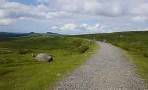
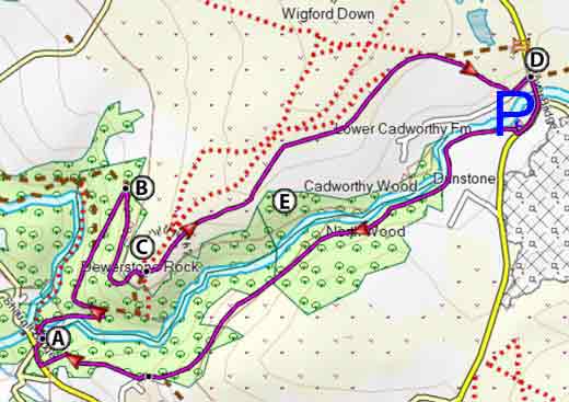
Walk 2 Dewerstone & Cadover Bridge(4.2 miles)
Difficulty:![]()
A very popular walk ideal for a non-rainy day.
If parking is a problem then start from a Car Park near Cadover Bridge.
| Limited Spaces near Shaugh Bridge Car Park Cadover Bridge - see map. |
The Walk
A From the car park with back to main road head towards a wooden bridge. Once across the bridge turn right and take a cobbled path which steadily climbs to the next level.
After 320 m ignore path on right but turn left & continue for another 320m . Take the right fork and continue uphill. After another 320m turn right - ahead of you on your left are some ruins, part of a disused mine.
B Follow this path which after a while bends to the left and reaches the edge of the moor.
On your right is Dewerstone Rock.
C Head in a North Easterly direction following a grassy path keeping the river Plym and North Wood on your right.
Continue until you reach the boundary of the wood and turn right with wall on your right.
Walk downhill past Cadover Cross towards the bridge.
D Turn right and after crossing the bridge take right fork . At car Park turn right. Ahead of you on your left & at the back of the car park is a public footpath.
E Follow footpath for 1.3 miles keeping the river on your right.
Some stretches can be muddy.
A the lane turn right and soon take another public footpath on your right which leads you back to the main road & car park.
Download FIT for Watches / GPS
 |
| FREE SOUTH WEST HIKING MAP |
|
Map of Walk 2